
The Fluid atmospheric dynamics that has been driving the thunderstorms over South India for the last week or so continues to persist with multiple circulations across the Indian Sub Continent. One look at the wind charts pretty much confirms we are at a cusp of seasonal change and its only a matter of “when” rather than “If”. Yesterday saw once again interior areas get thunderstorms in the late evening and some of the coastal areas getting late night isolated thunderstorms from remnant moisture.
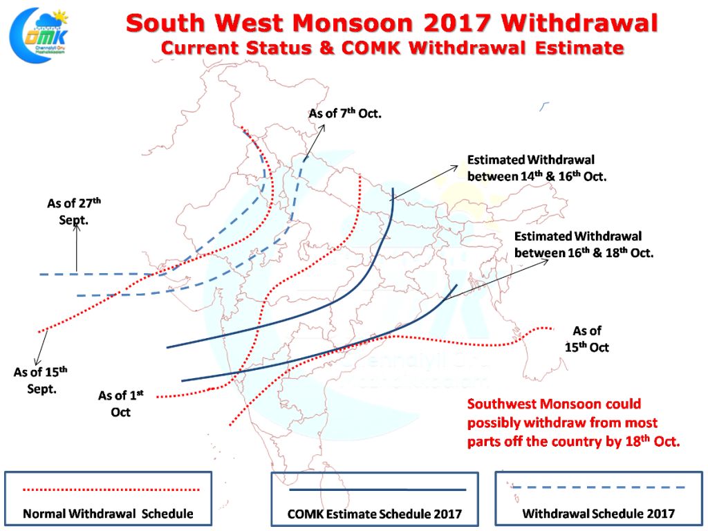
As we often repeat with extremely fluid situation prevailing now as Indian Sub Continent gets ready to bid its adieu completely to Southwest Monsoon & usher in Northeast Monsoon it makes sense to take one step at a time without looking too forward in the future. Keeping this in mind we have tried to create an estimate on when Southwest Monsoon could withdraw from the rest of the country. As always the case most of the times this year also could be a case of finishing nearly on time despite starting late. But the key question of when Northeast Monsoon Onset will happen continues to remain?
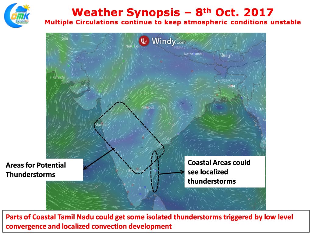
As mentioned in the opening remarks of today’s post large parts of India are under disturbed atmospheric conditions thanks to the various circulations that has been persisting across the sub continent. Today also we are likely to see thunderstorms in many parts of Peninsular India with possibly once again Interior Karnataka & parts of Konkan coast enjoying the best spells of rains.
Isolated rains are likely over parts of Interior Tamil Nadu with models indicating one or two spells of late evening / night spells of rains along the coast thanks to the low level convergence. These could be localized thunderstorms developing possibly from remnant moisture moving in from the interiors.
Powered by WPeMatico