
While it may be only first week of March the first heat wave conditions of 2019 is upon us from today. Once again as we keep repeating often prevailing wind patterns is the primary trigger for changing temperature patterns more often than not. In particular this holds good very much for Peninsular India where Easterlies / Westerlies drastically change the temperature outlook during the season between March & July.
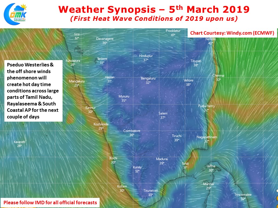
Weather models indicate a combination of Pseudo Westerlies & Offshore Wind Phenomenon to prevail over the southern parts of Peninsular India which is likely to create conducive conditions for hot afternoons over large parts of Tamil Nadu, Rayalaseema & South Coastal Andhra Pradesh over the next couple of days.
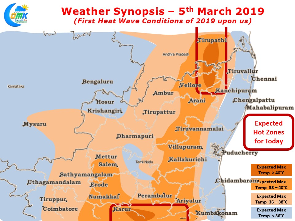
Today we could see parts of Rayalaseema & South Coastal AP record 4 / 5 degrees above normal temperatures with many places likely to cross 40 degrees Celsius. Some of this heat is likely to spill over into North Tamil Nadu as well, in particular over parts of Vellore & Tiruvallur district as models indicate westerly land winds to prevail over these areas well into the afternoon preventing any incursion of moist sea breeze. Coastal areas like Chennai will see hotter conditions due to the late arrival of sea breeze compared to the past few days though unlike the interior areas Chennai may not be uncomfortably hot.
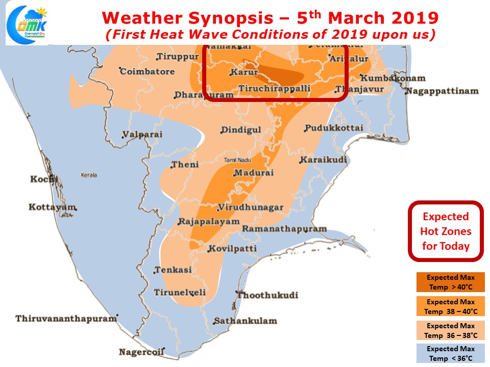
West interior TN and South TN is also likely to see day time maximum temperatures stay 3 / 4 degrees above normal today with parts of Trichy & Karur district along with few pockets of Perambalur district likely to be hot zone today. Tomorrow we might see the hot zone dip south slightly making parts of Tamil Nadu very hot during the afternoons.
Whether the early Heatwave Conditions warning is a sign of how Summer 2019 is going to be is a question only nature can answer