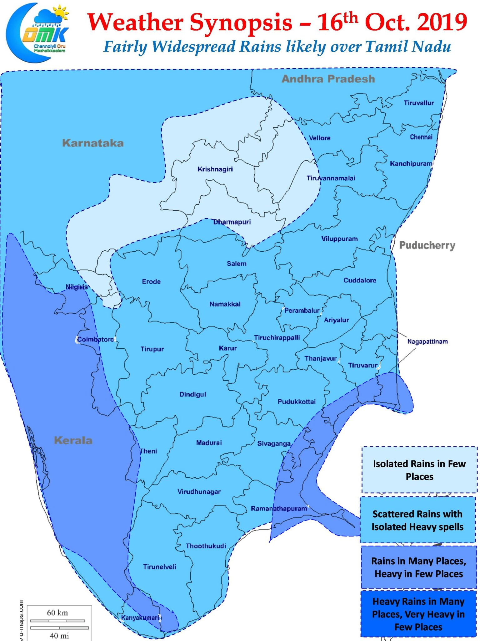
The Easterly Rains have returned with a bang over Tamil Nadu with many places along the coast getting good rains last night. Parts of South Tamil Nadu in particular Ramanathapuram district recorded heavy rains yesterday. Pamban recorded 102 mm with nearly 9 cms being recorded between 11:30 AM & 2:30 PM.

Chennai has been a case of hit or miss so far. While the other day Southern suburbs recorded light to moderate rains last night saw fairly heavy spell of rains hit the Western Suburbs with many private weather stations maintained by bloggers hitting half a century mark. The COMK weather station at Anna Nagar recorded 46 mm for the 24 hours ending at 5:30 AM with almost all of it happening between midnight & 3 AM.

A look at the satellite image indicate lot of convection prevailing over Bay of Bengal. With rain bands likely to move roughly in a East to West direction intermittent spells of Rains will hit the coastal areas all the way from Central AP to South Tamil Nadu. As the remnant moisture moves inland some places might see thunderstorms develop later in the afternoon. The heaviest spell of rains today is likely to happen around Central Coastal AP & Coastal areas around South TN.

On a larger scale Southwest Monsoon has checked out across most parts of the country except for few pockets of Peninsular India. By today the remaining parts of Peninsular India might also be out of the Southwest Monsoon conditions paving way for the arrival of Northeast Monsoon in a day or two.

Chennai may see cloudy skies with intermittent spells of Rains might hit a few parts of the city.


