
The stage is set for the development first Low Pressure in Bay of Bengal, first for the year 2017, bring excitement among all weather bloggers & watchers. The upcoming tropical disturbance is expected to form from a Trough of Low Pressure with embedded Upper Air Cyclonic Circulation currently lying over the Andaman Islands within the next 24 to 48 hours.
As one can observe from the pictorial representation Indian Sub Continent is subject to two seasonal wind regimes. The Westerly Wind regime between Apr/May to October and Easterly Wind Regime between October to Apr./May. The Southwest Monsoon & Northeast Monsoon are a subset of the respective wind regimes bringing in rains to the West Coast & East Coast.
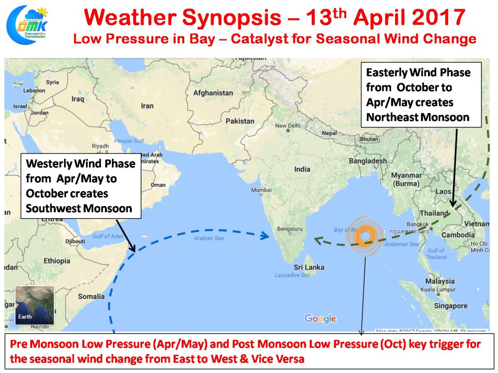
The key catalyst for the seasonal wind change is the formation of a tropical disturbance in Bay of Bengal during the Pre Monsoon (Ap. / May) and Post Monsoon (Oct.). As a matter of fact weather enthusiasts from Chennai keenly look forward to these Post Monsoon tropical disturbances in order to understand possible Northeast Monsoon Onset time frame. Similarly the Pre Monsoon disturbances are eagerly tracked to identify the start of the real summer for Chennai as North Westerly winds from the land bring in the heat from neighbouring Rayalaseema region.
During 2016 Cyclonic Storm Roanu was the trigger for the change in wind regime around May 17th while in 2013 Cyclonic Storm Viyaru triggered the change around May 10th. Similarly Severe Cyclone Laila triggered in the wind change during the year 2010. One can give many such examples of how tropical disturbances in Pre Monsoon season has been a key catalyst in the seasonal wind change process.
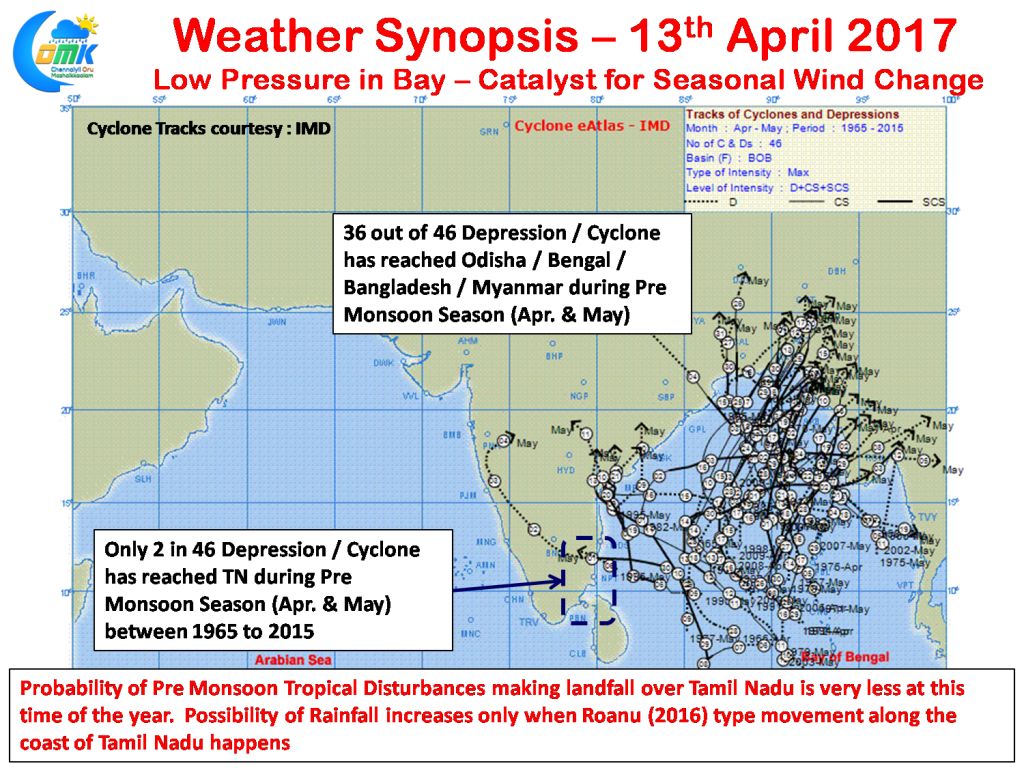
With a good consensus on the evolving Low Pressure in terms of the probability what should be our expectation for Tamil Nadu? The stakes are normally loaded against us at this time of the year with more often than not tropical disturbances forming in Bay of Bengal taking a Northward track and moving towards Head Bay region. To be precise roughly 5% is the probability of a Depression / Cyclone striking the Tamil Nadu during the pre monsoon season (Apr-May). As far as Tamil Nadu goes for best impact in terms for rainfall the disturbance has to form very close to Sri Lanka and move along the TN Coast on its northward journey similar to Roanu last year dumping summer rainfall on its way.
We will make a detailed post tomorrow on this year’s evolving disturbance in question and possible prospects for Tamil Nadu if any.
Powered by WPeMatico