
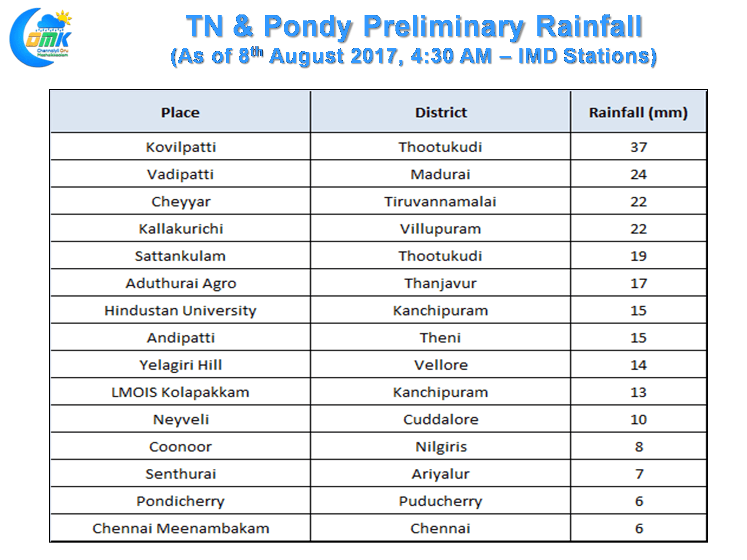
The scattered spell of evening thunderstorms continued over parts of Chennai yesterday as well with southern areas of the city enjoying a moderate spell of rains. Hindustan University & Kolapakkam recorded 15 and 13 mm respectively while the Airport observatory recorded 6 mm. Chennai Nungambakkam and the rest of the Western & Northern suburbs pretty much remained a spectator.
On the overall things continue to look good for Tamil Nadu to possibly received another very good spell of thunderstorms starting from Wednesday / Thursday as wind pattern turns favorably for the state. While models indicate a possible upper air cylconic circulation to evolve over the Comorin Sea the key point will possibly the Mid Level Easterly Winds which is likely to bring NEM like conditions for thunderstorms to thrive after being triggered by convection during the day.
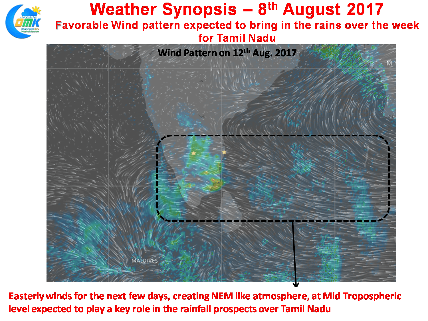
This spell of rains is likely to start either on Wednesday or Thursday with more probability taking into account the wind pattern from Thursday and could continue well into the second fortnight going by how models estimate. But we would like to keep looking at the short term, as things stand the rainy days are set to continue over Tamil Nadu till Independence day possibly. We will further update as things evolve.
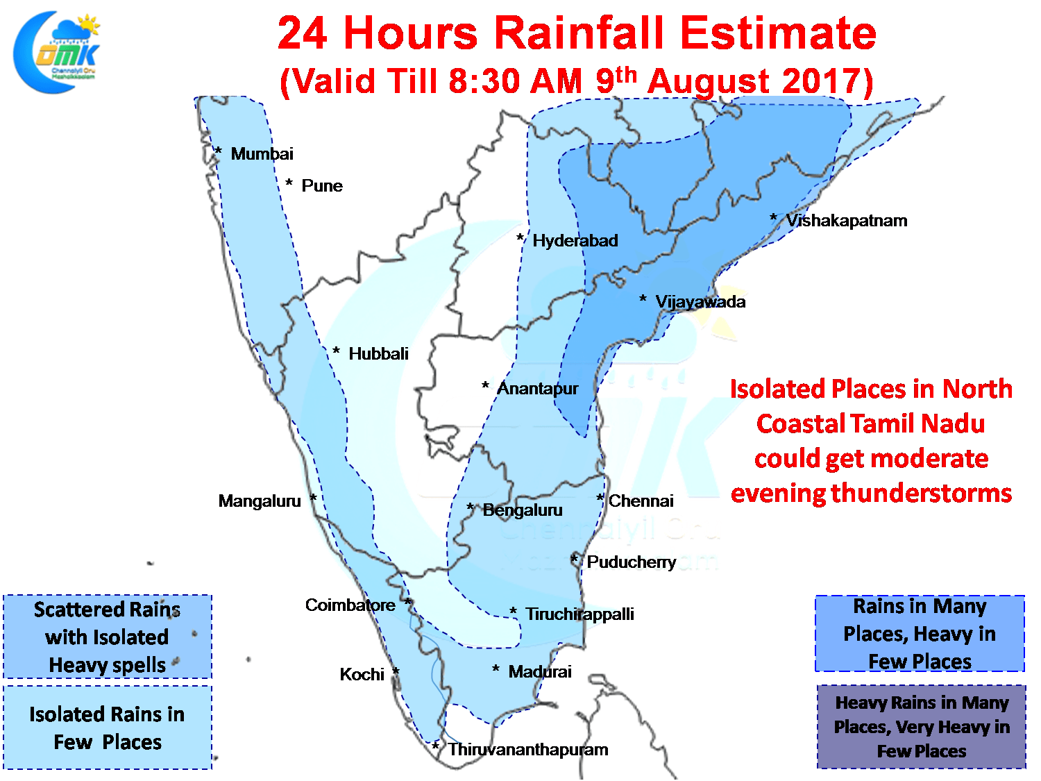
Today could be another good day for Coastal Tamil Nadu with the pattern following the last few days trends of South Tamil Nadu seeing early thunderstorms while Northern parts of the state will possibly see thunderstorms form around late afternoon while late evening could be the ideal time for them to bloom. Things are looking good for another good day of moderate to heavy spells of thunderstorms in one or two places over North Coastal Tamil Nadu. Models indicate one heavy late evening spell slightly to the North of Chennai which if lucky could possibly fall over the city areas as well. Interesting day to track nevertheless.
Powered by WPeMatico