As the seasonal deficit for Chennai Nungambakkam inched close to 50% for NEM2018 all eyes are on the Expected Easterly wave to bring some cheer to the citizens of the metropolis. The number looks alarming when one looks at the annual numbers for Chennai Nungambakkam, more than 60 cms is needed in the balance 30 days, a tough task.
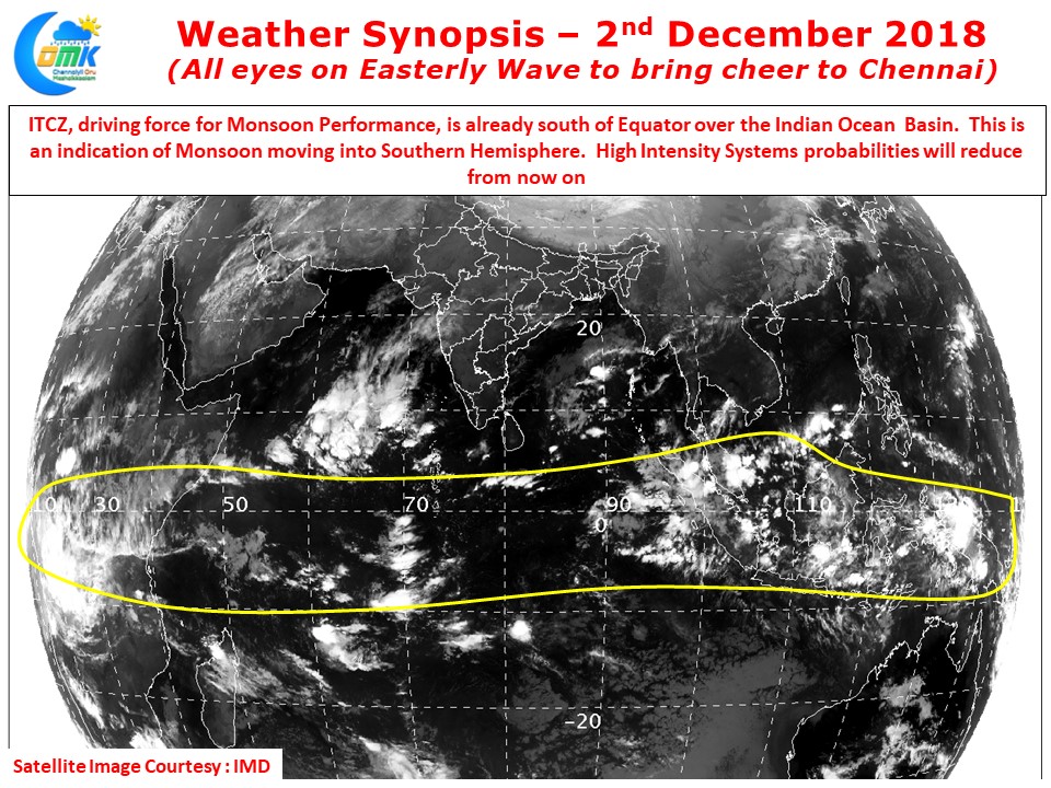
As weather bloggers we can’t afford emotions to cloud our judgements. A close look at the satellite image on a continental scale in conjunction with the wind charts reveal the ITCZ is now well on its way towards Southern Hemisphere. As we often mention while tropical waves like MJO etc enhance our suppress overall rainfall activity its Inter Tropical Convergence Zone (ITCZ) that keeps the monsoon pot boiling through its journey between Northern and Southern Hemisphere. In this journey across the Indian Ocean it creates and sustains Indian Summer Monsoon (SWM), Northeast Monsoon and Australian Monsoon. During the transition between ISMR to Australian Monsoon the intermediary phase creates Northeast Monsoon. Once the ITCZ starts moving into Southern Hemisphere we can see a reduction in high intensity rainfall events unless all supporting factors fall in place together. Even influence of tropical waves like MJO align with ITCZ.
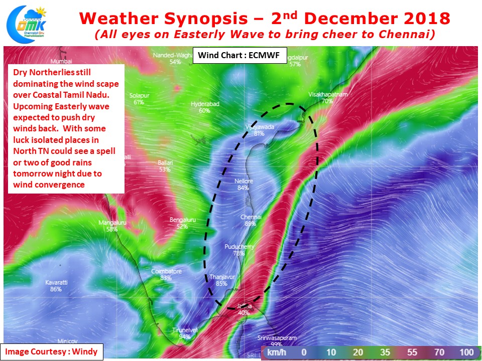
While the worries about ITCZ are genuine let us not lose sight of what could bring some cheer to Chennai. With the trough of low persisting near Andaman Islands it presents the immediate opportunity for some spell of rains across most of TN. Wind charts do show the coastal areas continue to be under the influence of dry Northerlies. But this dry Northerlies could turn into a blessing in disguise when the trough of low pushes across the moist Easterlies from tomorrow. During this phase one or two places around North TN is likely to receive a spell or two of good rains with rains to increase in intensity and spatial spread on Tuesday.
Keeping in mind the deficit staring at us every spell from now will be important for Chennai


