
After a flurry of heavy rains across many parts of Tamil Nadu things have slowed down drastically since last evening. The satellite image over Peninsular India also shows clear skies across the region with not much rainfall activity seen during the morning hours, typically the time associated with Northeast Monsoon period. This lull in rainfall activity is likely to continue for the next few days.
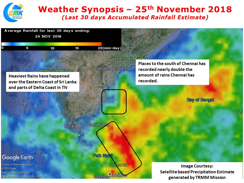
The last 30 days accumulated rainfall pattern gives a clear indication on how the rains this Northeast Monsoon so far has been skewed towards the Delta districts & Eastern Coast of Sri Lanka. In a strange irony places just South of Chennai seem to have got nearly twice the rains of Chennai city areas. Parts of Central Kerala on the back of the east to west moving Gaja seem to have recorded more rains than most parts of North TN districts of Chennai, Kanchipuram & Tiruvallur.
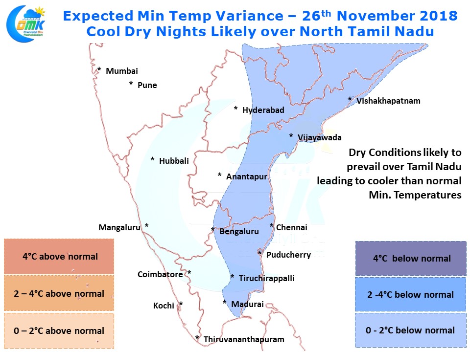
With Northerlies making a more pronounced presence over Tamil Nadu the night time temperatures have shown a further reduction in places like Chennai last night. Aided by the clear cloudless skies the next couple of nights are likely to be cooler than normal across most of North Tamil Nadu including Chennai. Tuesday night could see some of the places see nearly 2 / 3 degrees below normal minimum temperatures.