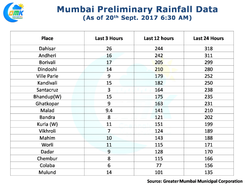
While most of Tamil Nadu saw dry weather yesterday, across the coast Mumbai saw a day that reminded the citizens of the earlier deluge days as rains battered the Metropolis from late afternoon well into the night with many suburbs crossing 25 cms and seeing hourly rain rates touch as high as 7 cms at times.
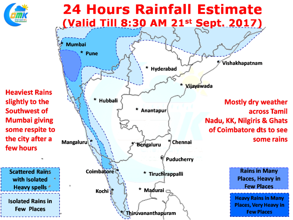
 But it appears the rain Gods indeed are likely to show some mercy on Mumbai as models indicate the heaviest spell of rains are likely to happen slightly to the Southwest of the city thereby preventing another day of deluge. With the Low Pressure currently persisting around Odisha / Chhattisgarh region along with an upper cyclonic circulation over the Konkan region the moisture will get recycled constantly over Central India.
Closer home it appears the next few days most of Tamil Nadu is likely to see dry weather with the exception of the places along the Western Ghats & South Tamil Nadu around Kanyakumari & Tirunelveli districts. The current Low Pressure has to complete its life cycle until with the rainfall prospects will be on the lower side for Tamil Nadu. The next best opportunity will come up when a possible Upper Air Cyclonic Circulation starts taking genesis around West Central Bay bringing some rainfall opportunities for North TN.
Powered by WPeMatico


