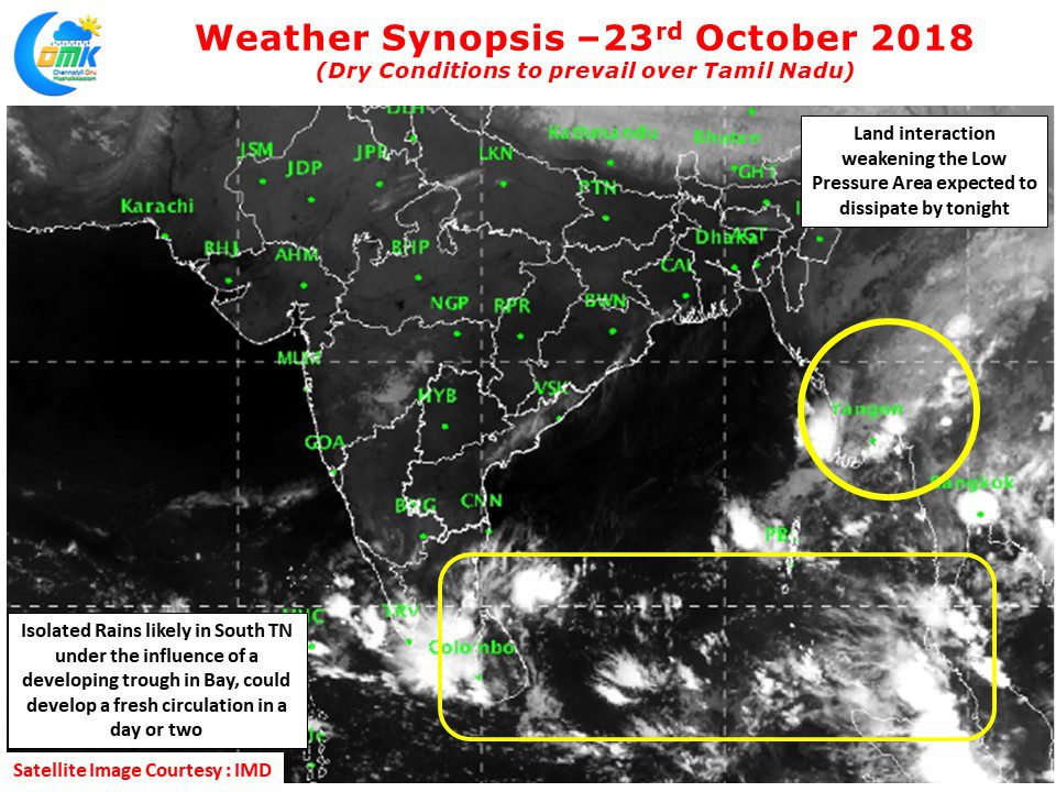
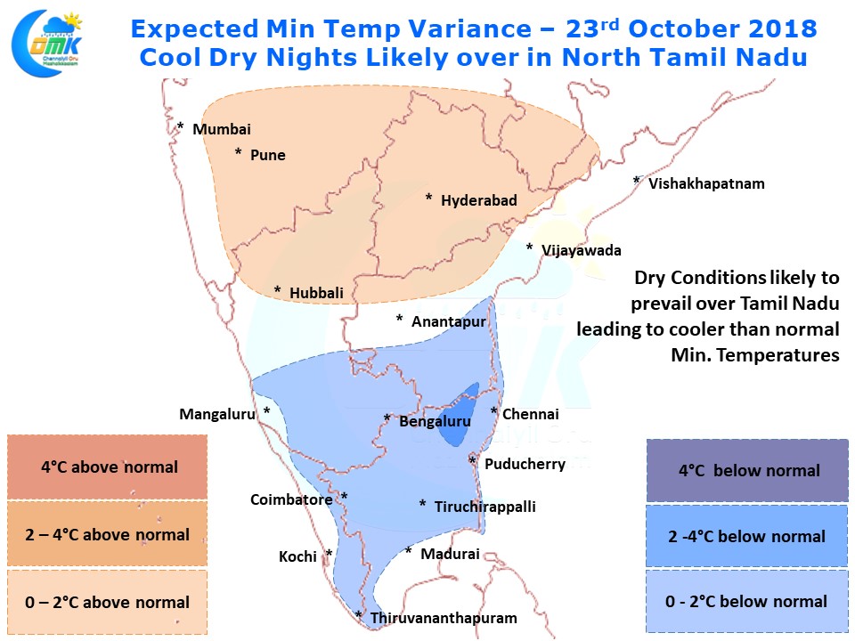
Compared to the past few days rains have eased over large areas of Tamil Nadu yesterday sticking to mostly parts of South TN. Places like Chennai saw nice and crisp sunshine during the day devoid of any major clouding. Indicative of the dry conditions today early morning also saw temperatures lesser than last night in the IMD AWS triggered by a more Northwesterly winds compared to Monday early morning.
Weather models indicate tomorrow also most parts of Tamil Nadu to see a degree or two lower night time temperatures than normal. In particular places in North Interior Tamil Nadu around Vellore / Tiruttani could be relatively cold for this time of the year.
The Low Pressure Area off Myanmar is expected to weaken today consequent to the land interaction and fade away from the sub continental weather influence. The broad trough persisting over South Bay is likely to trigger some isolated rains over South Tamil Nadu today. Crucially it could provide an opportunity for a circulation to develop in South Bay within the next 24 -36 hours or so. Along with a return of Easterlies this will create conducive conditions for the rains to return. Though it remains to be seen how much of it will actually translate into widespread rains for Tamil Nadu.


