
The D Day is almost upon us. Monsoon Onset over Kerala is now a matter of hours as the Official weather agency of the country, IMD, runs through their check of Onset Criteria in terms of rains, winds & cloudiness to confirm the official Monsoon onset over Kerala. In terms of depth of Westerlies while models indicate winds at 4.2 kms ASL to shift to Westerlies later today, things could be slightly different in real time.
A developing Low Pressure Area over Arabian Sea is likely to provide much needed impetus to Monsoon Onset and bring some sustained spell of rains to the West Coast of Peninsular India. It is pertinent to point out here all the districts are either deficit or large deficit so far since the start of Southwest Monsoon Season, similarly the coastal Karnataka districts are also seeing a deficit status indicating the poor rains so far in core monsoon areas.
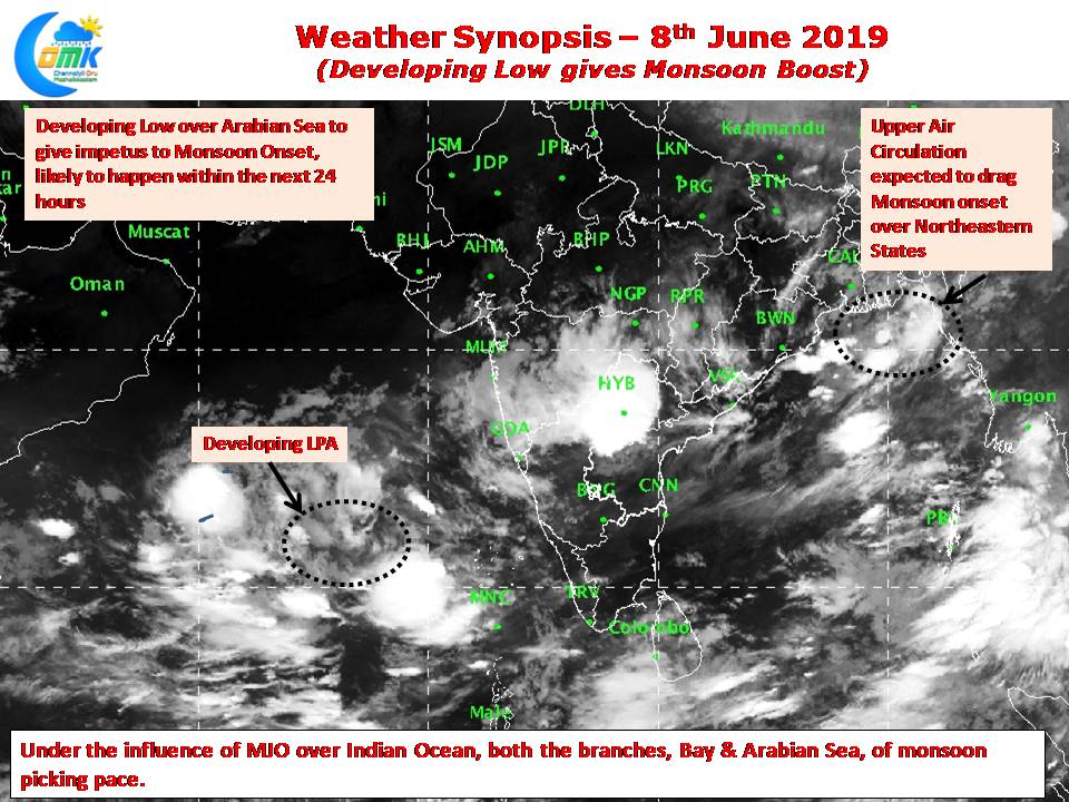
An Upper Air Cyclonic Circulation lying off the coast of West Bengal / Bangladesh for the past couple of days could play a role in dragging the Monsoon winds over Northeastern States over the next day or two. The Bay branch has stalled over the Andaman Islands for the past few days due to poor supporting conditions.
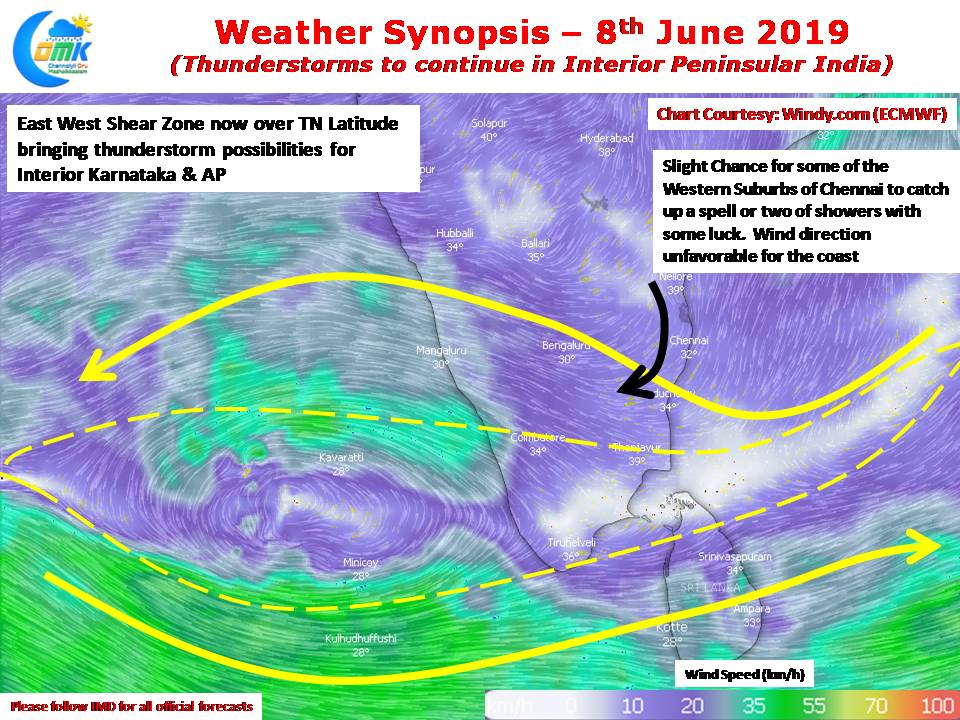
The East West Shear Zone is now lying around the 10N latitude due to which today also thunderstorms are likely over many parts of Karnataka, Telengana & Andhra Pradesh. Compared to the past few days yesterday saw slightly lesser thunderstorm activity over Tamil Nadu, today we may see even lesser activity as Stiff Westerlies at lower levels take control of atmospheric conditions. The winds at 3 kms ASL so far has been Northeasterly around the North Coastal TN areas including Chennai, today for the first time they change to Northerlies with a slight kink to the West. This could mean some light rainfall prospects for one or two Western Suburbs of Chennai though overall wind pattern remains unfavorable.