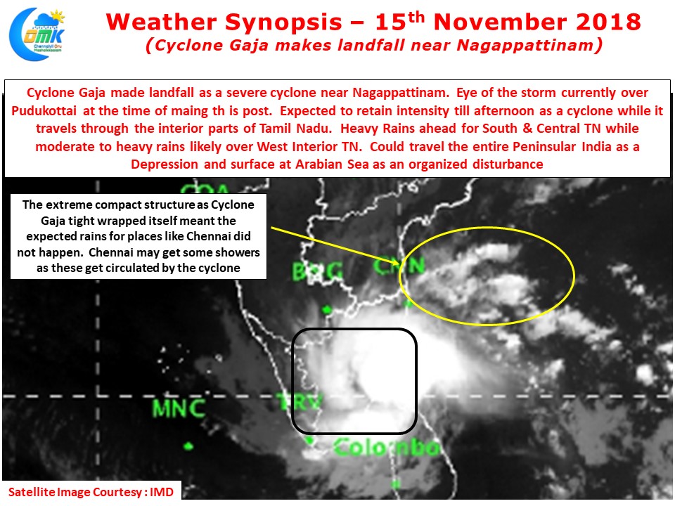
Defying all odds Cyclone Gaja made landfall as a very strong Cyclone around mid night near Vedaranyam. While the initial estimates where for a intensity reduction by Cyclone Gaja just before landfall. But the whole of yesterday Cyclone Gaja continued to intensify and made landfall as a marginal Category 2 Cyclone over the delta region.
Even after landfall it has continue to retain its structure and the eye is seen over Pudukottai at the time of this post. It could continue to retain cyclone strength until today afternoon while it travels through the interior parts of Tamil Nadu. For many people in these places this could be the first & last disturbance of cyclonic strength in their lifetime.
One of the key reasons why the estimated rains for Chennai never happened was the extreme compact shape which Cyclone Gaja underwent. Due to the tight wrapping of bands around its core the outer bands which were expected to give rains to Chennai never materialized resulting in a failed forecast.
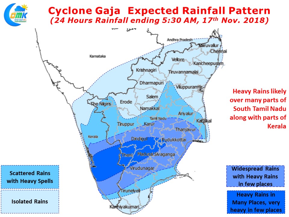
With Cyclone Gaja expected to continue in a W/SW path over interior Tamil Nadu many parts of South & Central TN are likely to receive very heavy rains over the next few hours. Isolated places along the Western Ghats could see very heavy rains as moisture gets trapped while the cyclone moves from East to West. As the cyclone moves across the Western Ghats parts of Kerala are also likely to record heavy rains in many places in the Central areas particularly along the high ranges.
Chennai could see some fresh rain bands move in from the sea as the cyclone circulates moisture but it would be prudent to keep expectations under check.


