The Indian sub continent is home to various forms of arts and dances. While most of them are learnt through formal training a few get passed through generations by practice. One such art known as “கழைக்கூத்து” in Tamil. Similar to the trapeze act in circuses this requires a lot of concentration, balance and coordination. Convective thunderstorms during Southwest Monsoon season over the leeward areas of Tamil Nadu are similar in nature. It is a complex phenomenon which depends a lot on fine balance between the factors in play. These factors like moisture from the west, convective rising through day time heating, favorable wind speeds & directions, sea breeze front etc need to be in sync with each other, complimenting and not counter acting against one another to bring about thunderstorms. Ofcourse along with this there are large scale factors that either enhances or suppresses these conditions overall for thunderstorm development.
The suppressed phase of Southwest Monsoon over the past couple of weeks had given a window active thunderstorms over many parts of Tamil Nadu though it appears Chennai and surrounding districts possibly benefitted the most from this phase of weak monsoon conditions. With a 66% excess so far Chennai district cumulative rainfall has already crossed the seasonal long term average of 459 mm for the Southwest Monsoon season. Not only Chennai is in the Top 3 districts that have the highest positive variance in Peninsular India this season In a sad irony and a reflection of the state of Monsoon over Kerala this year the cumulative rainfall for Chennai is higher than Thiruvananthapuram district which in a normal year should have had more than double the rainfall of Chennai during Southwest Monsoon. No wonder Chennai AP IMD observatory is potentially heading for not only wettest August but make a run for one of the wettest Southwest Monsoon seasons as well.


While long term weather models indicate a slight revival of Southwest Monsoon during September the next few days will potentially see Convective thunderstorms continue over Tamil Nadu. Once again it appears KTCC districts could be the biggest beneficiary of this spell as well which is likely to see its best days of rains today and tomorrow under the influence of an East West Shear Zone type of conditions over parts of Peninsular India. The next couple of days will potentially see better rains before a gradual strengthening of westerlies would mean faster movement of thunderstorms reducing the rainfall quantum associated with it for a place.
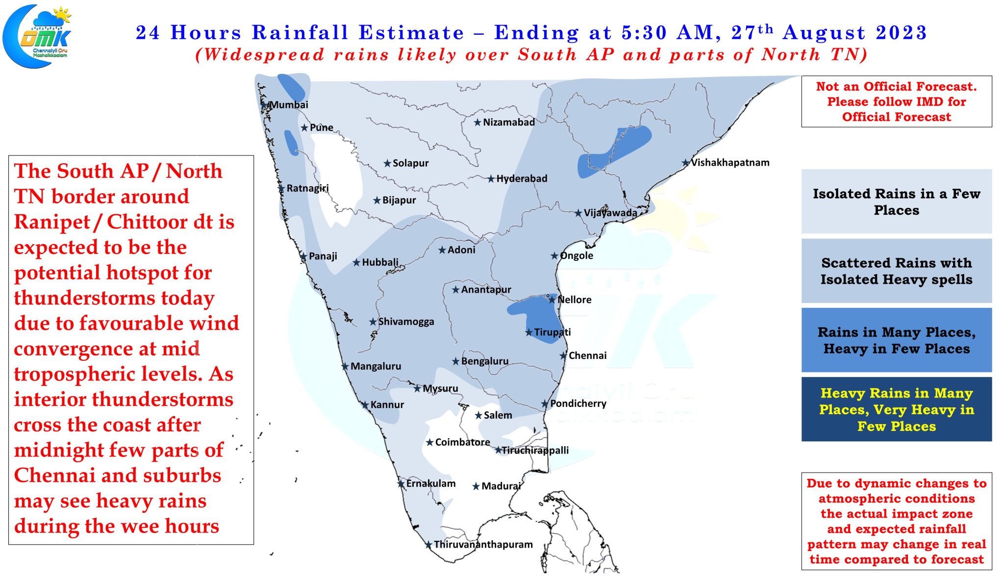
Today and tomorrow the steering is expected to be very weak which could mean as thunderstorms develop during the evening hours over the interior areas of Rayalaseema region it will slowly make its journey towards the coast bringing heavy spells of rains over the areas it passes through. As has been the case the past week there is a fair chance thunderstorms will intensify closer to the coast when it reaches after midnight. This potentially could mean one or two places around KTCC district may see intense thunderstorms during the early hours of Sunday. All in all the stretch along the AP / TN border covering Vellore, Ranipet, Tiruvallur and Chittoor district seems to be the hotspot for weekend thunderstorm activity.
With the trend of models having a slight North bias this year dont be surprised if the entire hotspot zone lands over North Tamil Nadu.

