Typically convective rains for Coastal Tamil Nadu picks up pace when the Westerlies weaken during subdued monsoon phase. The role of sea breeze in this development of convective rains can never be ignored. More often than not the role of sea breeze can be identified in any thunderstorm activity that is formed in places like Chennai closer to the coast. Even in some instances as remnant thunderstorms from the interior areas move closer to the coast they get intensified by the sudden burst of moisture provided by the sea breeze front.
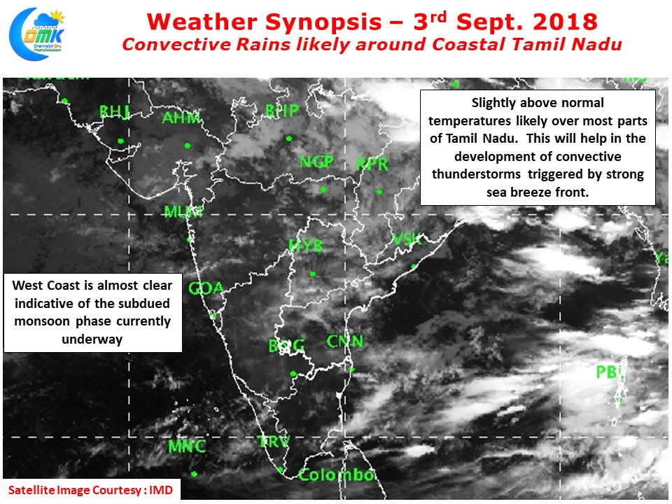
The satellite image over Peninsular India pretty much sums up the story of Southwest Monsoon as things stand. While Bay is seeing some convective activity under the influence of a weak MJO wave persisting over the Maritime Continent, on the other side, Arabian Sea is almost clean as a whistle with no clouding seen. The weak monsoon will influence the day time temperature patterns over Tamil Nadu with slightly above normal temperatures likely during early part of the day & afternoons.
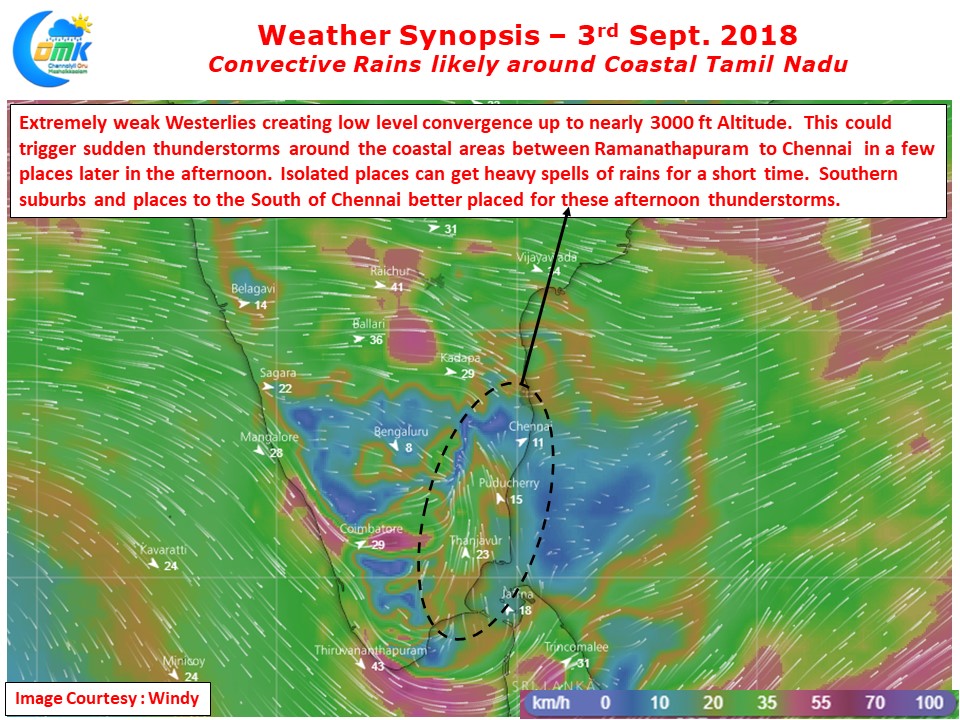
This increased temperatures creates conducive conditions for a strong thermal gradient between land and sea enabling a strong sea breeze front to kick in around afternoon time. Numerical Models indicate fairly weak westerlies and a very strong lower level convergence all the way from surface levels to about 1 kms Above Sea Level altitude. This convergence will trigger sharp spell of rains in a few places along the coast. So dont be surprised if you get hit by sudden burst of rains as sea breeze front moves inland and triggers the thunderstorm equation.
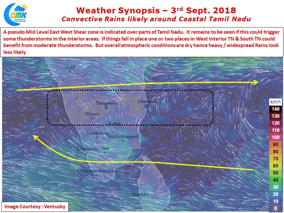
On a slightly larger scale there is a pseudo East West Shear Zone over the interior areas of Peninsular India. Under normal conditions this should trigger fairly widespread thunderstorms. But with the overall atmospheric conditions remaining dry and not so inviting it remains to be seen if this could trigger any storms. If things fall in place parts of west TN & South TN could get isolated thunderstorms.


