At COMK we often mention about the difficulties of thunderstorm inferences in a tropical place like Tamil Nadu when compared to more synoptic rains. With multiple factors influencing the convective thunderstorm equation is always complex. Add to it mostly weather bloggers use Global Models where the resolution of models are coarse for Micro Forecasting in a smaller geographical area like specific cities etc.
During Southwest Monsoon season it has been proven time and again convective thunderstorms peak over Tamil Nadu during the Break in Monsoon period. As Westerlies slow down the convective process triggered by the day time ground radiation makes it conducive for thunderstorms to develop rather than getting sheared off by strong upper level westerlies. Unlike the past few days today’s morning Satellite Image indicates the absence of upper level clouds across South India which creates the right base for convective process to develop in the interior areas.

Coastal areas are seeing the remnant thunderstorms that gave some sharp spell of showers in few parts of Chennai during the early hours. But this is unlikely to impact the overall thunderstorm development as the process typically starts from the interior areas where upper level clouds are clear setting the stage right for the day.
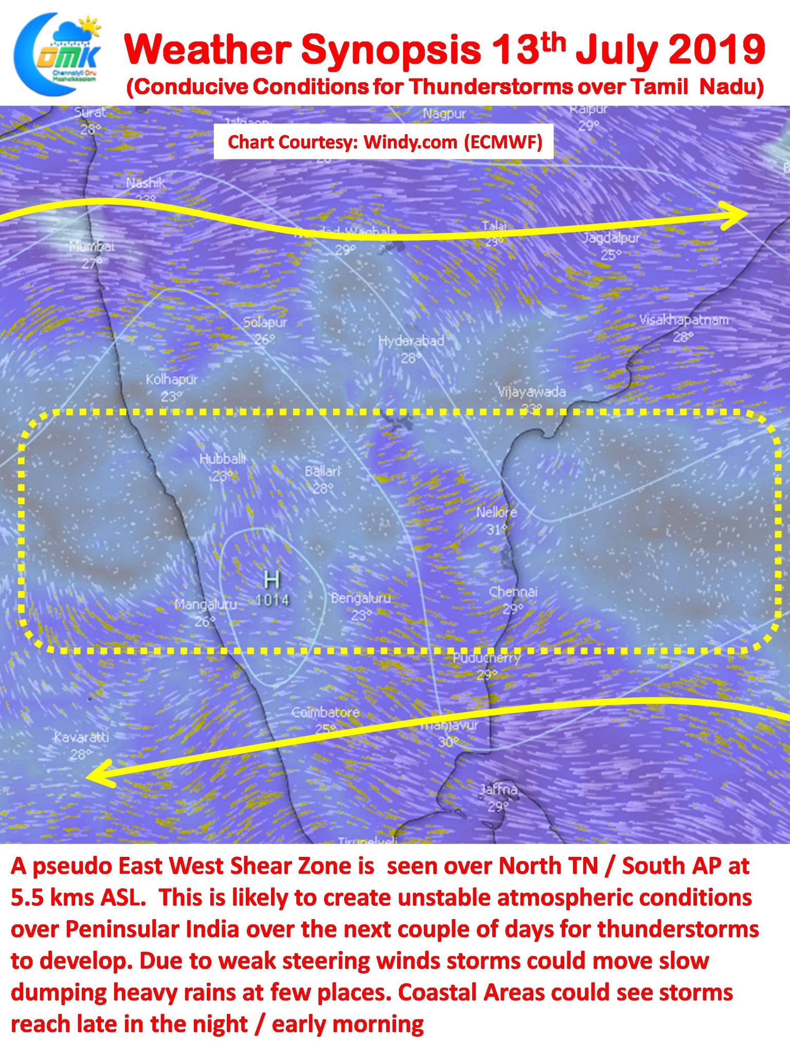
Wind charts indicate a pseudo East West Shear Zone / weak circulation prevailing at 500 hPa (5.5 kms ASL) over North TN & South AP. This typically is indicative of break in monsoon period. As days progress the Bay develops a circulation from this zone descending into a Low Pressure Area in Central Bay areas bringing back life to Southwest Monsoon.

The East West Shear Zone creates conducive conditions for convective thunderstorms to increase in intensity. Over the next couple of days things look good for many parts of Peninsular India to receive rains from thunderstorms. As is always the case during times of such Circulation triggered instabilities the rains start in the interior areas during the afternoon and take their own time to reach the coast where at times they interact with remnant sea breeze front which amplifies the effect. Occasionally thunderstorms reach well past midnight and intensify closer to the coast taking advantage of lower level convergence. With weak steering winds in the zone normally thunderstorms make very slow progress dumping heavy rains in the process.
Over the next couple of days most of Tamil Nadu has a good chance for rains & thunderstorms though as always the case with convective thunderstorms the actual impact area is heavily dependent on steering winds. Chennai will surely get a spell or two of moderate to heavy spells of rains during the weekend.


