Ever since Northeast Monsoon went into an enforced break period a lot of people have been giving more than cursory glance over the East hoping the possible disturbance in Bay gives a helping hand. Weather models though has been mostly showing a NW track for what is likely to be named Cyclone Bulbul. But as the very famous song sung by the legendary P B Srinivas in the movie Nenjil Oru Alayam goes முடிந்த கதை தொடர்வதில்லை இறைவன் ஏட்டினிலே,தொடர்ந்த கதை முடிந்ததில்லை மனிதன் வீட்டினிலே so Chennai weather bloggers continue to hope for a change in fortune always.

With the deepening of the Bay disturbance we are likely to see a bit of change in the wind pattern which is likely to create a possible wind convergence over the interior parts of Tamil Nadu. This could mean moderate rains over a few places in West Interior TN and along the Ghats while Coastal Tamil Nadu will remain relatively dry.
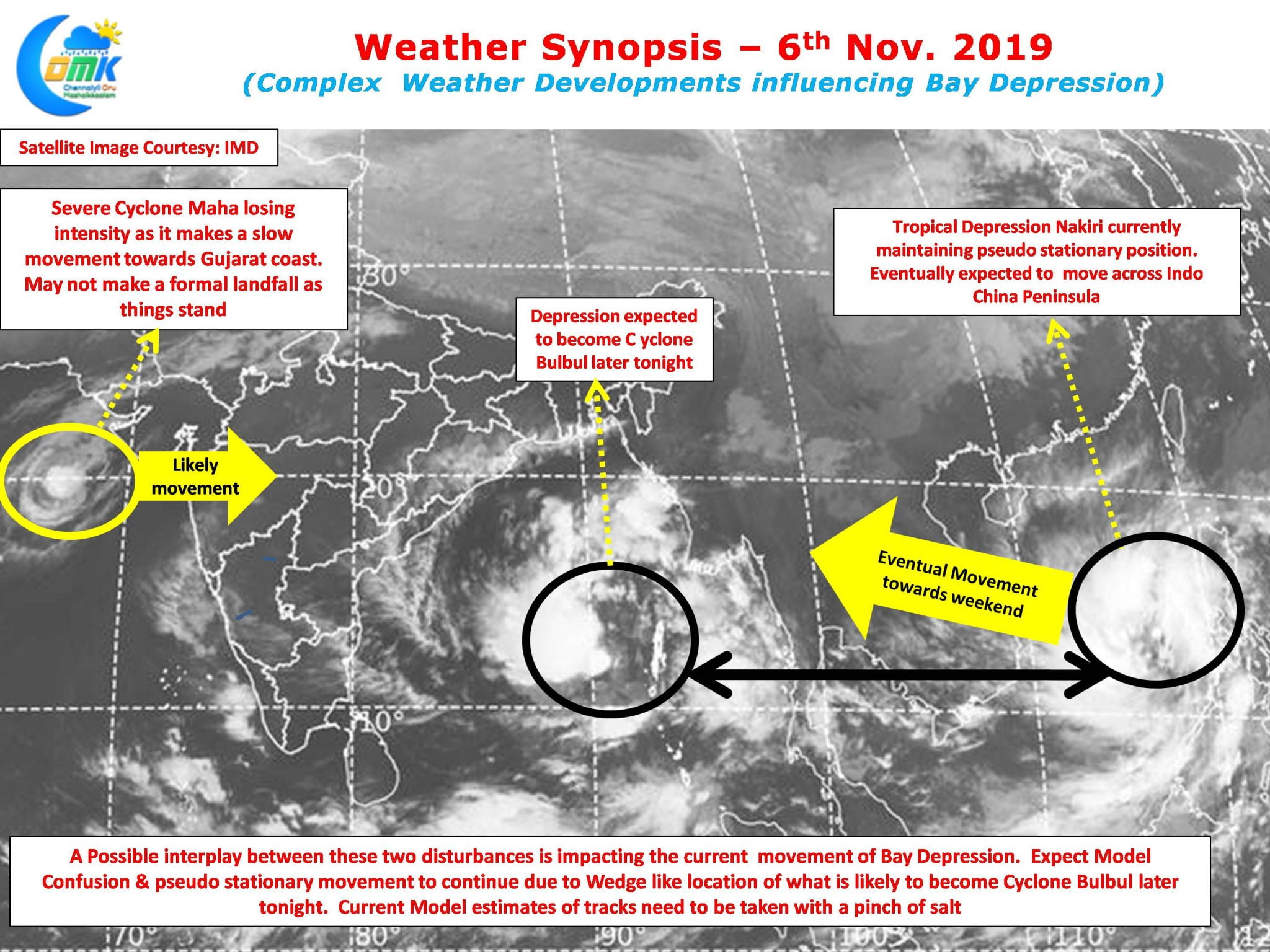
On the larger scale Bay Depression is possibly under the influence of some complex weather pattern happening not only over the Indian Sub Continent but also over the South China Sea. On the one hand there is a fast deteriorating Cyclone Maha that is heading towards the West Coast while out there to the East of Indo China Peninsula a Tropical Depression has been trying to find its bearing while maintaining near stationary movement.

Between these two disturbances the Bay Depression is possibly wedged bringing a possible interplay between the two depressions over Bay & South China Sea. Though models seem to be enthusiastic about a possible NW path for what is likely to be Cyclone Bulbul the complex dynamics mean all model outputs need to be taken witha pinch of salt. In all probability as it intensifies into a Cyclone expect a quasi stationary movement by the Bay disturbance over the next 24 to 36 hours before a possible realignment of track.
எப்பொருள் யார்யார்வாய்க் கேட்பினும் அப்பொருள்மெய்ப்பொருள் காண்ப தறிவு is applicable to models as well.


