The biggest challenge weather communicators around the world face is the threat of false alarm. Over time if the false alarm rate remains high the response to alarms will start diminishing. Nevertheless, over the past five years, roughly seven out of 10 tornado warnings have been false alarms. Even NWS in America face the false alarm conundrum. As we aim to give a head start for disaster preparedness earlier than before the probability for false alarm increases. The false alarm conundrum is once again upon us as Coastal Tamil Nadu faces another rainfall event.
Northeast Monsoon even on a normal year is not for the weak hearted. This year’s monsoon has been particularly stressful with more misses than hits. As the season made onset during mid October an widespread rainfall event became a one day event. Mid November event initially promised to be widespread event for Coastal Tamil Nadu. Eventually it was Delta districts that benefitted the most. The long breaks in between rainfall events have added fuel to the fire. It is almost a Deja vu moment for us at COMK. Way back in 2018 after sticking the head out for “Cyclone Phethai” we had to eat the humble pie. But as always the key question is should we alert or remain conservative due to past failures?
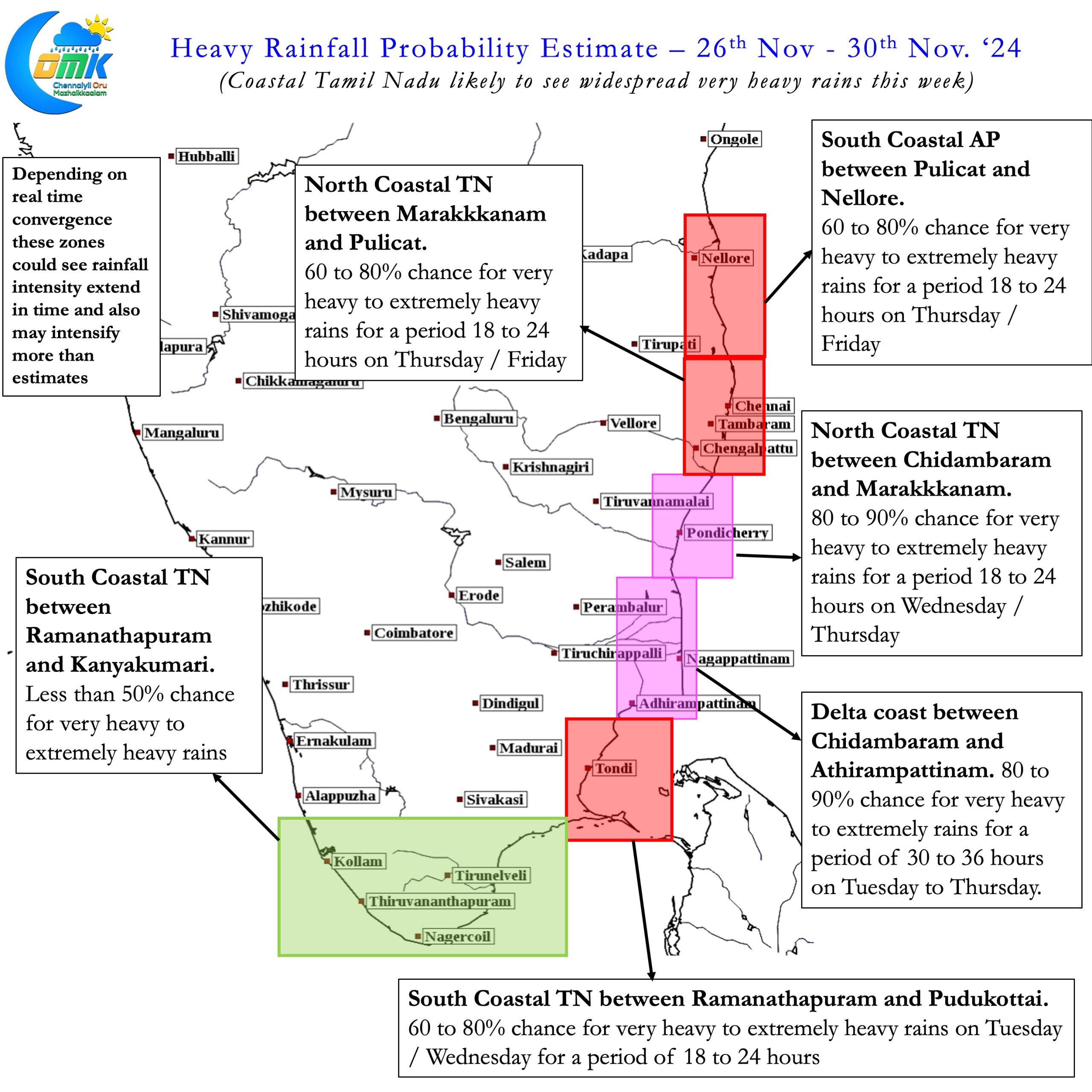
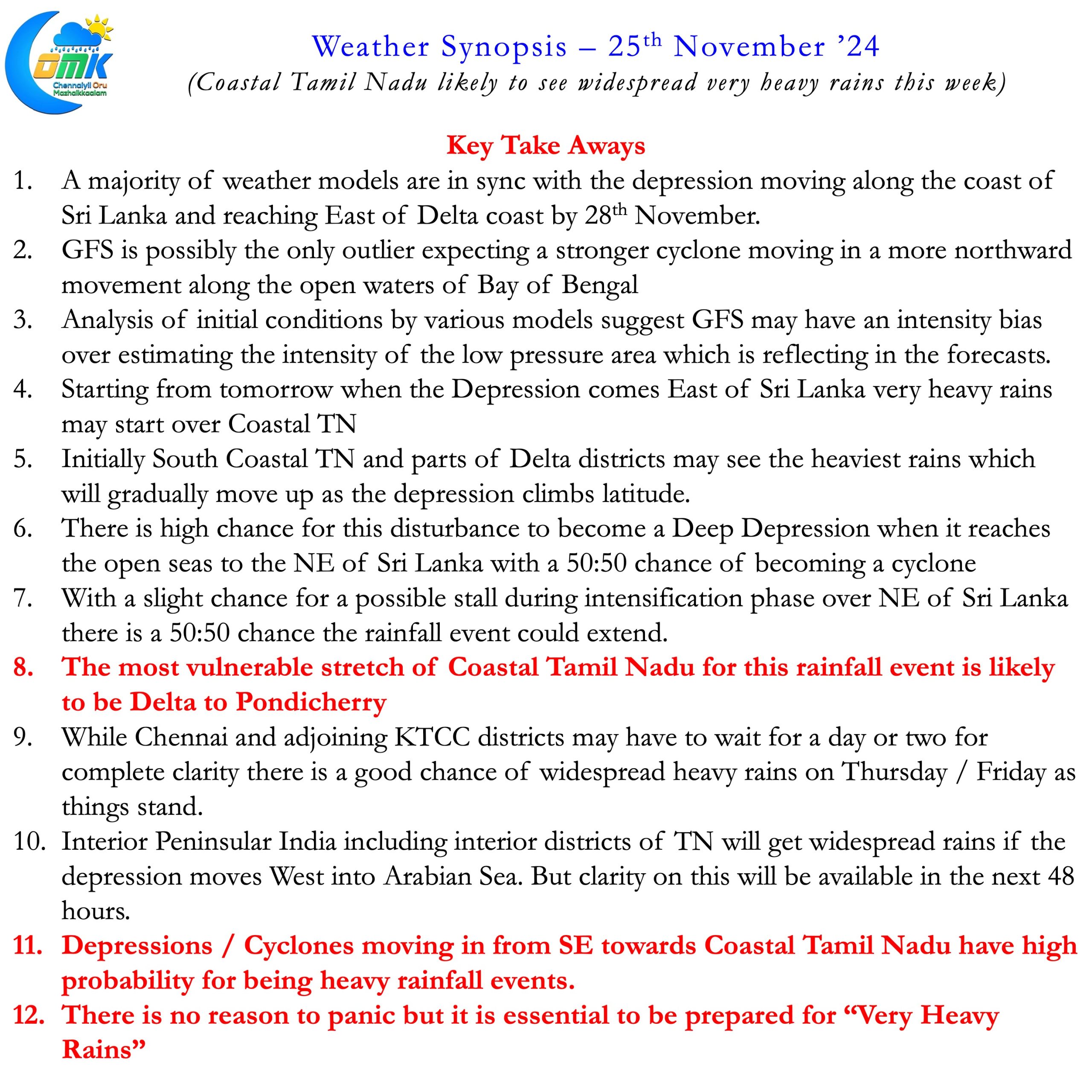
It is essential to be prepared for rains. With this in mind requesting everyone to not panic but be prepared the Key Take Aways from COMK for the upcoming week. Please note in real time based on movement and intensity of the depression the associated convergence may change. Along with it the rainfall events may change in intensity, time period and geographical impact.
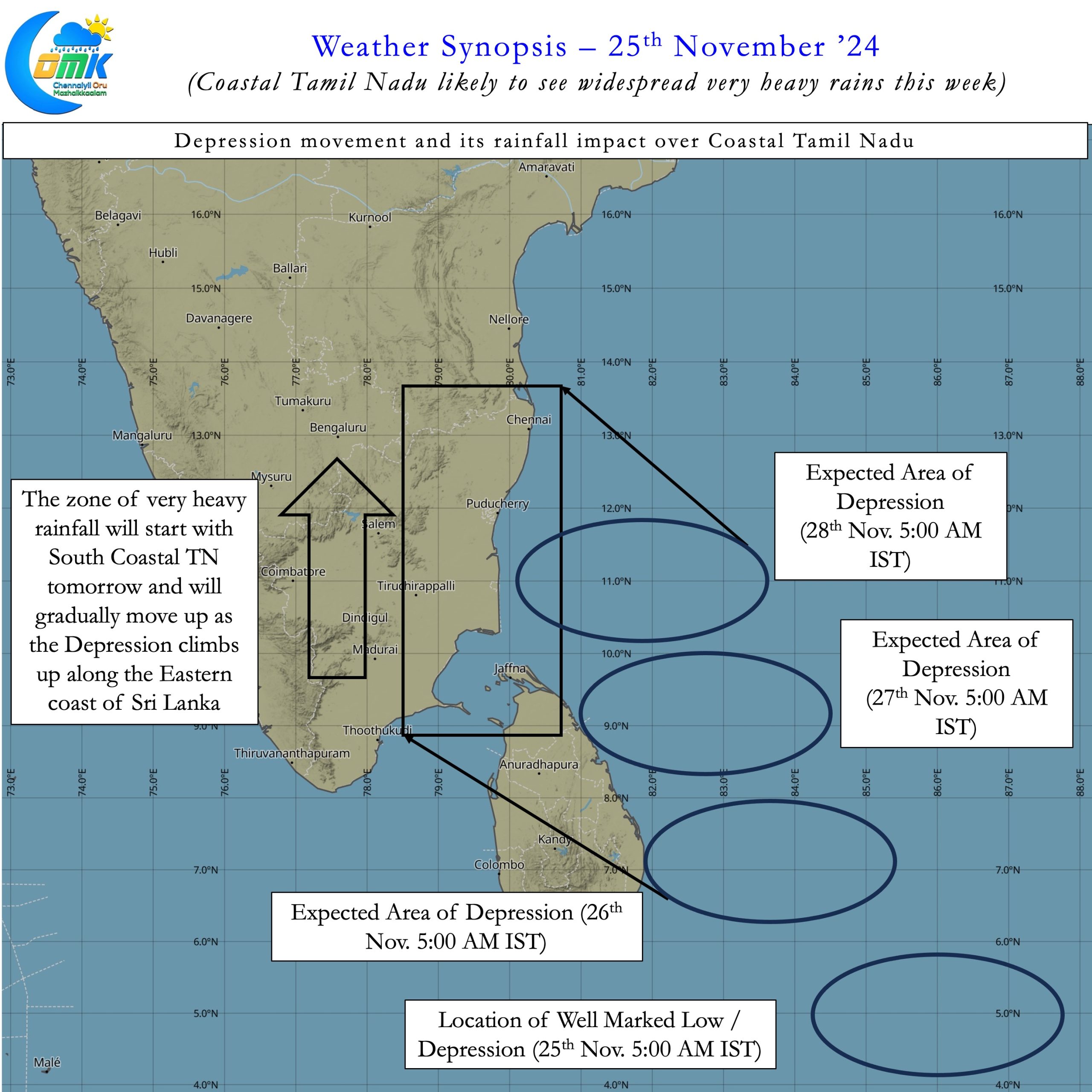
- A majority of weather models are in sync with the depression moving along the coast of Sri Lanka and reaching East of Delta coast by 28th November.
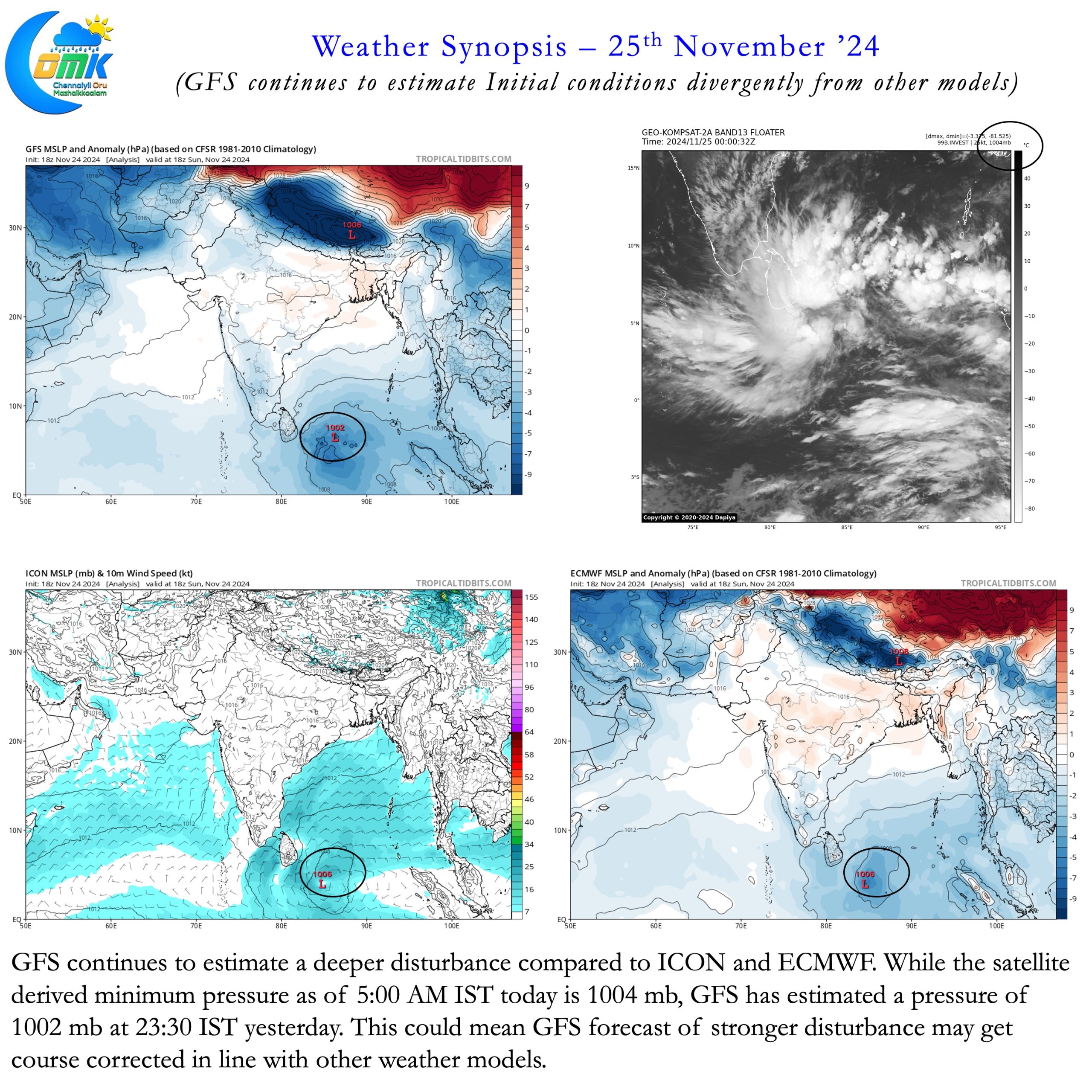
- GFS is possibly the only outlier expecting a stronger cyclone moving in a more northward movement along the open waters of Bay of Bengal
- Analysis of initial conditions by various models suggest GFS may have an intensity bias over estimating the intensity of the low pressure area which is reflecting in the forecasts.
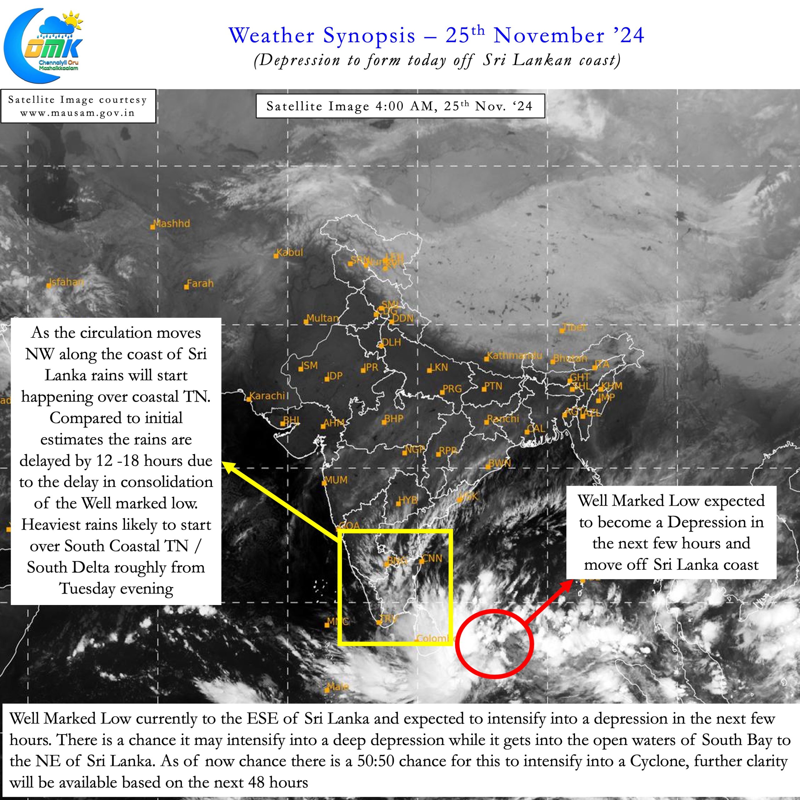
- Starting from tomorrow when the Depression comes East of SriLanka very heavy rains may start over Coastal TN
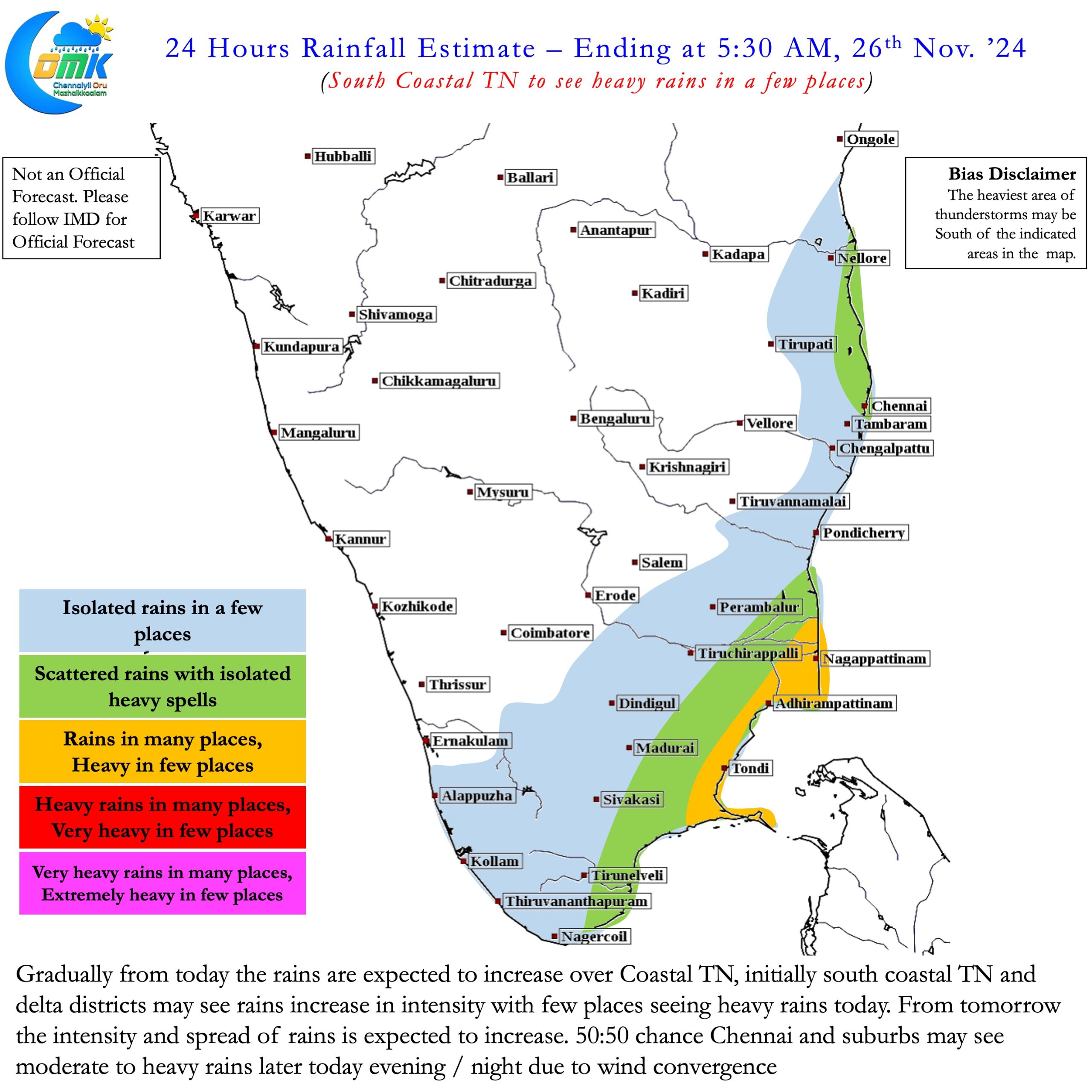
- Initially South Coastal TN and parts of Delta districts may seethe heaviest rains which will gradually move up as the depression climbs latitude.
- There is high chance for this disturbance to become a Deep Depression when it reaches the open seas to the NE of Sri Lanka with a 50:50 chance of becoming a cyclone
- With a slight chance for a possible stall during intensification phase over NE of Sri Lanka there is a 50:50 chance the rainfall event could extend.
- The most vulnerable stretch of Coastal Tamil Nadu for this rainfall event is likely to be Delta to Pondicherry
- While Chennai and adjoining KTCC districts may have to wait for a day or two for complete clarity there is a good chance of widespread heavy rains on Thursday / Friday as things stand.
- Interior Peninsular India including interior districts of TN will get widespread rains if the depression moves West into Arabian Sea. But clarity on this will be available in the next 48 hours.
- Depressions / Cyclones moving in from SE towards Coastal Tamil Nadu have high probability for being heavy rainfall events.
- There is no reason to panic but it is essential to be prepared for “Very Heavy Rains”

