
In a precursor to the upcoming Northeast Monsoon season many places in Tamil Nadu recorded rains brought in by Easterlies. With Southwest Monsoon expected to withdraw from more places in North India in a day or two all eyes are on the seasonal change towards Northeast Monsoon.
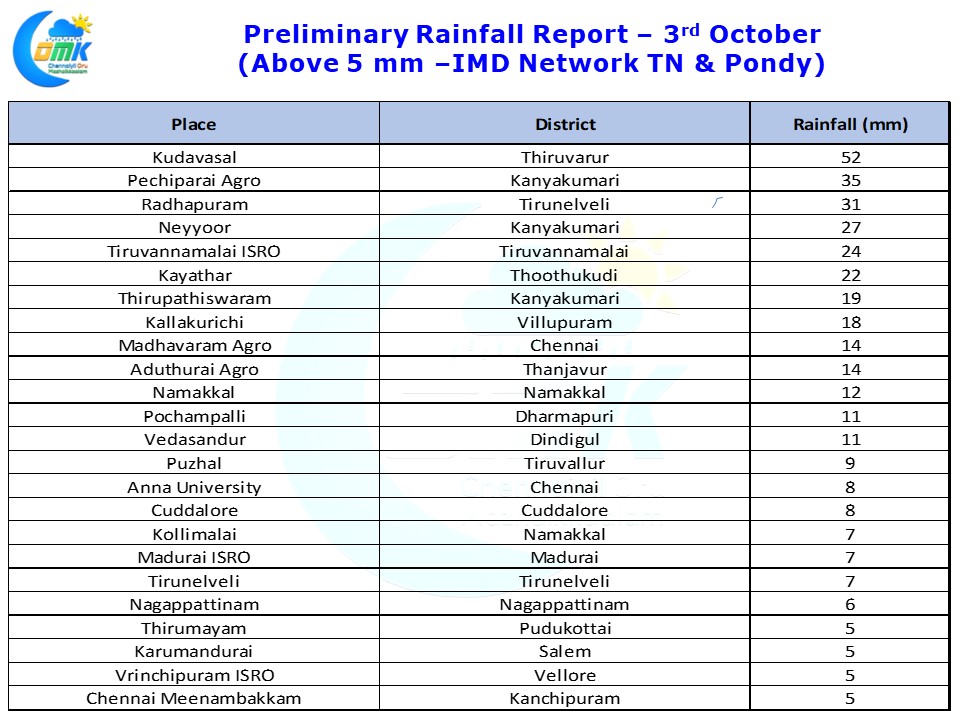
Few parts of Chennai recorded light rains during the early hours of today.Kudavasal in Thiruvarur district recorded 5 centimetres while many places in Kanyakumari and Tirunelveli District also recorded moderate Rains last evening.
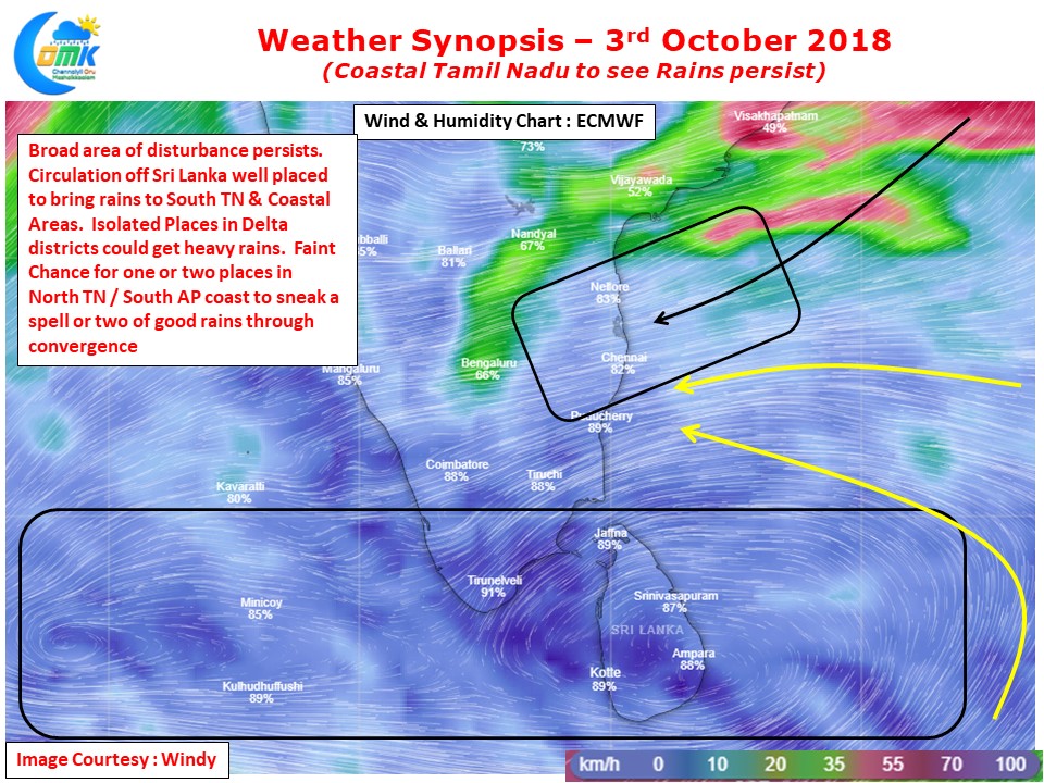
With the broad area of disturbance still persisting between Lakshadweep and east of Sri Lanka Northeast monsoon like conditions continues to influence weather over most parts of Tamilnadu. Over the next couple of days the upper air cyclonic circulation of Sri Lanka is perfectly placed to bring rains over coastal Tamil Nadu. With slightly more streamlined Easterlies, even if it is a temporary phenomenon, we can see an increased rainfall activity over Coastal TN for the next few days.
. Models continue to develop the Lakshadweep circulation into an organized strong disturbance while there is some divergence on the future course of the upper air cyclonic circulation prevailing over East of Sri Lanka. We will get some clarity on this possibly tomorrow with some momentum expected over Arabian Sea. With a seasonal cusp “Westerly to Easterly” conditions there is always a case for Models struggling under rapidly changing weather dynamics.
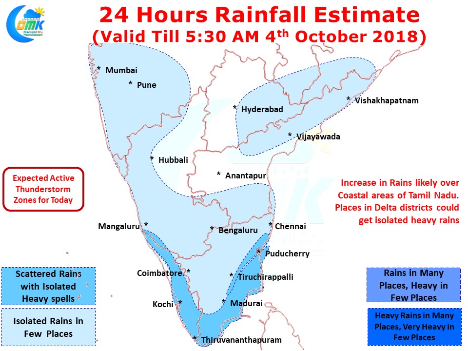
Wind charts indicate few places in Delta districts to record moderate to heavy spells of rains in the next 24 hours or so while there will be more places along the coast to get light to moderate rains. South TN will continue to benefit from the circulation recycling moisture over the region.
While today morning saw light rains in a few places around Chennai things look up for a good spell of rains tonight / tomorrow morning. There is a faint chance for one or two places in South AP / North TN to benefit from the convergence of winds from different masses – slightly drier winds from NNE & Easterlies carrying more moisture from Bay. This will depend a lot on how the eventual wind pattern happens in real time.