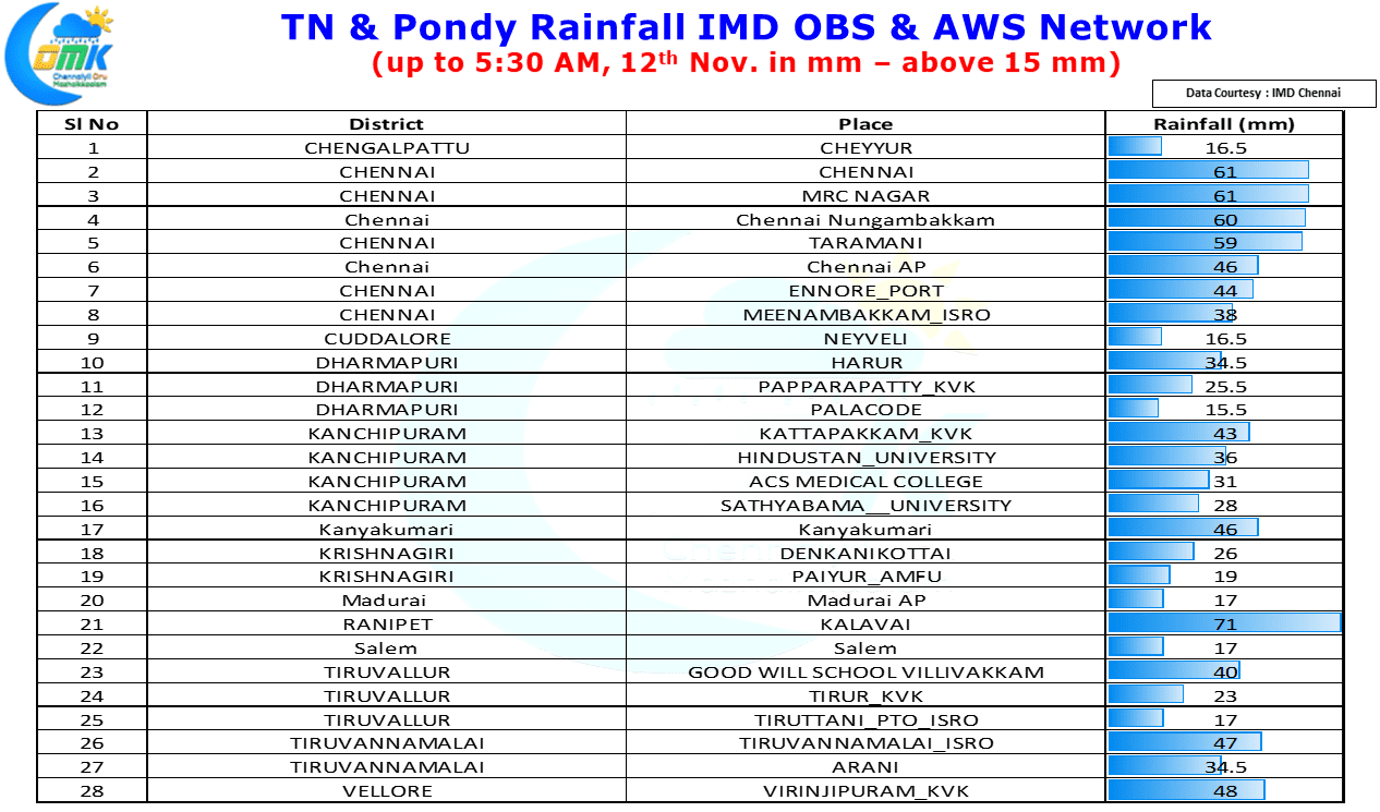
After battering for nearly 5 days with varying intensity that resembled a T20 innings, Powerplay on Sunday middle over consolidation during the week & end of the innings flourish on Thursday / Friday, rains have eased since last evening bringing some much needed relief to Chennai & suburbs which saw localized flooding / water logging across most parts of the city. Though the rainfall numbers may sound a little low around Chennai & suburbs yesterday in the overall context of the past few days each additional mm certainly added to the water logging in the city.
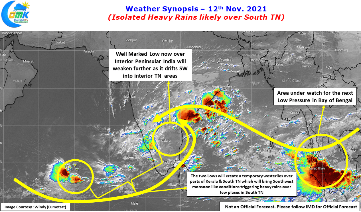
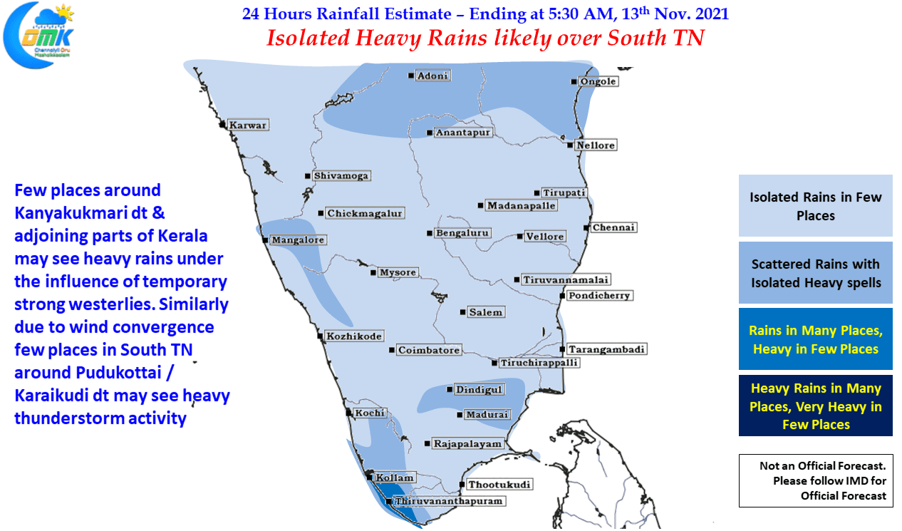
The Depression that was the trigger for not only Chennai’s rains past week but also the extreme rains part of Delta saw earlier this week finally crossed close to Chennai last evening. Currently it is lying as a well marked low over interior parts of Tamil Nadu and adjoining areas. It will gradually weaken as it continues to stay over land. Meanwhile along with this Low & the low that has been staying along in Arabian Sea will create temporary Westerlies over parts of South TN & Kerala. This strong westerlies will resemble a Southwest Monsoon day bringing heavy rains over parts of South TN particularly Kanyakumari district & adjoining areas.
Similarly wind convergence created by the remnant low will also trigger moderate to intense thunderstorm activity over parts of Sivagangai / Pudukottai areas. This might bring isolated heavy rains in these districts and adjoining areas of Madurai, Dindigul, Trichy, Thanjavur & Virudhunagar dts. North Tamil Nadu including Chennai may see reduction in rains though isolated localized rains may happen time to time though these spells of rains may not be long.
With regard to the possible low pressure that is likely to evolve over Andaman Sea in the next day or two while it may be little early to worry about possible impact for Tamil Nadu it would be wise to keep a tab on it so that any rainfall episode which at this moment may bring more damages than a possible Depression / Cyclone. More on it as the disturbance evolves.


