
After the disappointment of Cyclone Phethai when not even a single place in Coastal TN recorded any meaningful rains almost everyone was looking forward to this weekend for some rains. With the Trough of Low extending up to 1.5 kms above sea level many weather watchers were keenly observing for possible development of this disturbance.
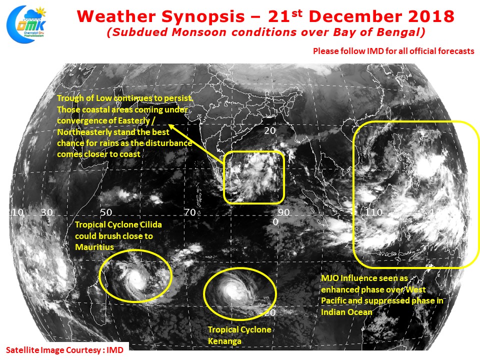
Currently lying off Sri Lanka the trough continues to move approximately in a East to West direction. Overall one needs to keep in mind the relatively subdued monsoon dynamics prevailing over Bay of Bengal. ITCZ is possibly providing more support to Southern Indian Ocean while the presence of MJO over West Pacific and adjoining areas has created a suppressed phase over North Indian ocean making overall atmospheric conditions fairly subdued. This could mean compared to original expectations the rains will possibly less spread and less chance for heavy rains as well.
But one possibility which we cannot ignore is the possibility of thunderstorms triggered over places falling in the Dry Air Boundary region, a region where the dry Northerlies meet the moist Easterlies. As things stand one or two places in Delta & South TN could fall in this region which could bring heavy spell of rains in extremely isolated places. Similarly as the moisture gets moved from East to West some of it may get trapped and possibly give moderate to heavy rains in one or two places over the Western Ghats.
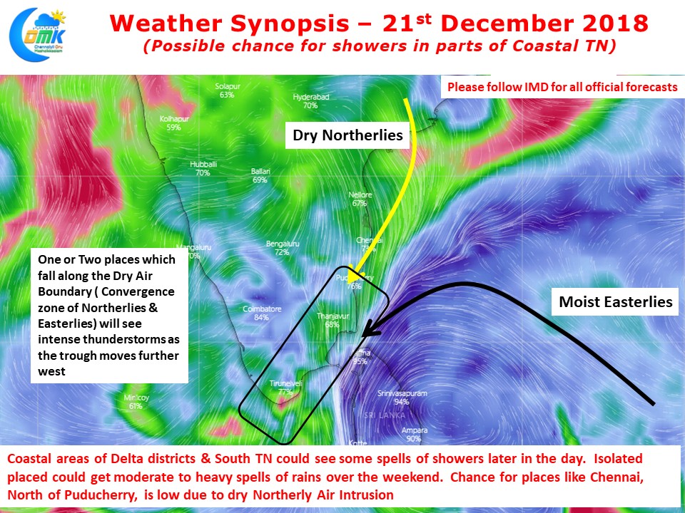
For places to the North of Puducherry like Chennai the chances are less for any major rainfall activity since these places are coming under the influence of the dry Northerlies. Unless any major change in atmospheric conditions happen North TN will have to be content with some passing spells of showers