Aided by the Low Pressure that prevailed over North Bay Southwest Monsoon finally made some progress covering large parts of Peninsular India. Though running well behind schedule IMD confirmed the onset of Southwest Monsoon was complete over Karnataka, Tamil Nadu, Andhra Pradesh & large parts of Telangana. It remains to be seen though if current year may end up as one of the latest onsets for Mumbai which typically sees Monsoon onset around 10th June.

As is the case many a time, the Low Pressure Area in Head Bay has triggered a weak off shore trough running from South Konkan to Kerala that has brought back some bit of mojo to Southwest Monsoon. Under the influence of this off shore trough the rains could increase over Kerala & Coastal Karnataka and also over the Western Ghats. This could augur well for inflows into the dams over the Western Ghats.

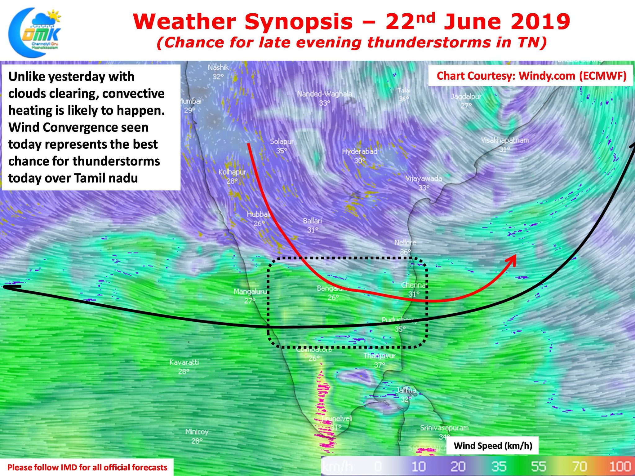
The improved monsoon dynamics had created a partly cloudy skies most of the day yesterday playing spoilsport for thunderstorm development over Tamil Nadu. Today though indications are clearing skies during the morning hours could provide conditions for convective development. Additionally the wind convergence seen today represents the best chance for thunderstorms over Tamil Nadu.

Parts of North West TN along with Tiruvannamalai, Villupuram, Cuddalore, parts of Delta, Kanchipuram & Tiruvallur dts are in line for some late evening thunderstorm activity. With westerlies firmly establishing we can expect some of these thunderstorms to eventually find its way towards Chennai & Suburbs.


