While Rains in Chennai has continue to be elusive for the past few days even though places not far away from Chennai has seen spells of light to moderate rains during the past week in particular the stretch around Ponneri / Pulicat has seen moderate thunderstorms hit regularly.
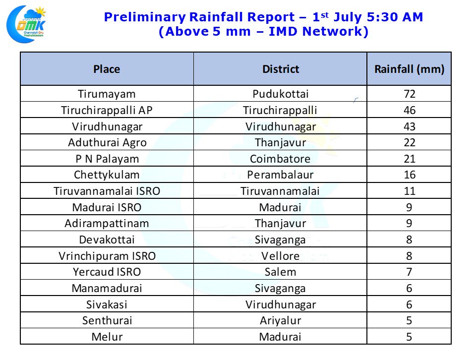
Yesterday was one of the better days of thunderstorms for Tamil Nadu as many places in Madurai, Sivaganga, Karur, Pudukottai, Tiruchirappalli districts recorded moderate rains. Parts of Delta districts also recorded good rains particularly around Thanjavur district while Nagappattinam & Tiruvarur districts had to feel happy with light rains from the remnant storms that moved in from the West. Tiruchirappalli that was seeing absolutely dry days after the onset of Monsoon saw one blinding spell in the evening with the Airport observatory recording nearly 5 cms of rains as most parts of the city saw intense thunderstorms.
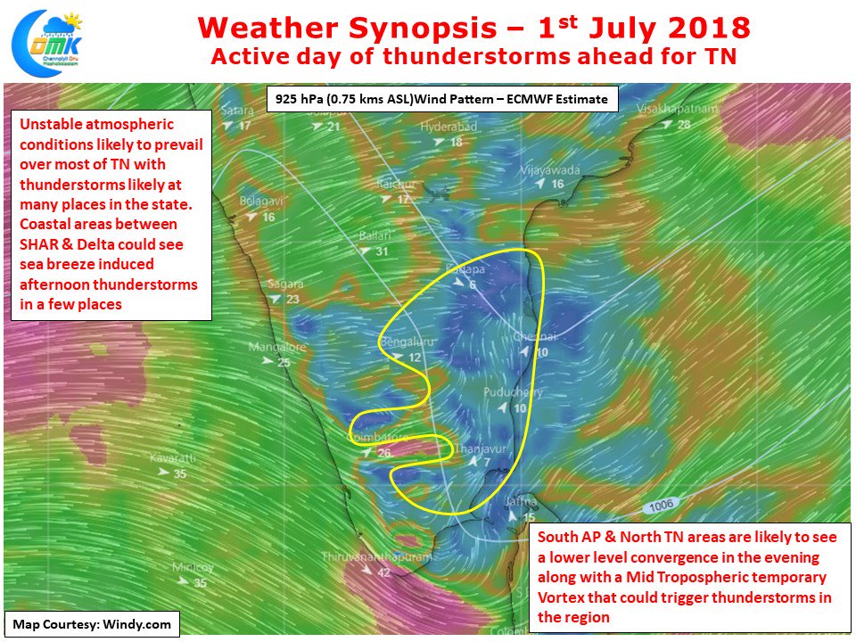
Overall the unstable atmospheric conditions that triggered thunderstorms over many parts of the state is likely to continue today as well. Once again sea breeze and associated lower level Easterlies are likely to be a key component in the equation with numerical models indicating a lower level convergence over North TN & adjoining parts of South AP. Along with it there is likely to be a Mid Tropospheric Vortex (pseudo circulation) which could make it ideal for some thunderstorms and rains in Chennai & surrounding areas. Coastal Tamil Nadu could once again benefit from thunderstorms along with a few interior places in South TN & Central TN. Few places in Coimbatore, Erode, Salem, in West TN could also see isolated thunderstorm activity. All in all its going to be another active day of thunderstorms for Tamil Nadu and a good day of rains in Chennai as well.


