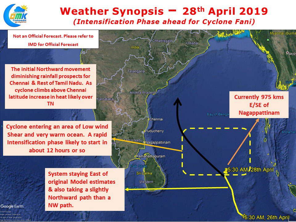
Cyclone Fani, currently lying at 7.3N, 88E, about 975 kms E/SE of Nagappattinam, has been taking a Northward track climbing up the latitudes. With its entry now into the open waters of Bay the system is looking at an active intensification phase ahead. Compared to yesterday’s satellite image today Cyclone Fani is certainly looking better…
Category: Weather Update
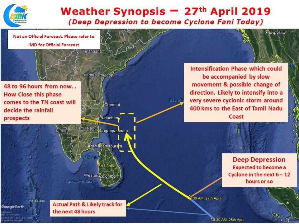
Deep Depression to become Cyclone Fani Today
Yesterday’s Well Marked Low intensified into a Deep Depression over night and is in on its way to becoming Cyclone Fani over the next 6 – 12 hours or so. Still lying in the lower latitudes of Equatorial Bay, as we mentioned in our post yesterday the South movement by its Cross Equatorial Sibling has…
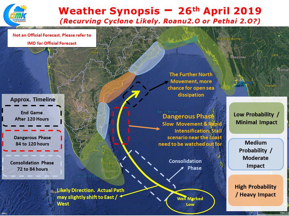
Bay Low likely to intensify into a Depression today
The Low Pressure Area in Equatorial Bay intensified into a Well Marked Low last evening and is likely to intensify further today into a Depression. The overall theme though continues to remain fluid with the disturbance keeping both weather watches & weather models on tenterhooks alike. Overnight satellite images show the disturbance trying to cut…
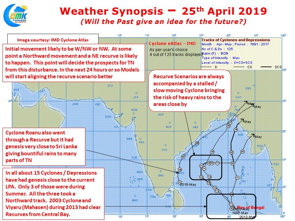
Low Pressure in Bay, system consolidation awaited
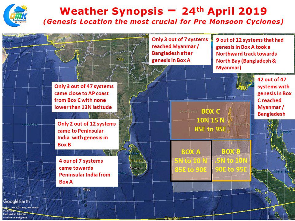
In what is going to be a nail biting journey for not only weather bloggers but media & public as well, the Low Pressure Area has formed in Equatorial Bay very close to the Equator. This is the first step in this journey towards what is likely to be a very strong Pre Monsoon Cyclone….
Eyes on Bay but Nature runs at its own pace
From yesterday the talk of the town has been possible Cyclone towards Tamil Nadu. While weather bloggers have been keeping an eye on weather models for a possible disturbance to evolve the Flash Alerts by Television media from yesterday afternoon has created a frenzy. The dry spell and poor NEM last year has added to…


