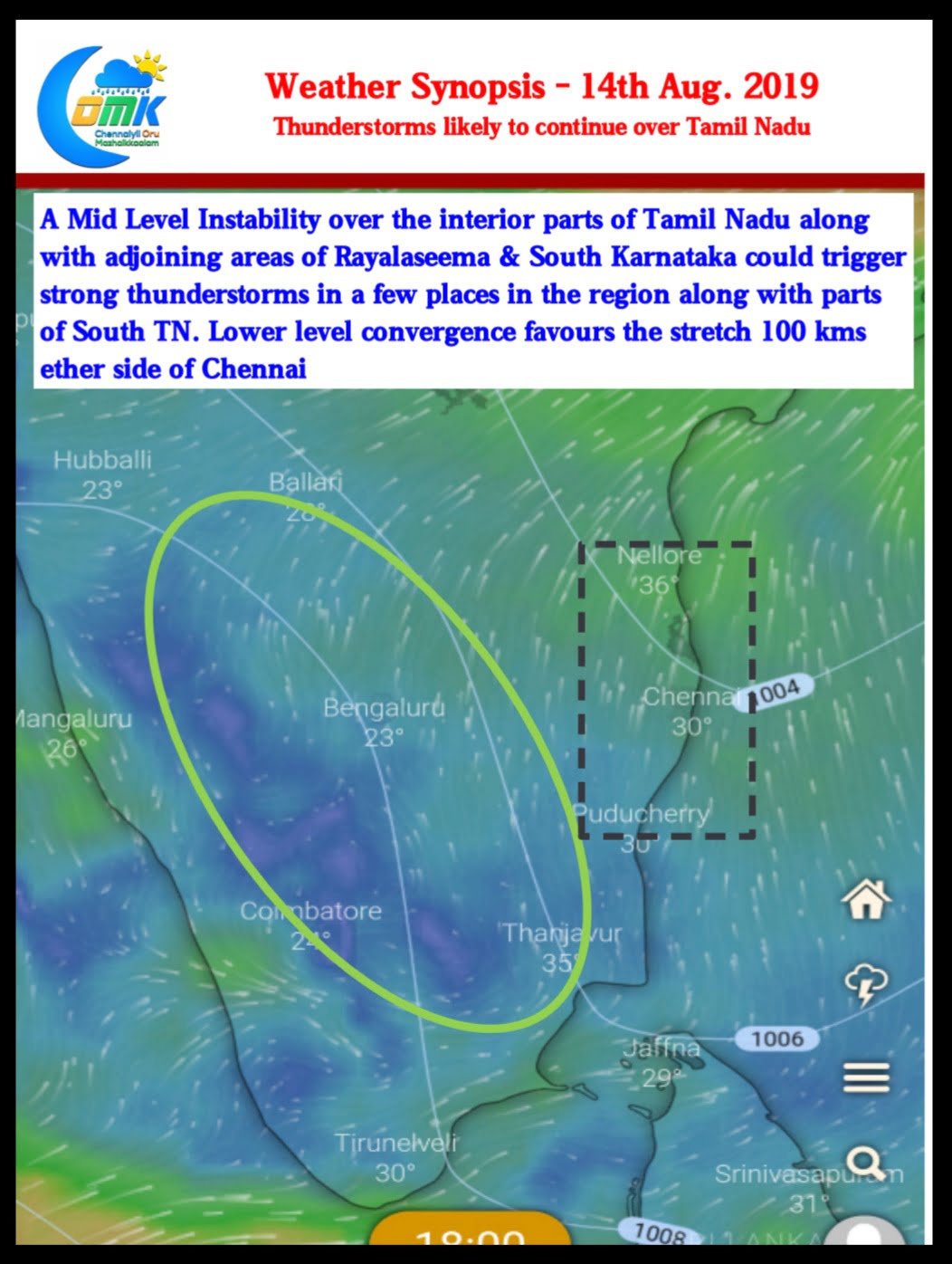
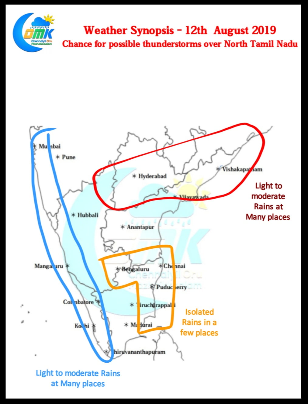
Yesterday saw the return of thunderstorms over Tamil Nadu as many places recorded light to moderate rains in the evening. Parts of Chennai also recorded moderate spell of thunderstorms with Anna University recording 14 mm during the evening spell of rains. Satellite image indicates strong banding from the Low Pressure Area over the ChotaNagpur region….
Category: Weather Update
West Coast Slows Down to bring relief
In what could be a huge boost for relief & rehabilitation efforts over the battered places in Western Ghats the rains have slowed down since yesterday with further reduction likely today. Avalanche, famous after 200 cms recorded in 72 hours, recorded just 5 mm for the 24 hours ending today morning 6 AM. Satellite image…
Ghats pay a huge price for the plains
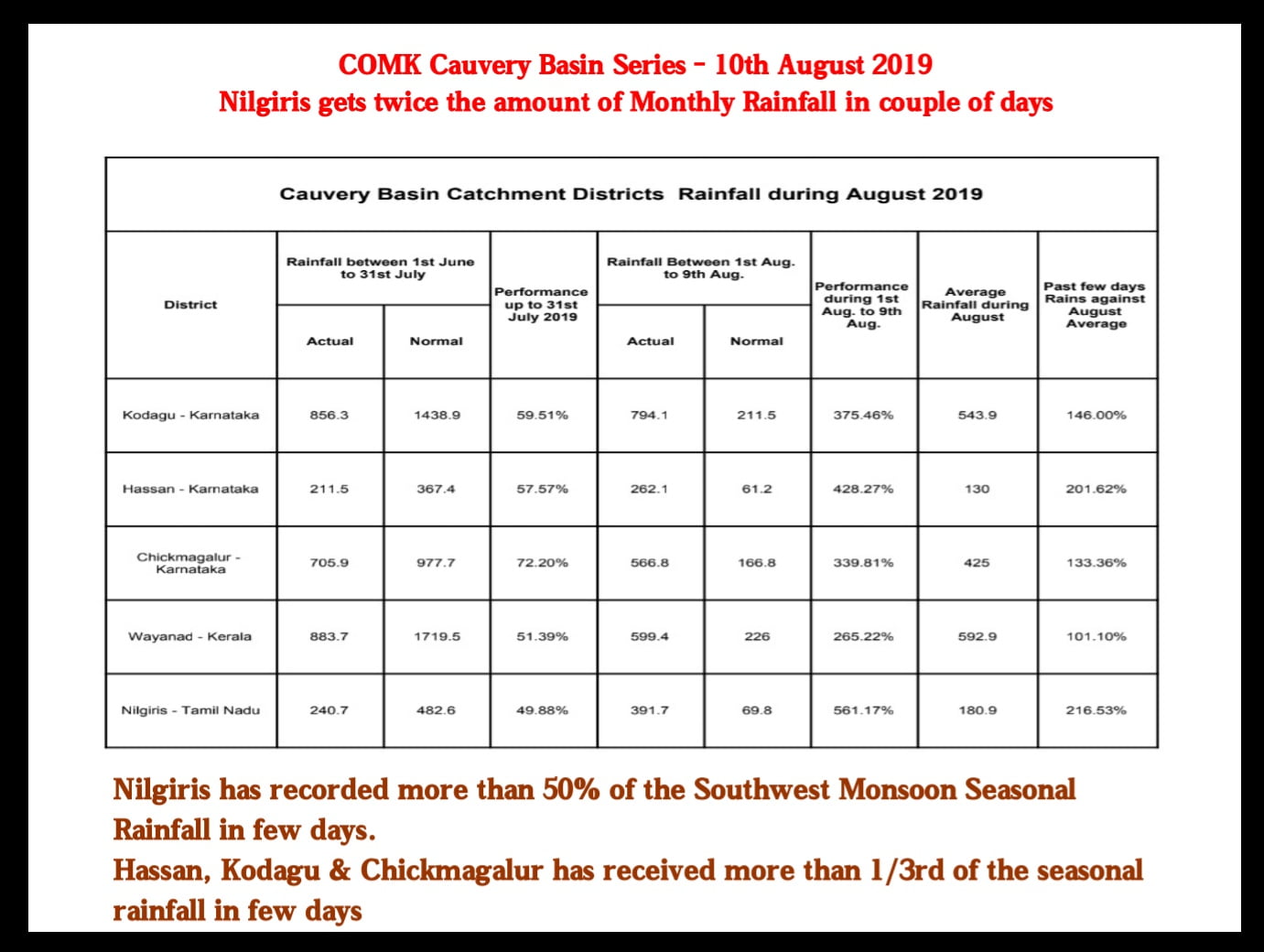
A few days back we had put up a post on how the storage levels of dams in Tamil Nadu are a concern with half of the Southwest Monsoon gone. On 23rd July 2019 we had mentioned about how a Cauvery Basin could come under pressure due to poor rains in the catchment areas till…
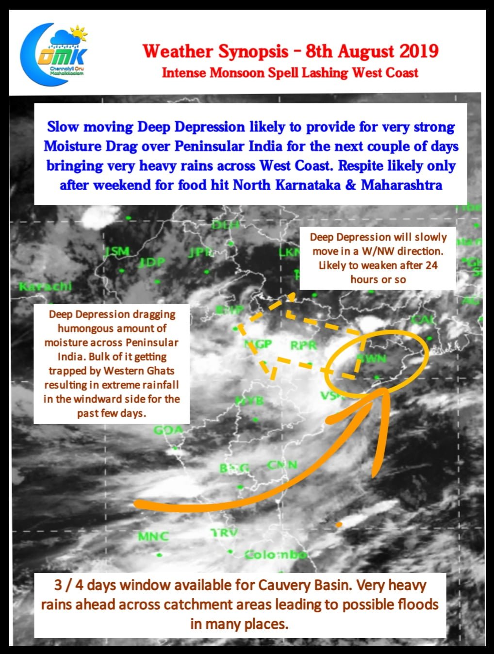
Deep Depression creates Monster Monsoon Spell
Southwest Monsoon has been extremely vigorous over the West Coast bringing extremely heavy rains over many places in Western Ghats. Both Godavari & Krishna basin has been getting very heavy inflows leading to large scale flooding over Peninsular India. In particular North Karnataka is possibly seeing historic water levels in Krishna & it’s tributaries like…
Active Monsoon Conditions Persist
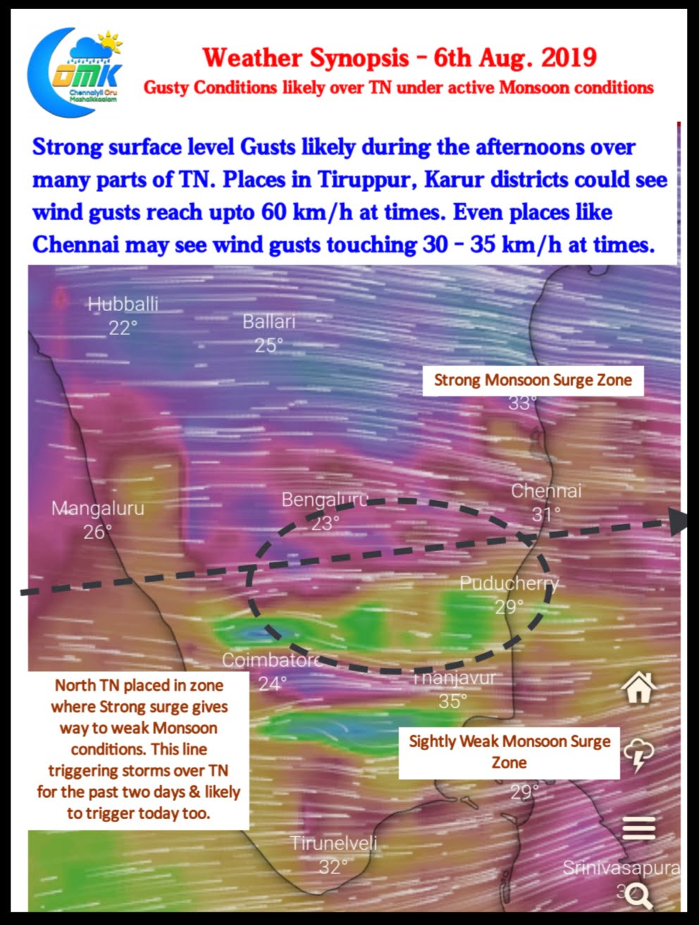
Southwest Monsoon has been vigorous over the West Coast with many places along the Ghats all the way from Maharashtra to Tamil Nadu seeing heavy rains. Mukurthi Peak recorded 31 cms for the 24 hours ending today morning. With West coast seeing active monsoon conditions it’s likely to be a very windy day over many…


