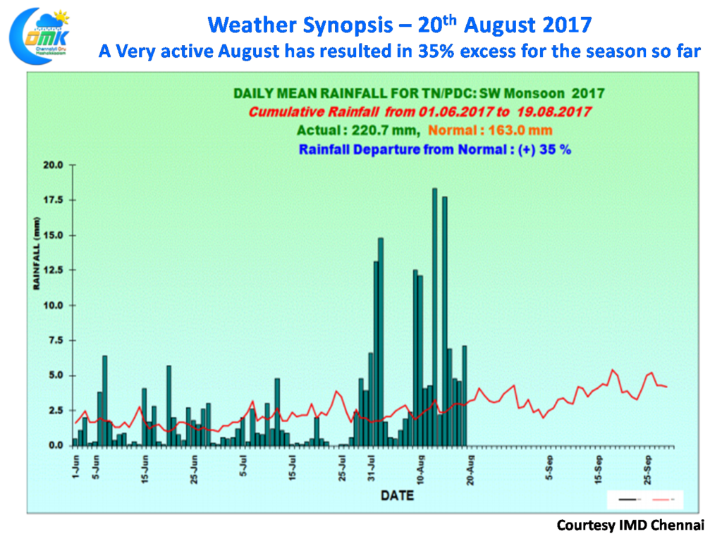
While overall thunderstorms have slowed down over most of Tamil Nadu, yesterday saw Chennai and surrounding areas receive light to moderate rains with Puzhal recording about 17 mm rains while Mailam, Pondicherry, Neyveli recorded some light rains as well. Overall though August has been extremely good for Tamil Nadu so far with the state sitting at 35% excess as of yesterday though the two core monsoon districts Nilgiris & Kanyakumari along with Tirunelveli continues to see deficit conditions.
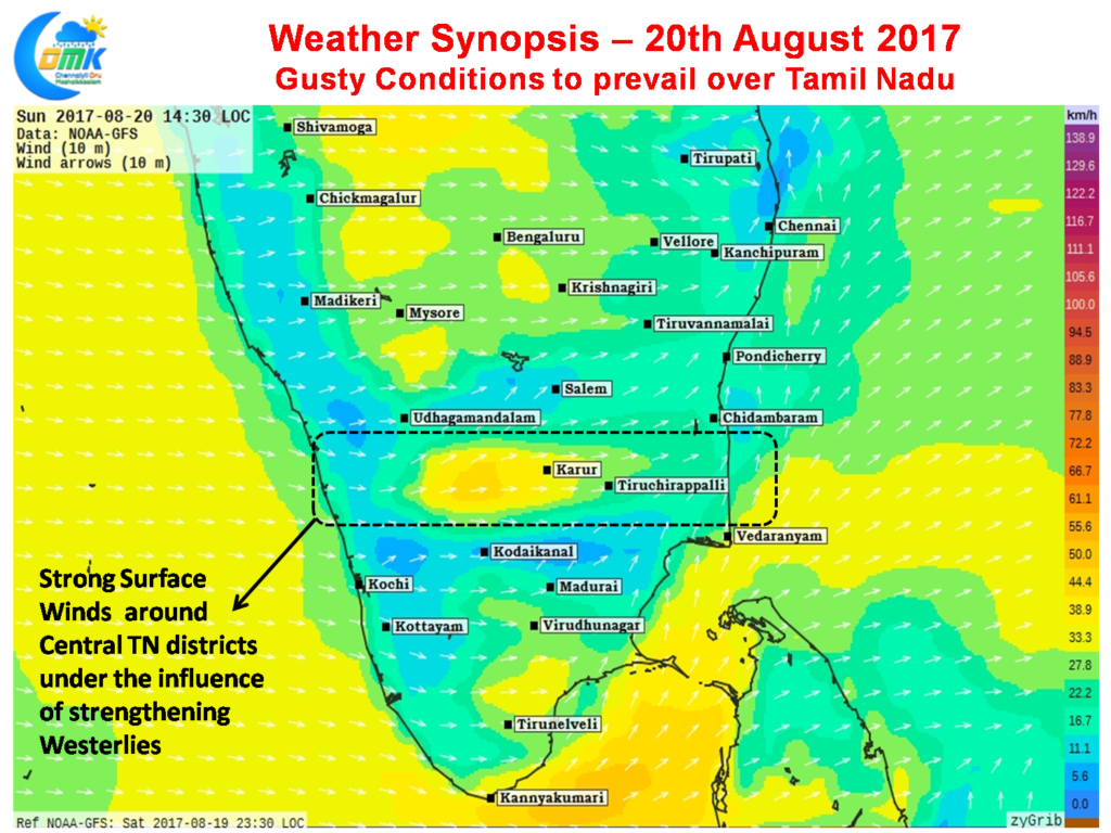
Windy conditions are expected to prevail over most parts of Tamil Nadu under the influence of strengthening Westerlies as the Low Pressure currently straddling the Eastern parts of Central India moves further west over the next 24 to 48 hours. Blustery conditions during the day with some strong gusts at times are likely to be seen in the Central TN region particularly to the East of Palghat gap
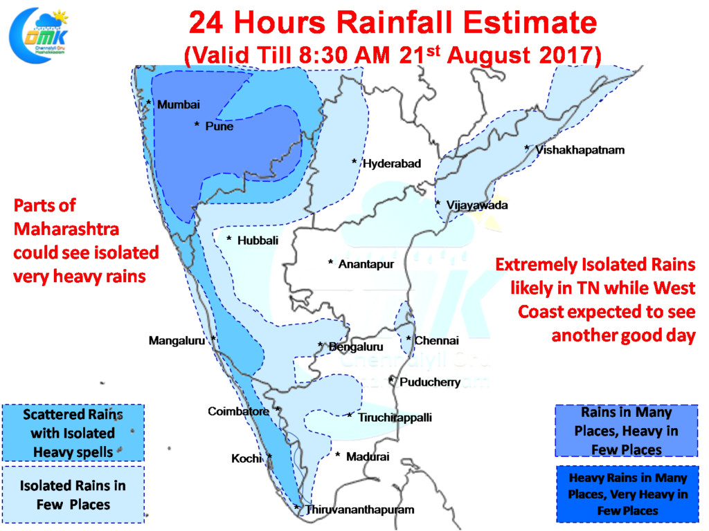
Rains continued over most parts of West Coast with some isolated heavy rains over the Konkan coast thanks to the moisture drag created by the Low Pressure Area. The good development is the effort LPA is making to drag the monsoon trough from the foothills of Himalayas. The Eastern arm of the trough is now over Central Bay while the NW arm is slowly shifting down towards Rajasthan.
 Rains are likely to continue over the West Coast with few places in line to get moderate to heavy rains over the Konkan area of Maharashtra once again. Models indicate decent prospects for Coastal Karnataka & North Kerala as well which could ensure some inflows into the Dams bringing some cheer to the farmers.
As far as Tamil Nadu goes, one or two places in North TN could get some sharp spells of showers later in the evening, but the strong monsoon current will ensure these storms pass even before you realize with wind speeds touching nearly 50 km/h at 850 & 700 hPa levels. One or two places in and around Chennai could get a spell or two of passing showers from these lightning quick thunderstorms.
Powered by WPeMatico


