
The first spell of Veppa Salanam Rains for Interior South India brought in historic spell of rains to parts of Bengaluru as both IMD observatories in HAL & City recorded heaviest rains during February in more than 60 years. Some Automatic Weather Stations maintained by the KSNDMC recorded nearly 10 cms last evening with bulk of it happening within an hour or so.
As mentioned in our post the other day a wind induced instability triggered by the Easterly trough was one of the main reasons for this spell of thunderstorms which also brought in rains along the Western Ghats and few other places of South Tamil Nadu. Few places in Tirunelveli district recorded light to moderate rains last evening.
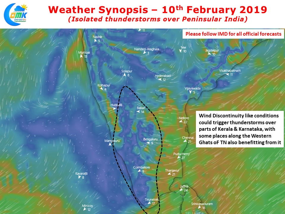
Today the wind discontinuity, a semi permanent feature during the pre monsoon season, like feature is present though slightly weaker than yesterday. This could bring in rains to parts of Kerala & Interior Karnataka though the rains may not be as heavy as yesterday. With some luck parts of Interior TN also could see light spell of rains along the Western ghats once again.
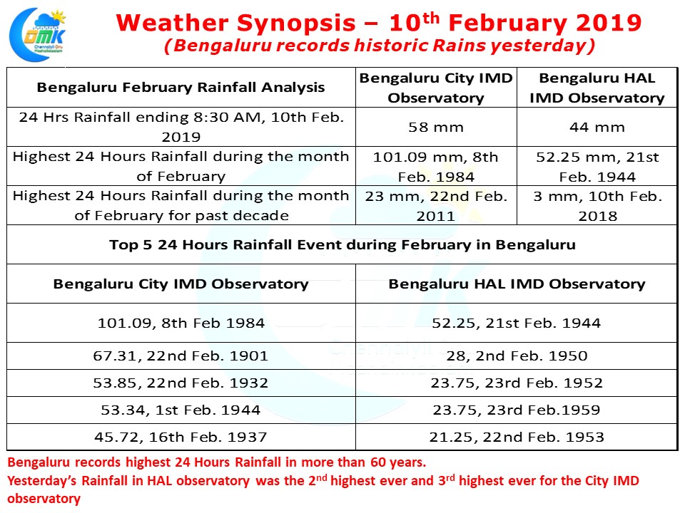
February is typically not known as a high rainfall event month for Bengaluru, with the pre-monsoon thunderstorm season kicking in towards end February / early March. The average rainfall during February is less than 10 mm in Bengaluru effectively making yesterday’s spell nearly 5 times the average monthly rainfall. It is though too early to think about the possibility of pre monsoon thunderstorms starting early for the interior places.