
The Well Marked Low continues to consolidate in the Equatorial waters of Bay pretty much holding a near stationary position for more than 24 hours. The cross equatorial winds have been so far beneficial for the disturbance which continues to retain its connect towards its equatorial twin.
This connect between the twins continues to hold back the Well Marked Low around the Equatorial Waters. As mentioned in our post yesterday the disturbance needs to come into the open waters of Bay to intensify further. As long as it continues to remain in the equatorial waters the Coriolis forces will not be aid the disturbance.
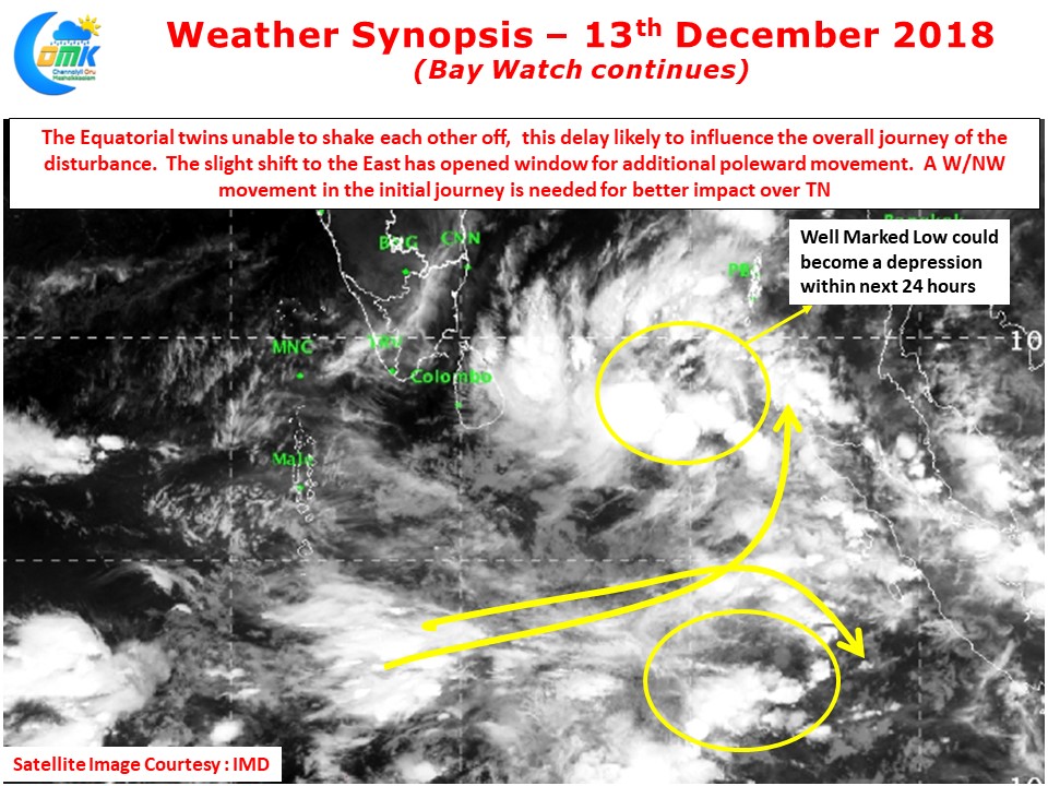
This delay in consolidation is clearly bound to influence the overall life cycle of this disturbance without doubts. The Eastward shift of the vortex seen yesterday has possibly opened the window for more poleward movement. One also needs to watch out for an interaction between the incoming Mid Latitude Trough & the Indo China Ridge. This interplay is also providing an opportunity for Northward movement as reflected in the latest model outputs.
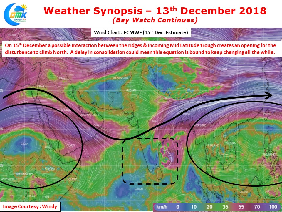
Until the system comes out of the Equatorial waters the delay in consolidation could mean model outputs will continue to change. It would make sense to wait and watch for things to evolve. The overall oceanic and atmospheric conditions continue to remain favorable for intensification of this system. There is no appreciable change seen in steering environment either except for the Interplay mentioned above. With an elliptical path likely for the disturbance the initial W/NW movement will hold key on how close it will come towards TN Coast
As things stand we at COMK still stand by our estimate yesterday in terms of overall impact zone while the delay in consolidation could mean a lag in the timelines