
In our post a couple of days back we had mentioned about the possibility of a disturbance evolving in Bay of Bengal in what could turn out to be a crucial fortnight for NEM 2018 especially for places in North TN like Chennai which still have a lot of catching up to do in terms of bridging deficits.
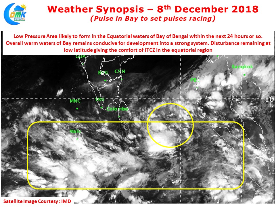
The Equatorial waters along South Bay is now all set to host the next disturbance. Within the next 24 hours or so we can possibly see a Low Pressure Area form in the area between Banda Aceh and Sri Lanka. Looking at the satellite images indicate a developing convection to the East / Southeast of Sri Lanka.
There is a fair bit of cross Equatorial support being provided for the system. Also the presence of ITCZ close to the equator is likely to provide sufficient protection for the disturbance even if it were to take time in consolidating itself.
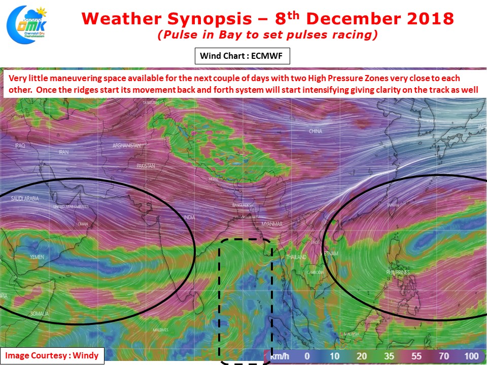
The wind charts indicate a possible period of slow progress or near stationary movement as two high pressure zones have provided very little maneuvering space for the disturbance to move around. Over the next couple of days the usual back and forth movement by ridges will allow the disturbance some leeway.
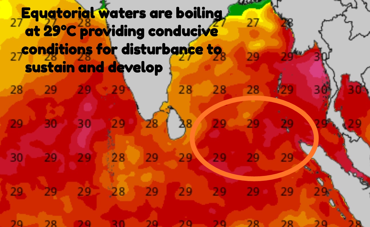
With influence of MJO already seen in the Indian Ocean basin another factor that is likely to be in favour of the evolving disturbance is the boiling waters in Bay of Bengal. The sea surface temperatures around Equatorial waters are a very hot 29°C which is ripe conditions for survival and development. Once the system starts intensifying we need to see how atmospheric conditions play around in the form of wind shear etc.
As we always say patience is the key with weather. This one is also likely to test our patience until it aligns itself to a ridge firmly