
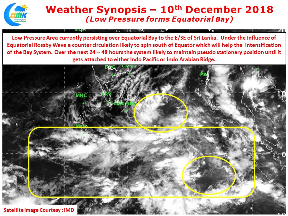
Yesterday IMD confirmed the formation of Low Pressure Area in Bay of Bengal along the equatorial waters off Sri Lankan Coast. Currently the Low Pressure Area is lying in a very safe zone under the protection of Equatorial ITCZ Zone allowing it to intensify over the next few days. The Satellite image also clearly indicates the clear influence of Equatorial Rossby Wave with a counter circulation ready to spin in the Southern Hemisphere to the south of Equator. This counter circulation is likely to provide good cross equatorial support for the Low Pressure Area to become a well marked low in the next 36 hours or so.
We at COMK always keep repeating how the gensis location is critical to any tropical disturbance. As we have mentioned in the past all cyclones tend to get steered by the High Pressure Zones which are semi permanent in nature. While in a case where no High Pressure Zone exists then the cyclones will move in a NW direction over Northern Hemisphere and SE direction in Southern Hemisphere under the influence of the Earth’s rotation. Cyclone Gaja, Cyclone Vardah, Cyclone Thane all were past events which were influenced by the Indo Arabian Ridge majorly while Cyclone Titli, 1999 Odisha Super Cyclone, Phailin, Hudhud were cyclones that completley got steered by Indo Pacific Ridge.
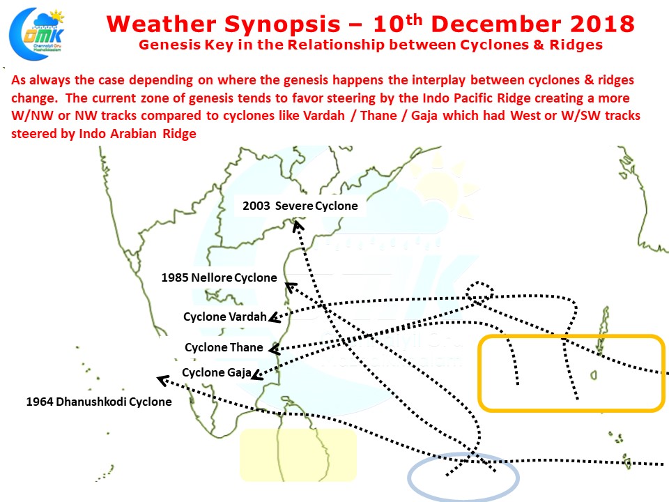
If one were to look at the current genesis point it seems this particular zone falls more often than not under the Indo Pacific Ridge steering which typically takes the cyclones in a NW track. While Gaja was a November cyclone which behaved like a December cyclone taking a W/SW path, both Vardah & Thane had origins much further North compared to the current genesis zone bringing the Indo Arabian Ridge into play. 1985 and 2003 December saw two cyclones have origin in similar scenario as current and head towards Coastal AP. Both were not marginal cyclones. while the Rameswaram cyclone of 1964 passed through this area intensifying all the way through its W/NW track slamming parts of Northern Sri Lanka & Ramnathapuram district.
Taking into account the current genesis area we at COMK believe this upcoming disturbance is likely to be under the influence of Indo Pacific Ridge and possibly take a NW track. But before that we are likely to see a couple of days pseudo stationary movement until this system intensifies and comes under either of the ridge’s control. While the probability map is indicative and possibly made taking into account how things could evolve with the current understanding of the dynamically evolving scenario.
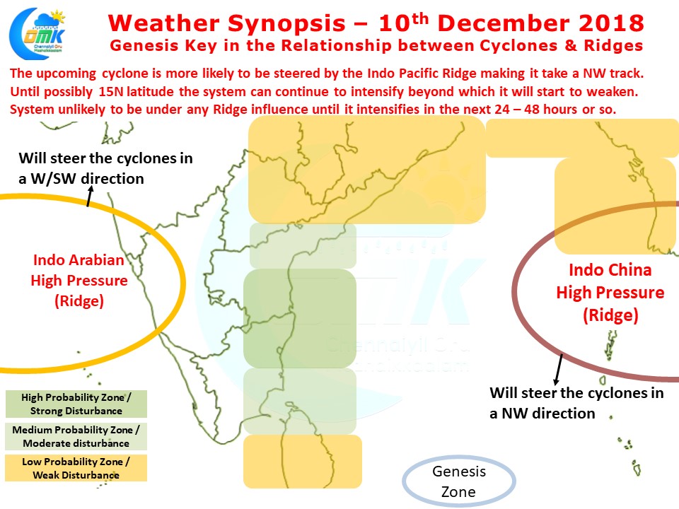
With influence of fairly strong MJO over Indian Ocean this upcoming disturbance has a very good chance of intensification on the back of some very warm waters in Bay of Bengal. Beyond 15 N latitude things may not be very conducive for any intensification, until then things look very good for the disturbance to develop. With this in mind there is a very high possibility of a possible landfall of a strong cyclone between Puducherry & Nellore coast. The other possibility which should not be discounted is a moderate system drifting in a W/NW direction towards the delta coast. As things stand this one possibly will mimic the 1985 Nellore cyclone though the intensity is still a bit of unknown.
Depending on how the banding happens and possibly intensification time frame we may see precipitation patterns change so exact rainfall impact areas will be known once the system becomes possibly a depression.