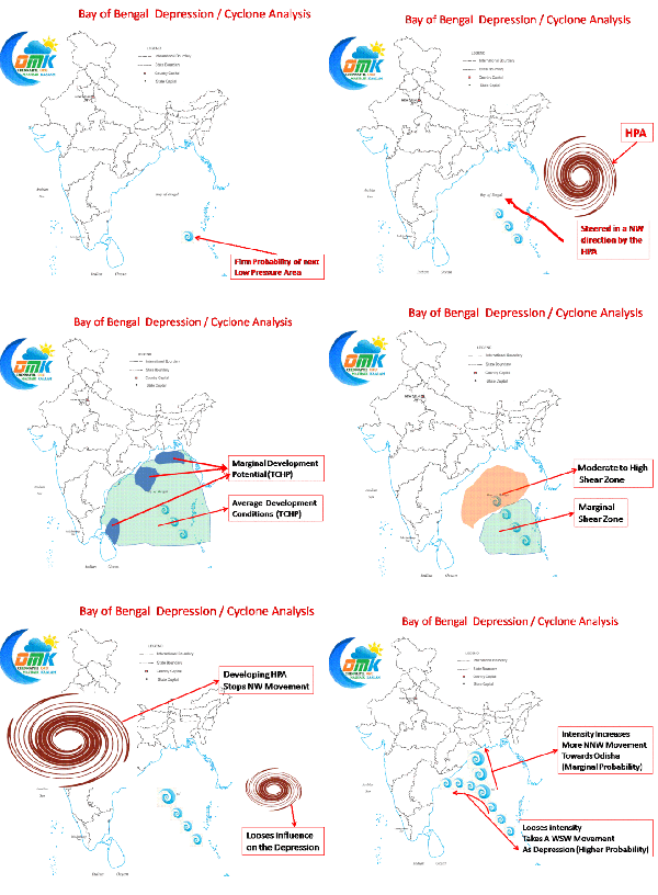
COMK Blog exclusively for the first time brings out a forecast for the Bay Disturbance which covers all aspects that govern the evolution of a cyclone in a seamless manner. Just wait as the story evolves on its own through an animated GIF.
Starting from where the Low Pressure Area might form we track the journey as how it gets steered through from Andaman Islands to possible landfall over the Eastern Coast of India. During this journey we have tried to explain how High Pressure Areas (HPA), that play a vital role in the directions the cyclones take, to the two sides of the system work in tandem to bring its journey path.
Where and how this system would evolve and end up is still debatable, COMK would keep you updated as it evolves. But if what we have put up does indeed happen Chennai would face its next rain break for a week or so.
Do share your feedback on our latest effort.


