The last couple of days one of the highly talked about subject is Cyclone Phethai, a name given by Thailand among the ring of Indian Ocean Countries. To be pronounced as “Pay-Ti” the name has caught a lot of fascination among the Tamil public with many calling it பேதை. With the Bay disturbance still running at its own pace, the discussions about how to call “Upcoming Cylone” can wait for another day or two.

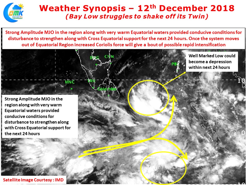
In our yesterday’s post we had mentioned about how the Equatorial Twins have been helping each other in their respective development. The Bay disturbance continues to retain a connect to its Southern Hemisphere twin. While this has helped it to develop into a Well Marked Low and possibly intensify into a Depression, the disturbance needs to cut the chord connecting to its twin for its own benefit.

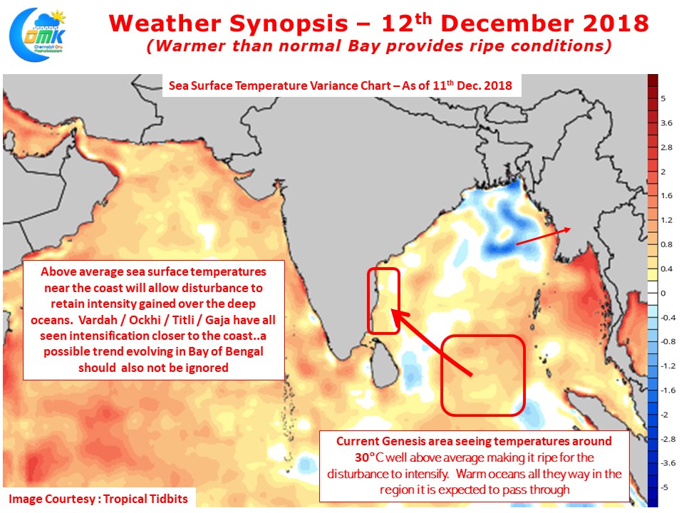
Currently staying close to the equator is not allowing the Well Marked Low to take full advantage of the warm oceans and MJO over the Indian Ocean region. If one were to look at the ocean charts the Genesis area is seeing boiling waters at nearly 30°C sea surface temperatures with above normal temperatures seen almost all across the Bay including the coastal areas adjoining North Tamil Nadu & South Andhra Pradesh. We can expect a bout of rapid intensification once the system moves out of the low latitudes as currently weak Coriolis force near the Equator is hampering intensification. Also one needs to keep in mind over the last couple of years Vardah, Ockhi, Titli & Gaja all of them intensified very close to the coast which indicates a potential trend developing in Bay of Bengal. This should not be ignored in the current context as well keeping in mind even around the coast the surface temperatures are nearly 27°C.

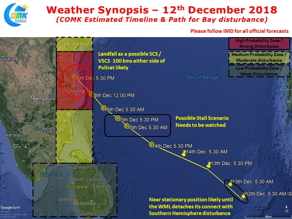
With genesis location firmed up and possibly the influence of Arabian Sea Ridge expected to be minimal things are falling in place for an early estimate of what could be the possible track of the upcoming disturbance and likely landfall zone. Our Regular readers will know COMK had put possible Chennai landfall more than 48 hours before landfall while in the case of Cyclone Gaja we had said 50 kms either side of Karaikal nearly 36 hours before landfall. While in the current context the disturbance is nearly 4 days away from the expected landfall it may make sense to give an estimate of what is ahead with possible landfall zone to give a headstart to our regular followers. Please note once things firm up tomorrow when the disturbance comes into the open waters we can firm up the track and possible landfall location.
While some of the worst Hurricanes have carried Girl names it remains to be seen if பேதை will move around graciously or behave as a naughty kid.


