The relationship between weather bloggers and disturbances in Bay of Bengal is like that of a love affair between young adults. And just like how most breaks up end up being a messy affair with long drawn withdrawal syndrome effect weather bloggers also go through such emotions when disturbances end up not providing enough rains. The recent depression could possibly rank the highest in terms of the disappointment scale considering during peak NEM a stalled depression parked off the coast of Tamil Nadu leaving many parts of Chennai and suburbs with not even 10 mm of cumulative rainfall over the entire period. Compare that with say Roanu which brushed the Chennai coast as a depression during peak summer in 2016 and gave more than 20 cms of rains to most of Chennai and suburbs at the least expected time of the year.
It reminds of the very famous song from the movie Iruvar Ullam acted by Chevalier Sivaji Ganesan from the year 1963. No two disturbances are same even if they form at the same place and travel almost the same way and reach the same destination like the BOB5 and BOB6 (Odisha Super Cyclone) during the year 1999 which happened with just a week gap between the two cyclones.
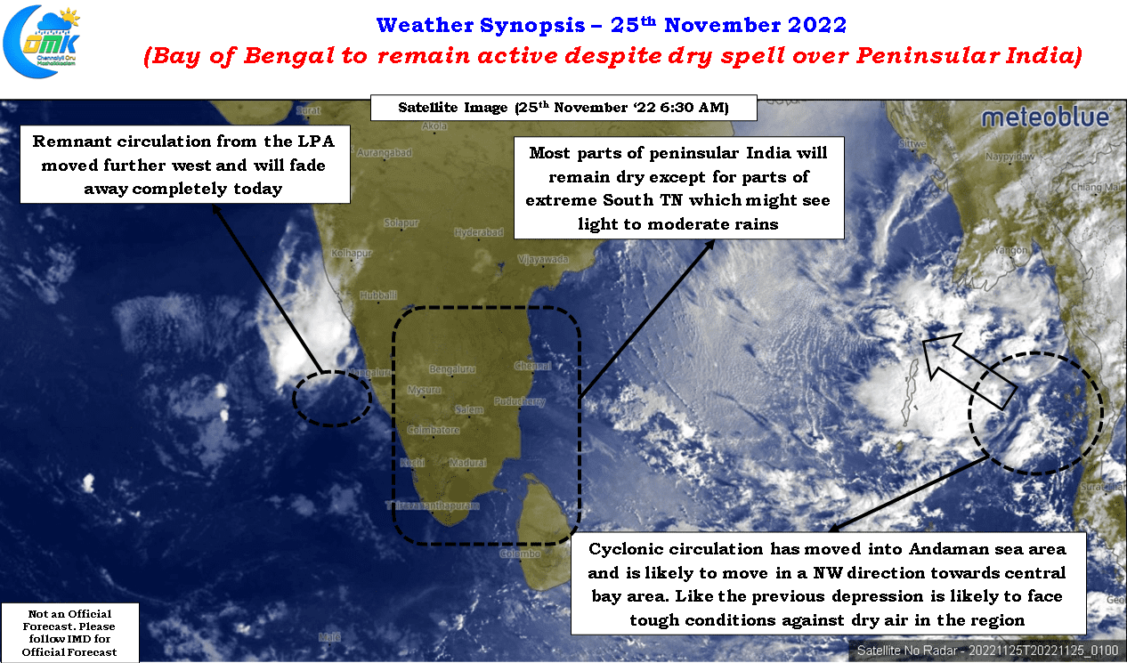
But disappointments are part and parcel in the weather blogging journey and the best way to put disappointment behind is get back to weather tracking earnestly. In a way today’s post also belongs to that category of putting behind the disappointment and looking forward to rest of the Northeast Monsoon season. The satellite image may look like a winter day with nothing on the horizon over peninsular India and winds flowing in from the North bringing the dry continental air. But whether the glass is half full or half empty depends on how we look at it.
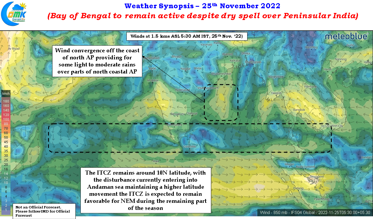
Looking a little further east one can see a fresh pulse that has moved into Andaman sea area from South China sea, the next in the series of pulses that have moved in since southwest monsoon period. To the west of peninsular coast we can see the remnant of 94B still alive, how much ever we wish to forget and move on from him, though it is expected to fade away as it move further west. In a way the upcoming pulse even if it does not give rains over peninsular India will probably play a crucial role in keeping up the ITCZ around 10N latitude which will become crucial when the next round of favorable pulses get pushed into Bay of Bengal from South China sea in a couple of weeks time.


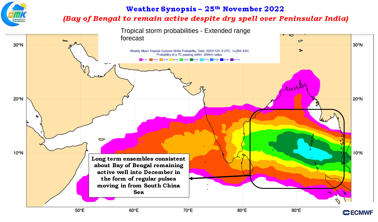
The long range ensembles are consistent about Bay of Bengal remaining active for the rest of the northeast monsoon season until end of December. By default the rainfall pattern during NEM is linked to these disturbances and while occasionally we get dealt a joker like 94B but more often than not some of the heaviest rainfall episodes over coastal TN has been intrinsically linked with such disturbances. In a way this consistent forecast by ensembles about weak to moderate pulses moving into Bay of Bengal from South China sea could provide for an active December on the back of a south moving ITCZ working favorably for coastal TN.
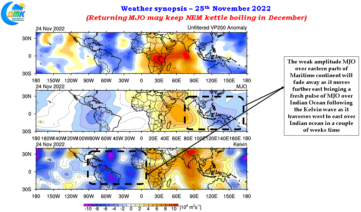
With La Nina still persisting in a mature state the base state interference over MJO is likely to provide another opportunity for north Indian Ocean to come under MJO influence for the second time during the NEM season. Under normal context when MJO makes a global circuit spending 45 to 60 days at times to cover the globe most of the times the fling between MJO and NEM happens only once during the season. It remains to be seen if some of the weak / moderate pulses currently shown during the month of December strengthens into a cyclone like the 2000 Sri Lanka cyclone.

