Southwest monsoon has been active over many parts of Central India and West India. Konkan coast which saw monster spell of rains on Friday continues to get moderate to heavy rains keeping the Far Eastern suburbs of Mumbai on tenterhooks.
A cyclonic circulation, remnant from the Low Pressure Area, along with a developing Low Pressure Area in Bay of Bengal has been creating a large moisture feed over Central parts of Indian Sub continent bringing heavy rains along with it. Eastern Parts of Rajasthan has also been receiving heavy rains with many areas seeing flash floods. Due to the interplay between these two Circulation places in North AP and Northern parts of Telangana could see heavy rains in a few locations.

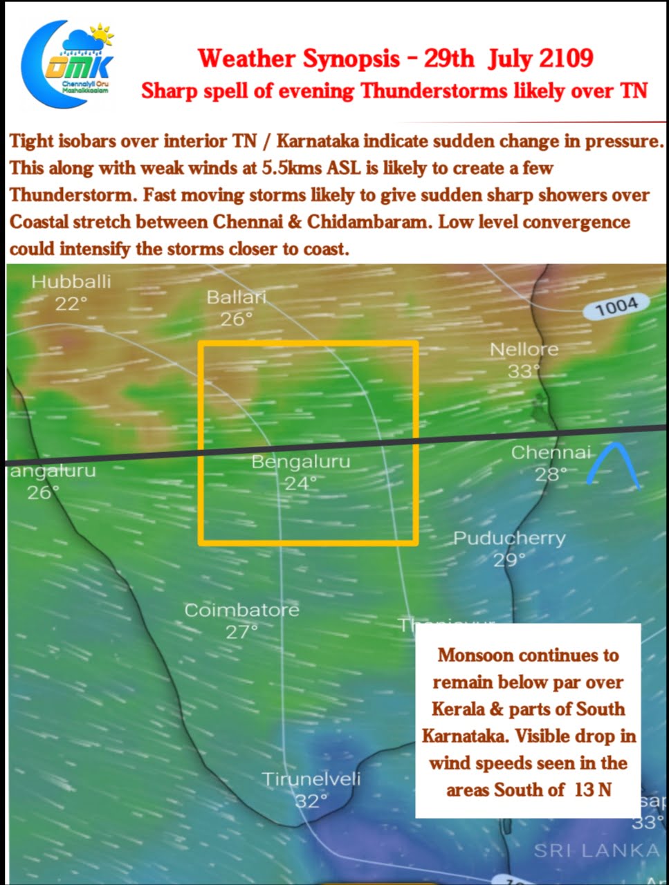
The wind charts clearly indicate the weak monsoon conditions over Kerala and South Karnataka. An imaginary line running along 13N seems to be the border between the active and not so active monsoon regions. It is ironical that for 24 hours ending 8;30 AM, today Devala, a Southwest Monsoon giant that comfortably rivals places like Valparai has recorded only 2 mm.

The upside to this prevailing weak monsoon conditions over parts of South India is possible Thunderstorms over interior areas. Today’s chart indicate a much closer than normal isobars signifying of rapid change of pressure gradient. This is indicative of possibly unstable weather later in the evening triggering potential Thunderstorms over Interior TN and adjoining parts of Karnataka. Additionally the winds at 5.5 kms ASL has been very weak as well. With Westerlies still reasonably strong these storms could comfortably move towards the coast where low level convergence is likely to enhance the storms. With fast steering winds the spells will be sharp & for shorter duration.


