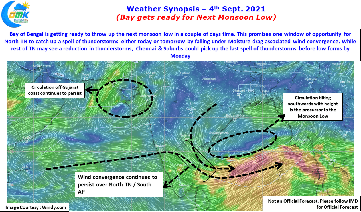
The much anticipated Low Pressure over Central Bay area is likely to develop within the next 24 hours or so bringing back some mojo back into monsoon dynamics which is currently at 9% lesser than long term average with less than 4 weeks left for the statistical Southwest Monsoon season to end. While the upcoming…
Author: Chennaiyil Oru Mazhaikkaalam
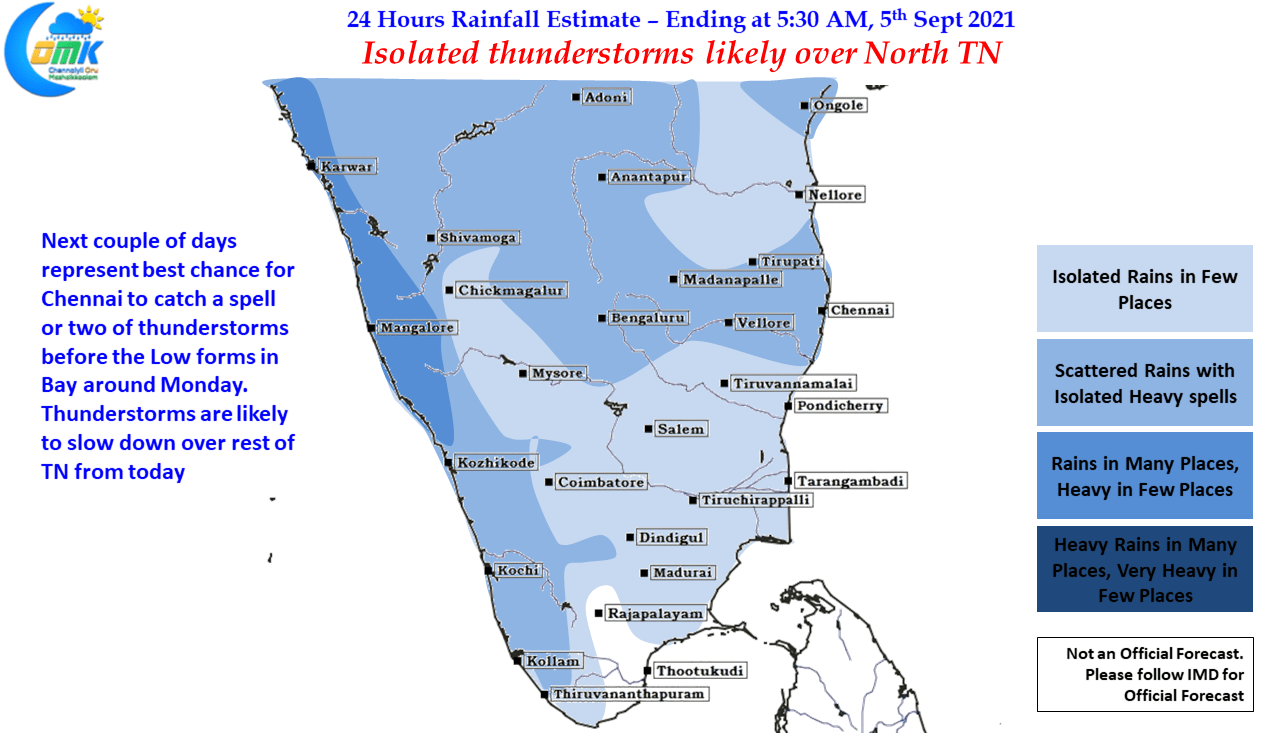
Isolated thunderstorms likely over North TN
It is often remarked the Tropics are a much more difficult proposition to give out accurate weather forecasting not only in the long term but even in the short term. A few days back there was a lot of talk on the supposedly Red Alert given by IMD for Tiruppur district. While the color coded…
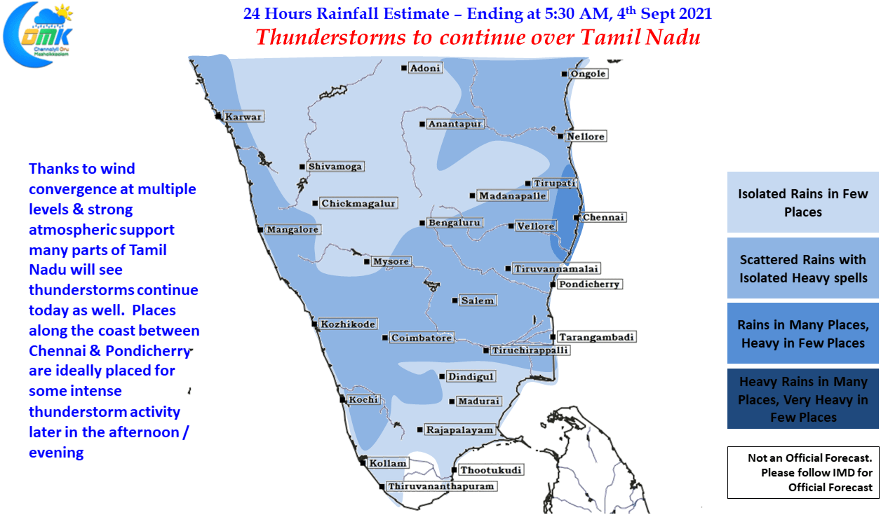
Thunderstorms to continue over Tamil Nadu
Thursday turned out to be one very good day of thunderstorms over Tamil Nadu, though Chennai completely missed out, with the Salem IMD observatory recording 9 cms of rains up to 5:30 AM in the morning. The IMD observatories at Trichy, Pondicherry, Athirampattinam also recorded between 3 to 5 cms of rains during the same…
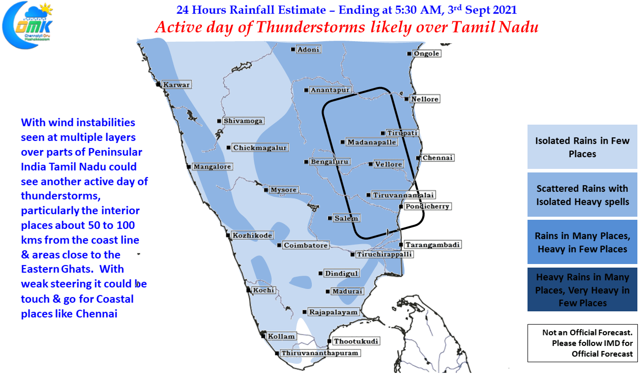
Active day of thunderstorms likely over Tamil Nadu
Southwest Monsoon for the season so far ending up to 31st August has recorded 652.5 mm against a normal rainfall of 716.9 mm which is about 9% deficit overall. Except for the Southern Peninsular India which has 8% above average rainfall during this period all other homogeneous regions are in the negative. Even with Southern…
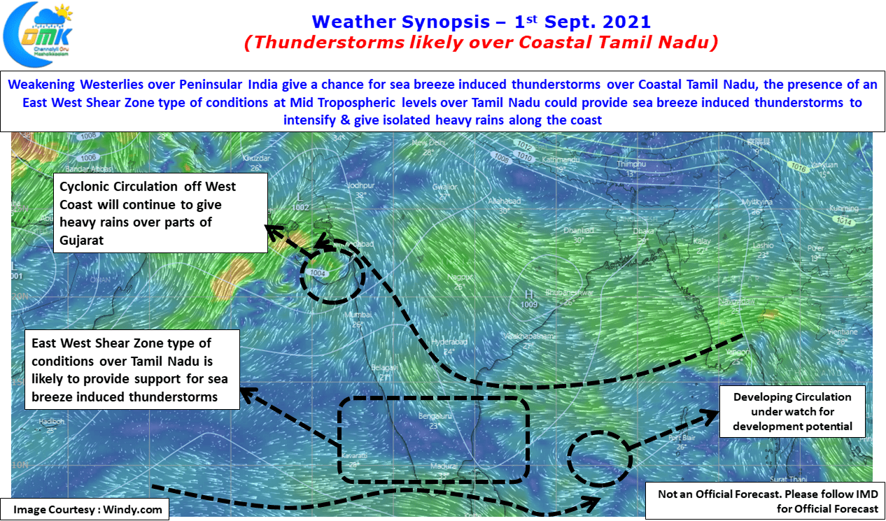
Thunderstorms likely over Coastal Tamil Nadu
Thanjavur 415 mm , Cholavaram 349 mm, Kalasapakkam 328.6 mm Devala 392 mm, Avalanche 322 mm July & August are traditionally the strongest months for Southwest Monsoon. August on an average sees about 4 Monsoon Low bringing about at least one monsoon surge during the month. But many would possibly not believe if the numbers…


