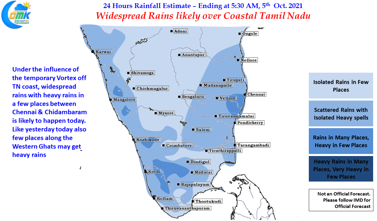
For the past few days most of Tamil Nadu has been seeing thunderstorms under the influence of the Upper Air Cyclonic Circulation that formed over South Bay and gradually moved west. While interior areas enjoyed very good spell of rains coastal areas did not benefit so much with places like Chennai remaining mostly a spectator…
Author: Chennaiyil Oru Mazhaikkaalam
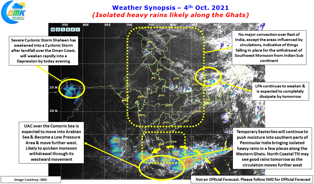
Isolated heavy rains likely along the Ghats
Thunderstorms continued to persist over Tamil Nadu with the first 3 days of the Northeast Monsoon season providing an accumulated rainfall of 42 mm which is nearly 1/4th of the October average for Tamil Nadu & Pondicherry. The 1st 3 days long term average rainfall is 13.9 mm so in effect the 1st 3 days…
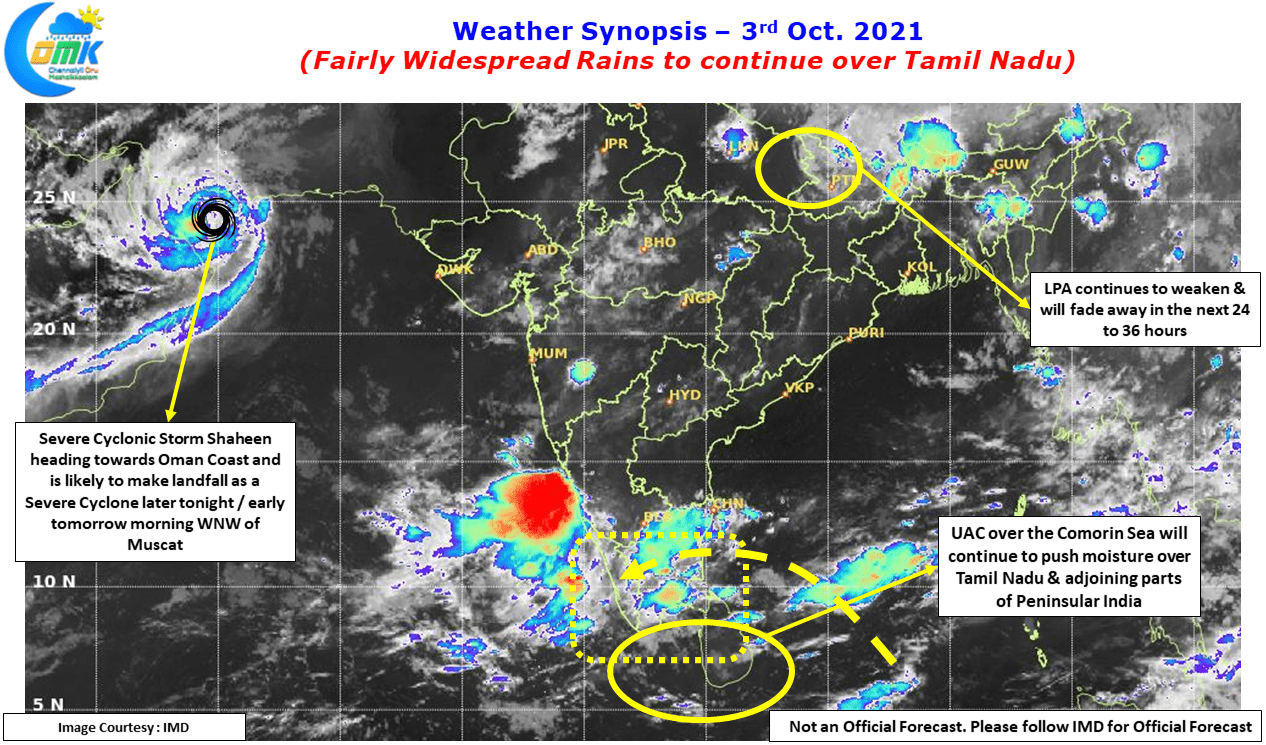
Fairly Widespread Rains to continue over Tamil Nadu
Rains continued over many parts of Tamil Nadu under the influence of the Upper Air Cyclonic Circulation which is now lying over the Comorin Sea area as it continues to jog in a general westward direction gradually. Erode which has already seen one intense episode of rains a couple of days back saw moderate to…
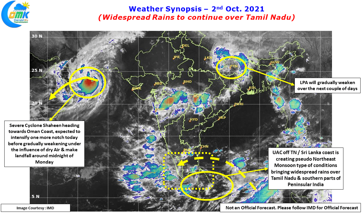
NEM like conditions to give Rains over most of Tamil Nadu
Has Northeast Monsoon made onset over Tamil Nadu? If you are an early bird & have a habit of gazing at the morning skies you would have noticed the skies over the coastal areas of Tamil Nadu completely different today morning compared to the past many months. Nice deep blue skies interspersed with lot of…
Isolated Heavy Thunderstorms likely over South Tamil Nadu
நான் வந்துட்டேன் சொல்லு, திரும்பி வந்துட்டேன்னு சொல்லு goes the famous dialogue from the movie Kabali. Similarly Thunderstorms announced their return back over Tamil Nadu yesterday as they dumped heavy rains over many parts of Tamil Nadu. In particular Madurai, Erode, Perambalur & Thanjavur districts saw heavy rains at many places. The Erode ISRO AWS of IMD…


