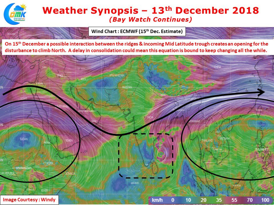
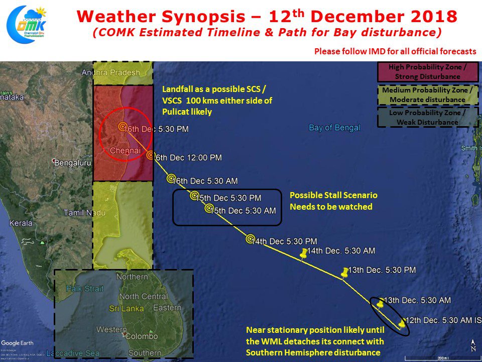
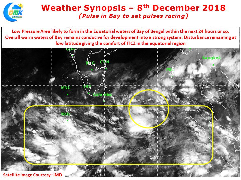
The Well Marked Low continues to consolidate around the Equatorial waters of Bay. The delay in moving to the open seas could influence overall life cycle of the disturbance. Despite change in model outputs #COMK stands by its estimates yesterday as of now.
Author: Chennaiyil Oru Mazhaikkaalam
Bay Disturbance churns at its own pace
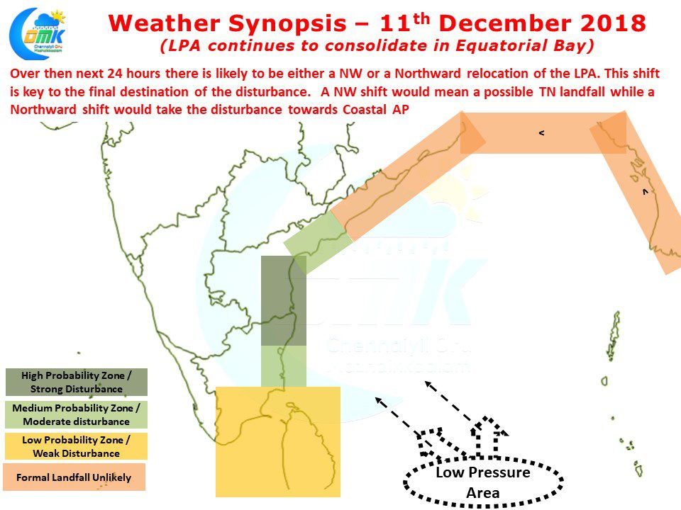
While the Bay disturbance churns at its own pace, an early #COMK update on where this one could be heading to in the context of some clarity in the genesis & ridge positions. N. #TamilNadu / S. #AndhraPradesh coast looks likely destination
LPA in Bay continues to consolidate
The Low Pressure Area in Bay of Bengal aided by its equatorial twin from the Southern Hemisphere has started to consolidate showing a fair bit of convection that has developed overnight. Satellite image clearly shows the interplay between the twins which continues to feed each other in the process developing both. As we kept mentioning…
Low Pressure in Bay – Tense wait ahead
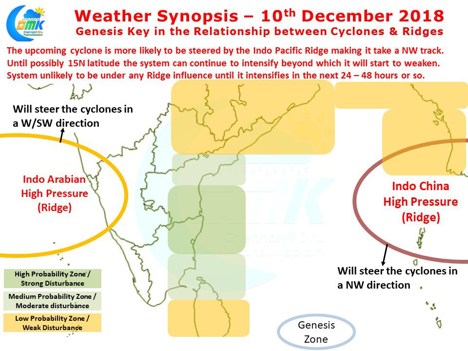
With the Low Pressure area forming in Bay of Bengal, a period of tense wait & anticipation is ahead for all of #TamilNadu. While it is too early to talk of exact landfall location, keeping in mind the heightened antcipation / rumours going around we at #COMK have given an indicated probability map
Pulse in Bay sets pulse racing
Pulse in Bay to set pulse racing for #Weather bloggers of #Chennai. Low pressure likely to evolve within 24 hours. No clarity yet on impact areas including #TamilNadu. #COMK


