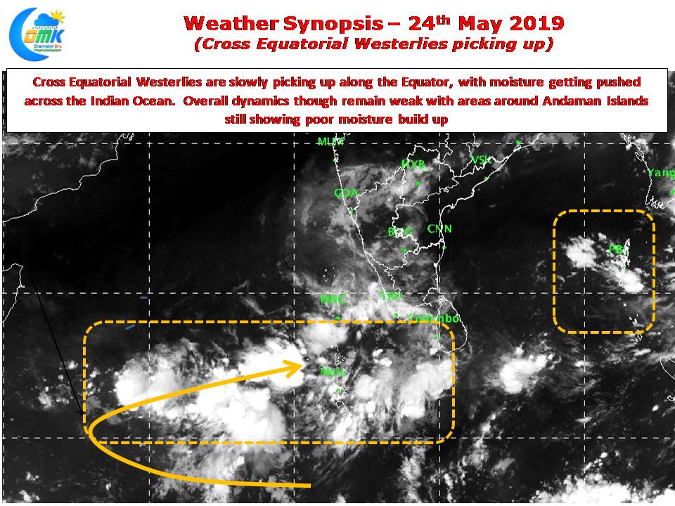
The last week of May is upon us when typically large parts of Bay & associated areas of Indian Sub Continent sees Monsoon Dynamics prevail. Between 15th & 20th May almost all of Andaman Islands would be under Southwest Monsoon while the Sri Lankan west coast will start seeing monsoon dynamics between 20th & 25th….
Author: Chennaiyil Oru Mazhaikkaalam
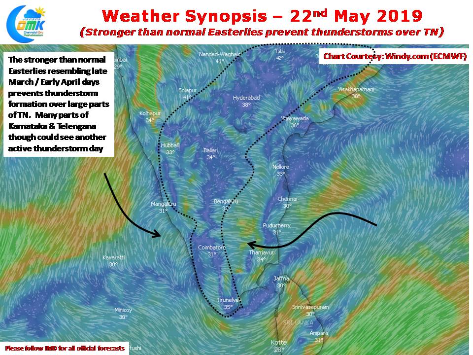
Stronger than normal Easterlies prevent thunderstorms over TN
While focus is always on summer and monsoons more often than not there are many areas of Tamil Nadu that look forward to the thunderstorm season. Especially parts of Kongu belt which come under the Leeward side of Western Ghats during Southwest Monsoon and too far away during normal Northeast Monsoon time get their majority…
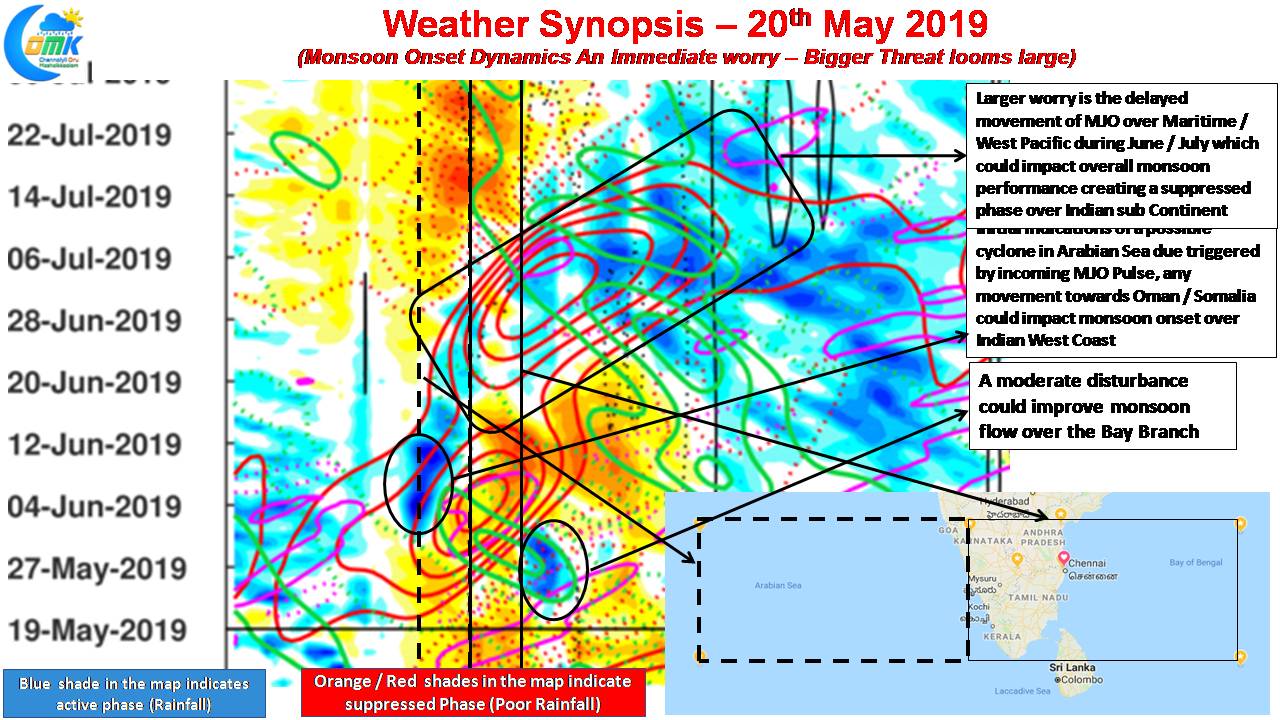
Weak Monsoon Dynamics A Worry – But Larger Threat Ahead (COMK SWM Series – 1)
As we get closer to the last week of May the most talked about phrase among weather watchers of the Indian Sub Continent is Monsoon Onset. Would it be on time over Kerala? How active would the onset spell be? Will it cover the entire country without any stall scenario? For the agrarian community of…
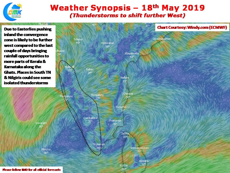
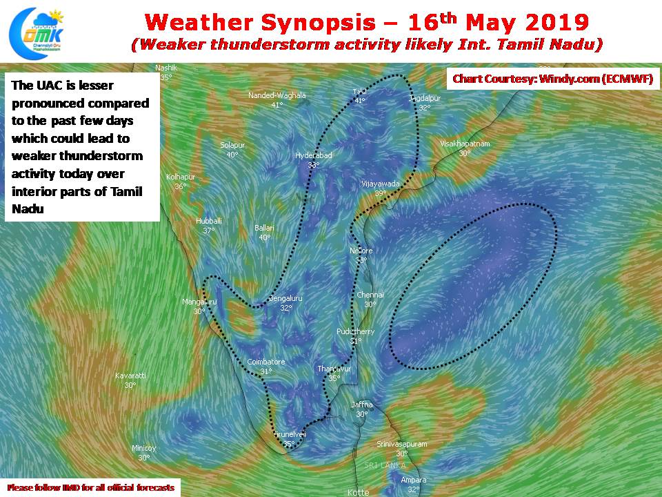
Interior Thunderstorms to slow down in TN
In what was another day of Summer Heat & Thunderstorms many parts of Tamil Nadu saw moderate thunderstorm activity bringing rains to parts of Trichy after what was a very hot day when temperatures touched 41.8ºC giving much relief in the evening to the citizens of the Rock Fort city. For the 5th day in…
Temperatures to be under control for Chennai & Suburbs
After a period of heatwave conditions, temperatures over Chennai & Suburbs have settled back to normal levels for the last few days. Yesterday both the IMD observatories at Nungambakkam & Meenambakkam recorded 0.5 & -0.4ºC respectively below average indicating the comfortable day time conditions prevailing along the coast. Today also things are likely to be…


