
Yesterday parts of North Tamil Nadu recorded late evening convective thunderstorms after what was a fairly clear and warm afternoon. The thunderstorms were focused around Vellore, Tiruvallur, Kanchipuram districts along with Chennai while another set of thunderstorms gave rains around Villupuram & Cuddalore districts along with adjoining parts of Pondicherry.
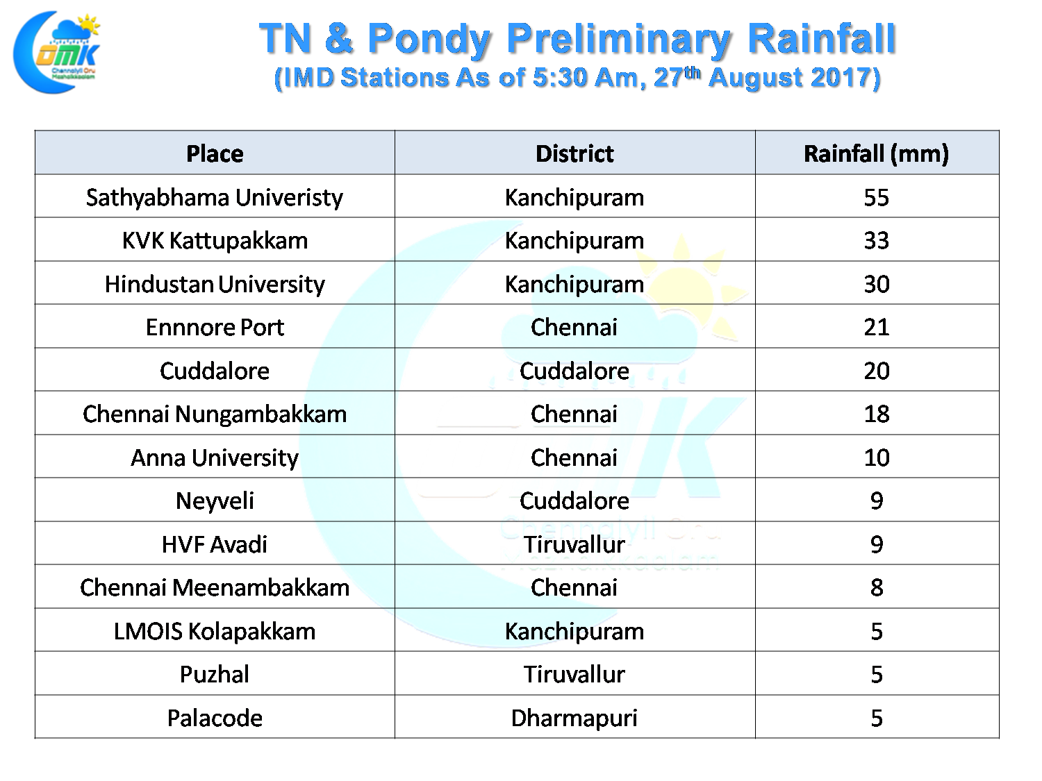
While moving from the interiors the storms were quiet fast as models had indicated in the morning. In a surprise twist as it neared the coast thanks to the convergence the storms slowed down allowing it to not only intensify but also provide moderate to heavy rains in many parts of South Chennai & suburbs. The IMD AWS at Sathyabhama University recorded 55 mm as bulk of the rain fell between Tambaram & Chengalpet. Though the two IMD observatories in the city area missed out with Nungambakkam recording 18 and Meenambakkam recording 8 mm the COMK AWS in Anna Nagar recorded 30 mm most of which fell around 8 PM with about 3 mm falling after midnight.
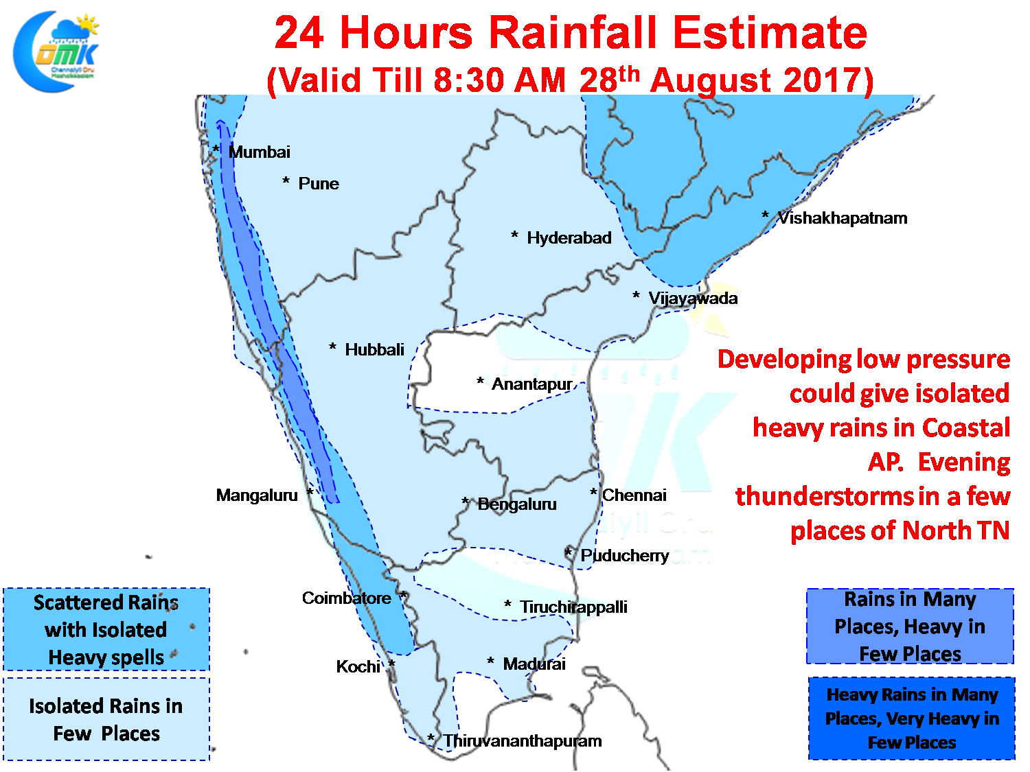
The Bay is getting ready to host another Monsoon Low off the coast of Odisha which could provide opportunities for heavy spells of rains over Konkan coast and in one or two places over Coastal Andhra Pradesh as well. Today also there is a fair chance for some rains over North Tamil Nadu and one or two places in the delta districts. The thunderstorms in the delta districts could be triggered by early sea breeze.
Models estimate some convective thunderstorm activity in the interior places to the West of Chennai which could give a spell or two of rains to parts of Chennai as well when they cross coast. Further in the evening we could possibly have clarity on exact prospects as current conditions evolve.
Powered by WPeMatico