In less than 12 hours from the time this post goes live for the first time in 19 months Mettur will reach Full Reservoir Level. The mainstream media will carry about how it has reached FRL for the nth time in so many years etc. With the inflow expected to remain high today and tomorrow from later tonight the outflow will have to be matched with the inflow. This could bring about another set of stories from media about how “So much” TMC water is getting wasted by reaching the sea. In all this one of the key points that gets missed out is “River Cauvery” has become a mute spectator in the political battles between the various riparian states.
A year back Raj Bhagat has put out a wonderful thread on how Cauvery does not need another dam or in other words cannot afford another dam. Similarly a few years back when Supreme Court had put a six week deadline to implement the “Scheme of Distribution” we had highlighted how an inflow based distribution system rather than a more staid monthly TMC allocation may make sense. An inflow based system allows for water to flow through the river over more areas as the rainfall picks up through the monsoon season in addition to ensuring all the riparian states share the bounty and misery in an equitable manner.

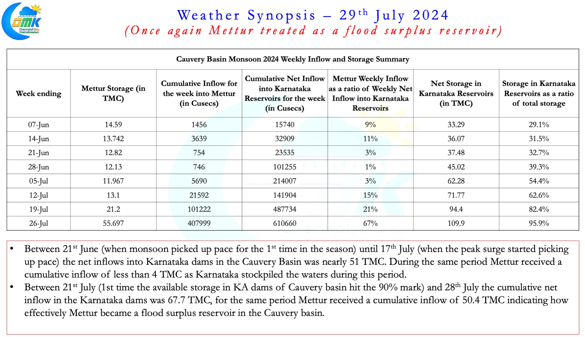

In addition to River Cauvery losing her voice this year once again has shown Mettur becoming a flood surplus reservoir for Karnataka. As the accompanying table shows between 21st June and 17th July in comparison to the total inflow of 51 TMC into the dams in Karnataka, Mettur recorded a pitiful inflow of only 4 TMC. This effectively meant the river pretty much did not flow beyond Kabini and KRS dams, the last two dams in the Cauvery Basin before the river comes into Tamil Nadu.
Similarly once the storage in Karnataka dams hit the 90 % storage mark the 3/4th of the inflow into Karnataka dams found its way to Mettur. Between 26th and 29th July the inflows when the safety of the dam becomes important on account of swelling inflows Karnataka conveniently started to release more than the incoming volume of water. In the interest of the river, and all the riparian states it becomes very essential a system of inflow based pro rata monthly share is arrived at the earliest.
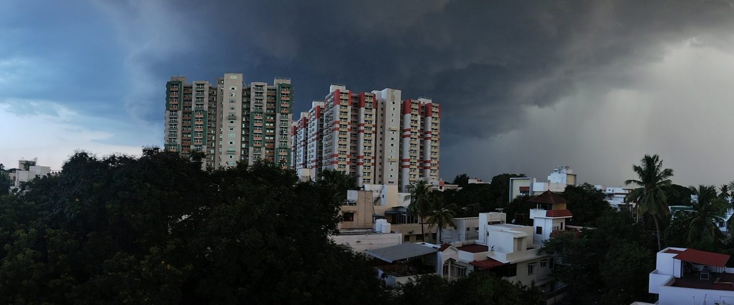
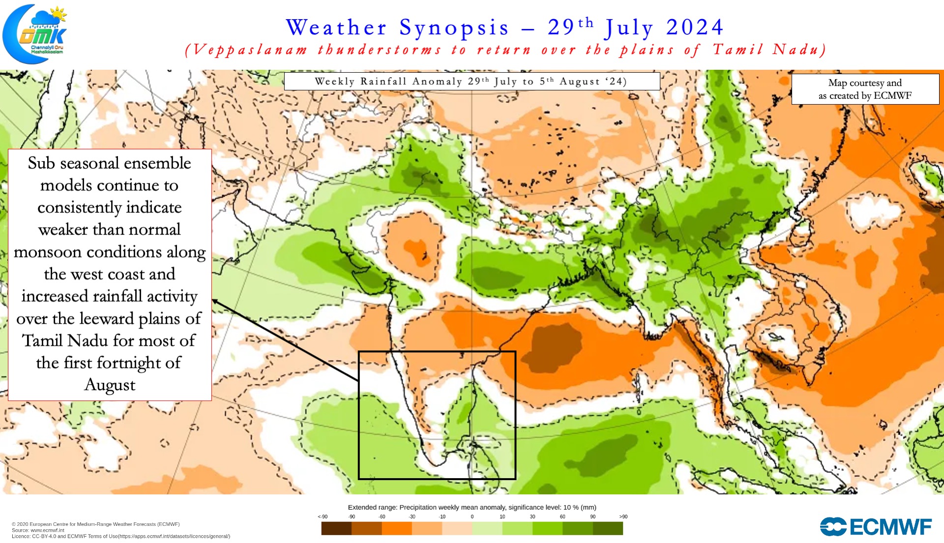
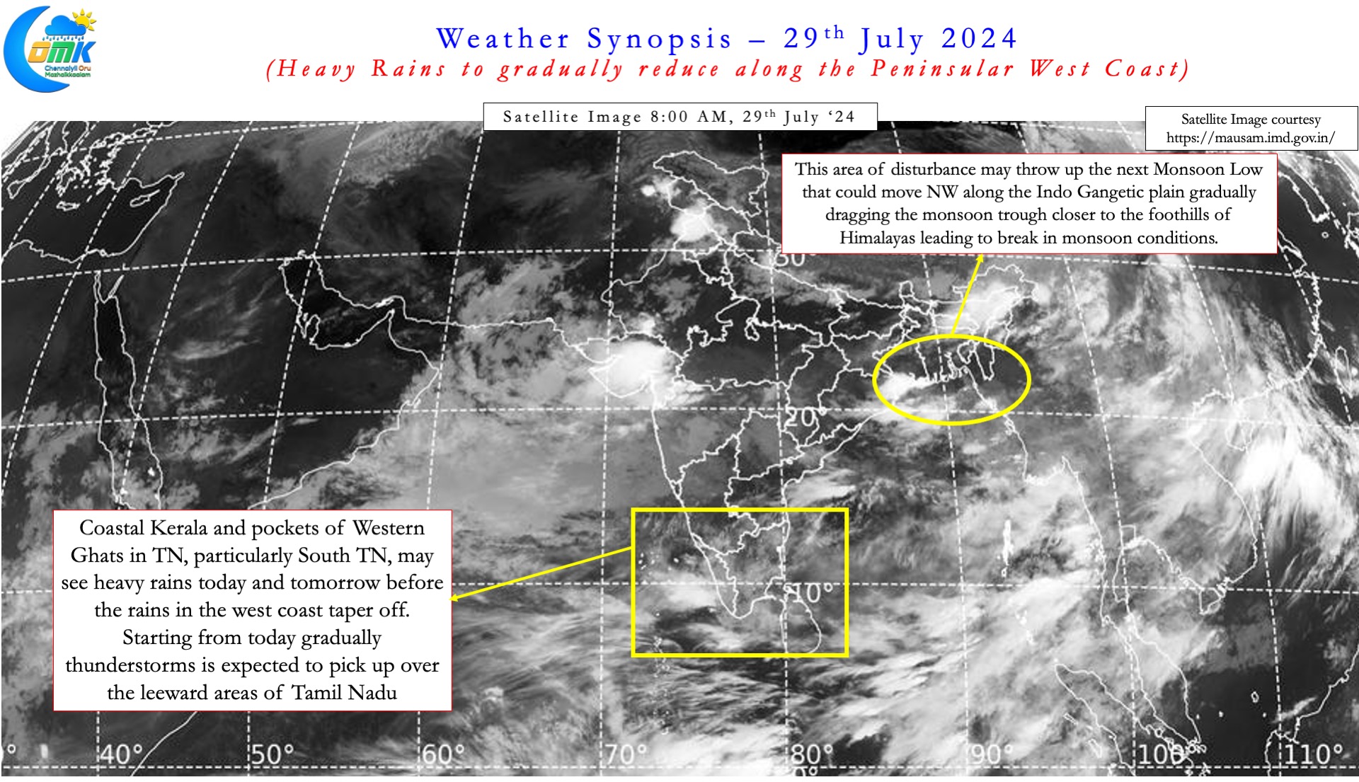
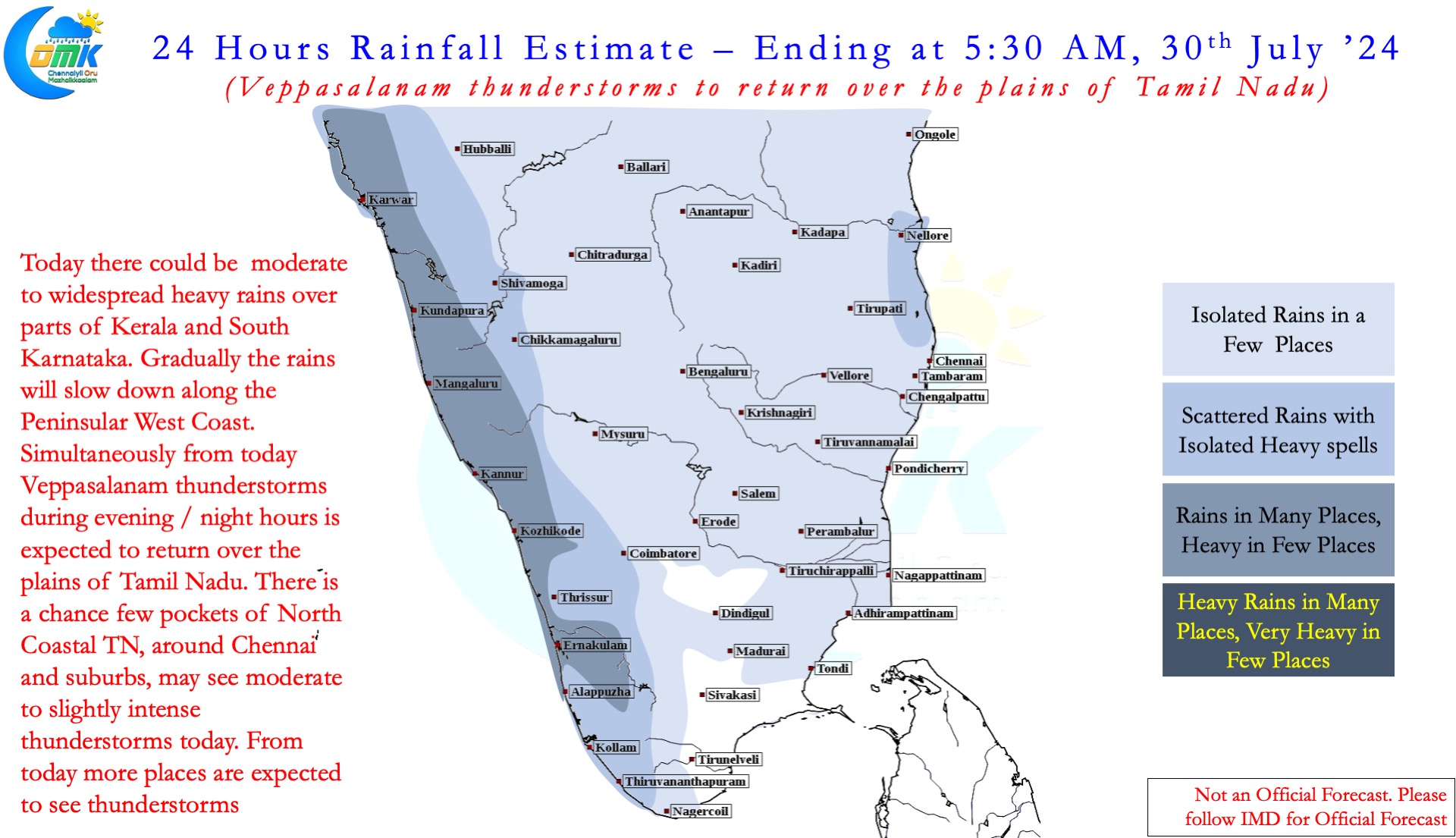
On the weather front there is increasing consistency among the weather models about a break in monsoon phase coming up. A possible low that might move along the IGP may drag the monsoon trough closer to the Himalayan foothills. This could mean the leeward plains of Tamil Nadu may start seeing convective thunderstorms from today. Rains over places like North TN is expected to gradually pick up from today with Friday to Sunday promising widespread thunderstorm activity over the plains of Tamil Nadu. This active phase of convective thunderstorms for the plains of Tamil Nadu is likely to continue up to middle of August as things stand.
Simultaneously we may start seeing reduction in rains along Peninsular West Coast as well. While today and tomorrow we may see some rainfall activity gradually from Wednesday the rains will start to reduce in the Ghats and along the coast.

