
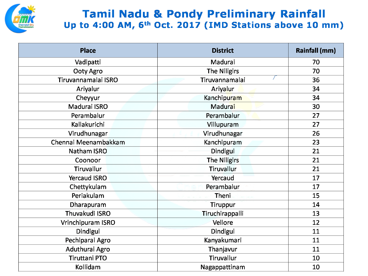
The active thunderstorm season has been providing more than enough rains since the turn of October with 33 mm already getting accumulated for the Northeast Monsoon seasonal tally in the first 5 days of the season. Yesterday was no different with the interior places of Tamil Nadu and adjoining parts of Karnataka & Rayalaseema region getting very good evening rains.
With the Upper Air Cyclonic Circulation in Central Bay expected to descend down into a Low Pressure Area over the next 24 hours or so we could possibly see some bit of monsoon dynamics swing back from the current thunderstorm environment over Tamil Nadu. Numerical Models indicate over the weekend the low pressure could traverse along the Central Indian region bringing heavy rains to places like Odisha, Chhattisgarh, Maharashtra & Madhya Pradesh. Consequent to this we can see the monsoon withdrawal stay put for a few days before it starts accelerating by 2nd fortnight of October.
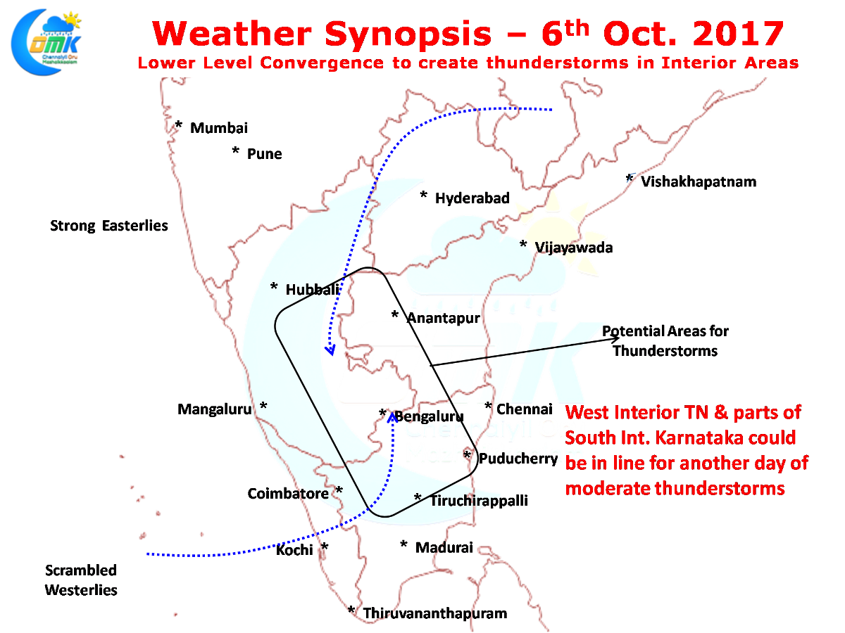
Today there is a low level convergence seen over West Interior Tamil Nadu & adjoining parts of South Interior Karnataka which could possibly trigger thunderstorms to the west of Chennai. While models do not indicate any major rainfall activity in and around Bangalore there is a fair chance on account of this convergence for a spell or two of heavy rainfall activity once again during the evening today.
As far as Chennai goes the steering winds continue to be weak which will hinder the movement of thunderstorms towards the coast for us.