
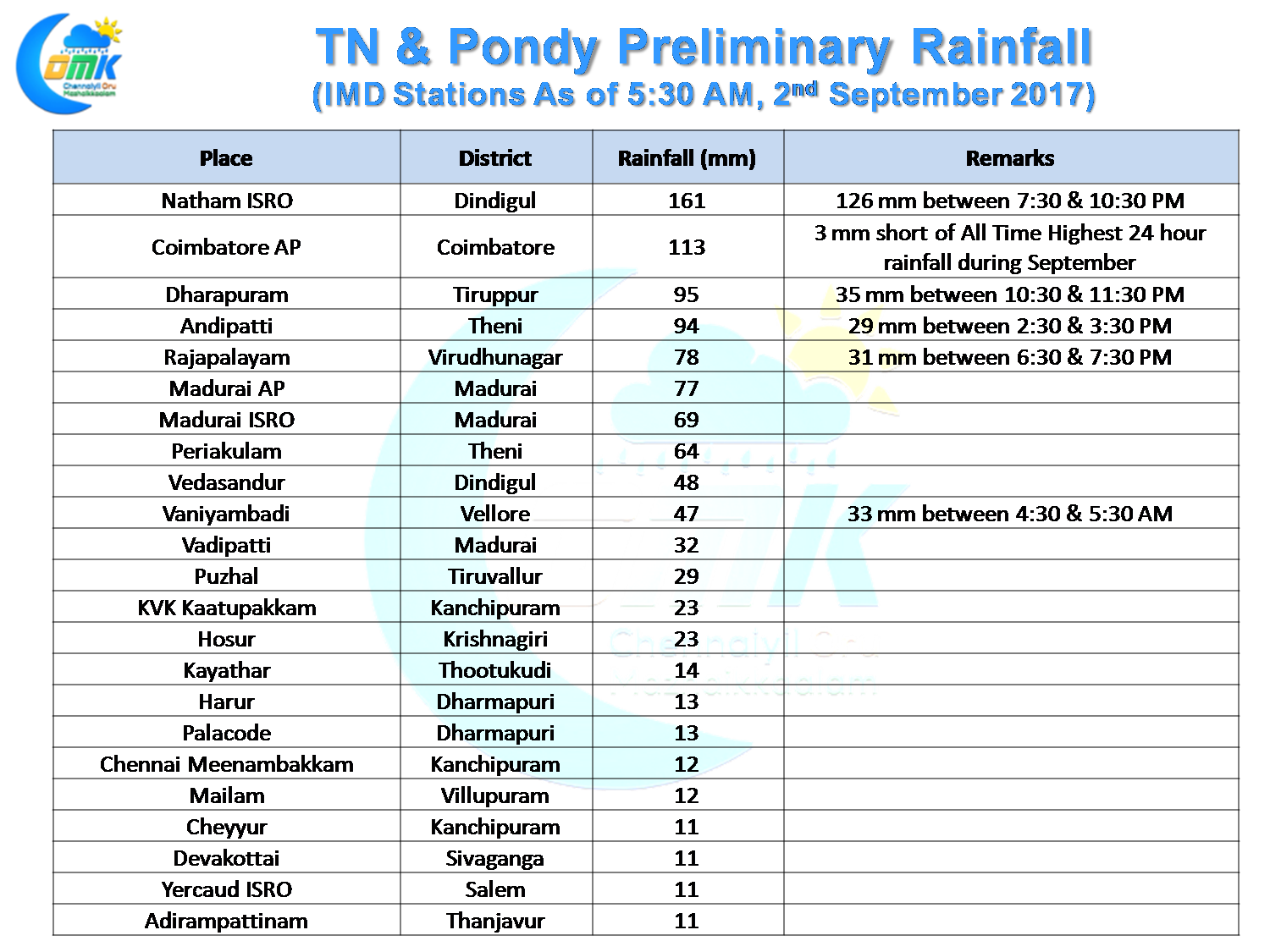
Thunderstorms in Tamil Nadu notched up a gear yesterday as interior parts of the state recorded very good rains. The highlights include the 113 mm from Coimbatore AP which is very close to its all time record for highest 24 hour rainfall, 116.8 mm recorded way back in the year 1948.
While parts of Chennai received convective rains from overhead development in the evening with Puzhal receiving bulk of its rains from the evening spell the wind pattern is not conducive for North Coastal TN as the winds are more Northerly rather than Westerly which could help us get benefited from the interior storms.
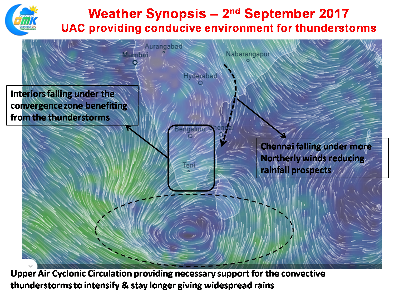
The table will also confirm how the rains peak after sun set with convection developing during the day through radiation and the Upper Air Cyclonic Circulation off the coast of Sri Lanka providing conducive environment for the thunderstorms to sustain longer and able to give rains for a wider area. While the the role wind instabilities are playing, creating the necessary convergence, is quiet obvious in the wind charts one should not discount the role clearer skies during day & heat radiation is playing in setting up things for the thunderstorms to trigger.
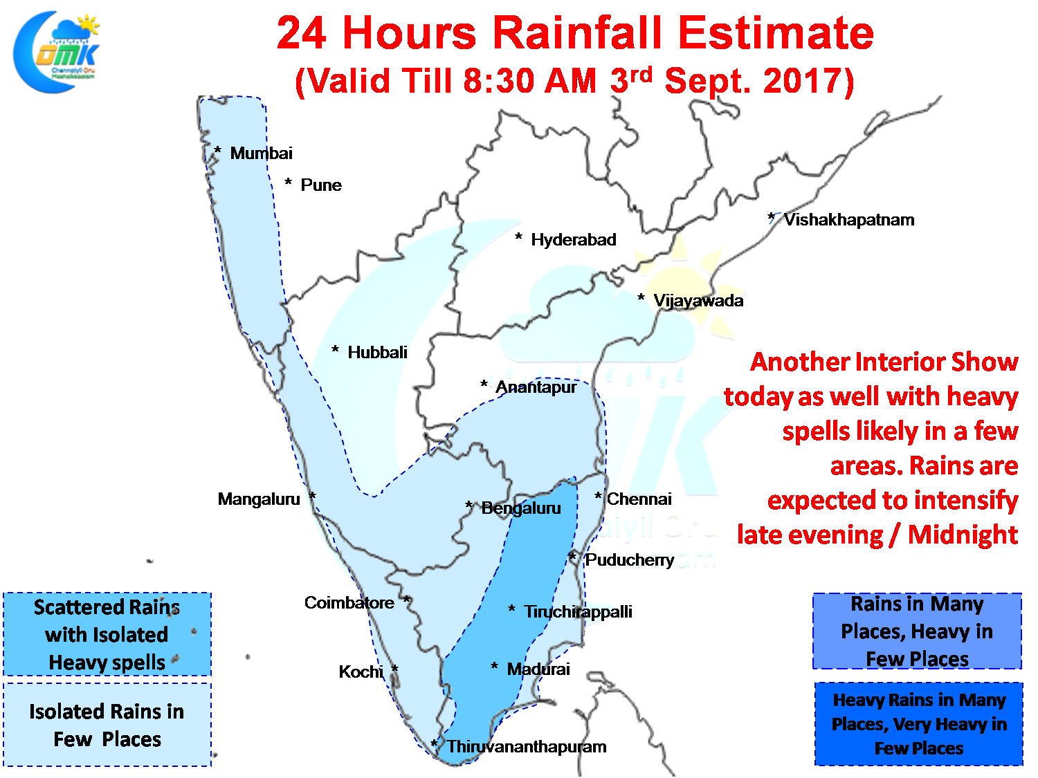
Today could be another good day for Tamil Nadu with interiors once again picking up the show. The invisible dry boundary seems to be 13N which is possibly one other reason Chennai is not getting any rains as to the NW of Chennai not much thunderstorms seem to be developing giving us an opportunity to benefit from as they move coast. West Interior districts are likely to be the biggest beneficiaries with possibly Krishnaigiri , Erode, TV Malai, Salem & Vellore in line for decent thunderstorms tonight.
Powered by WPeMatico