
Thunderstorms have started to slowly pick up over Tamil Nadu with today seeing some fairly widespread thunderstorms over many parts of the state in the districts of Villuppuram, Cuddalore, Delta, Madurai, Dindigul, Karur & Salem. If one were to look at the position of the Monsoon trough the eastern end has shifted closer to the Himalyan Foot hills while the western end aided by the Low Pressure in Pakistan and adjoining parts of Rajasthan continues to stay at the normal position.
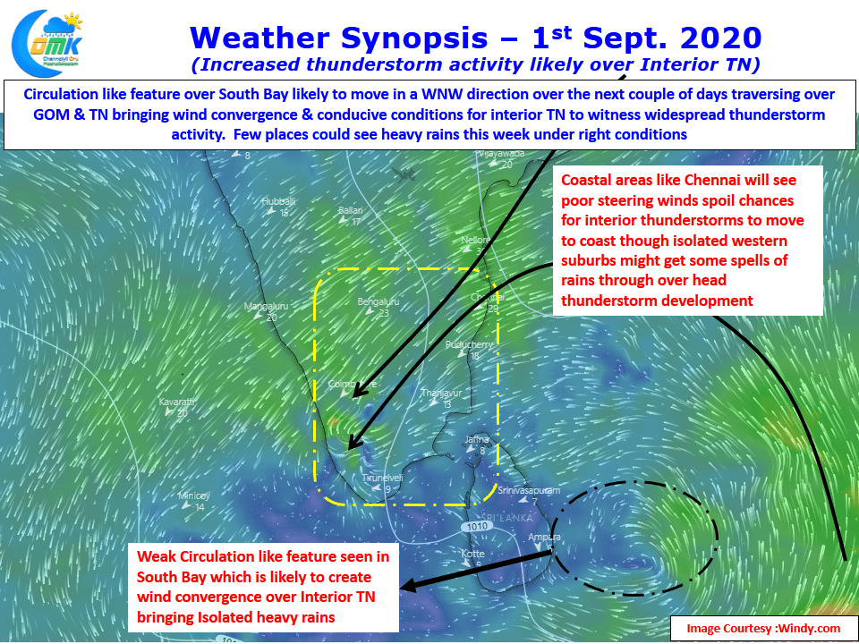
Down South though weather models indicate a developing circulation in South Bay which is expected to move across Peninsular India over parts of Tamil Nadu over the next couple of days. This is likely to create wind convergence over many places of Tamil Nadu bringing them under conducive conditions for thunderstorms.
Unfortunately for the coastal places like Chennai consequent to the circulation the wind pattern is not going to be conducive for thunderstorms from the interiors to move towards the coast as pseudo Easterlies prevail over North Coastal & Adjoining areas of South AP. Nevertheless as the circulation moves further west with a slight chance to become a low pressure over Arabian Sea there will be some improvement in the prospects for Chennai.