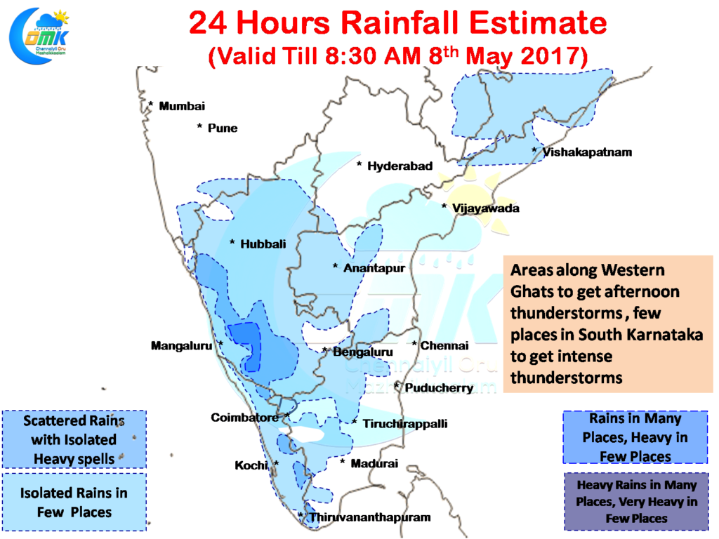
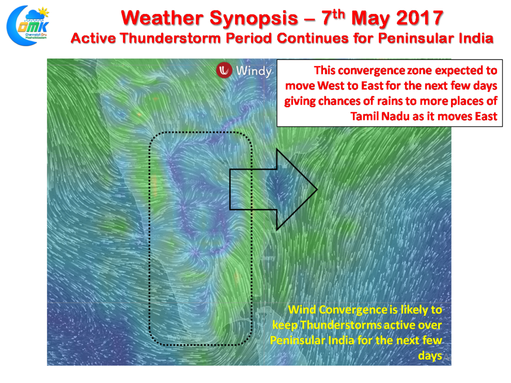
The active phase of the pre monsoon thunderstorm season over Peninsular India continues with another very good day estimated by models for South Interior Karnataka. The last couple of days have seen some intense thunderstorms developed by convective heating and triggered by the wind convergence under the influence of trough extending from Central India.
Today is also likely to be a similar story as the prevailing wind pattern is likely to bring fairly widespread thunderstorms over most parts of Kerala & Karnataka with a few places in South Interior Karnataka along the Hassan, Madikeri & Chickmagalur districts set to see intense evening thunderstorms.
Similarly isolated places along the Western Ghats in the Tamil Nadu & Kerala borders is also likely to see few spells of heavy rains. In particular places along the Srivilliputhur Giant Squirrel Sanctuary, Kalakkad & Mundanthurai Tiger Reserves could see good rains.
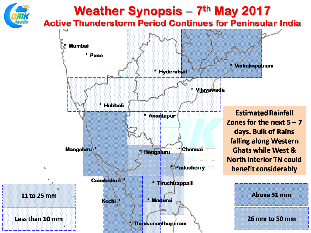
There is some good news for Tamil Nadu as well with numerical models indicating the convergence zone expected to move from West to East over the next few days before going back towards the West Coast as permanent wind changes take place. Due to this shift of wind convergence zone the thunderstorm zones are also likely to shift towards Tamil Nadu bringing in some good rains in the process.
As things stand starting from tomorrow we can see more places in Tamil Nadu getting influenced by these afternoon “Veppa Salanam” rains with once again keeping in sync with seasonal pattern Western areas of Tamil Nadu & North Interior Tamil Nadu along with areas adjoining Western Ghats best placed for thunderstorms. Nevertheless taking into account almost all of Tamil Nadu will get at least one good spell of rains within the next 5 – 7 days with the exception being parts of extreme North Coastal TN and adjoining areas of South Andhra Pradesh which could miss out due to unfavorable wind patterns.
Powered by WPeMatico


