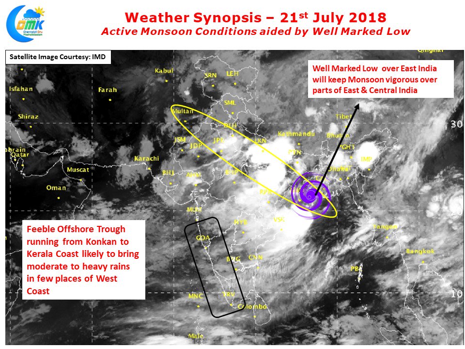
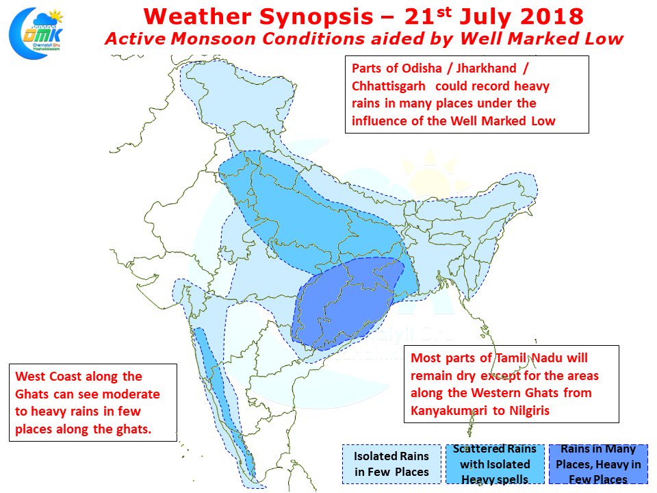
Southwest Monsoon has started to flex it’s muscles once again on the back of an intensifying tropical disturbance over East India. The Well Marked Low lying off the Odisha coast is expected to intensify into a depression in the next 24 – 48 hours or so. Under its influence heavy rains are likely to happen over many parts of East India and the adjoining Gangetic Plains as it moves Inland.
This could be a welcome relief to many parts of West Bengal, Jharkhand and Bihar which has so far seen a very subdued Monsoon after the initial burst. As the depression travels along the monsoon trough places in central India will also see increased rainfall activity. This active phase is likely to continue till early next week post which there is likely to be a break in monsoon. Even though Southwest monsoon has been fairly active the West coast had been seeing a slightly below par rainfall activity along the coast while the places along the Western Ghats continue to record moderate to heavy rainfall in many places.
The offshore trough which gets activated along with the tropical disturbance has been weaker than expected by models resulting in lesser than estimated rainfall activity. But this moderate rainfall activity is likely to intensify slightly along the ghats for a couple of days over the next day or two. This could ensure good inflows into Cauvery catchment areas which will help in retaining the good storage levels in the dams before Southwest Monsoon takes its possibly first long break of the season.


