With each passing day for the past couple of days thunderstorms have picked up in pace over Tamil Nadu. For 3rd straight day many places in South TN came under a fair bit of thunderstorms. The stretch between Pondicherry & Thoothukudi came under rains with thunderstorms starting early in the afternoon. Similarly southern suburbs of Chennai recorded a sharp spell of rains early evening through localized development as lower level wind convergence provided the necessary support for thunderstorms to develop. Interestingly parts of Chennai & Suburbs, particularly the western & southern suburbs saw moderate thunderstorm activity later in the night through interior storms triggering fresh cells closer to the coast as the moved West to East.
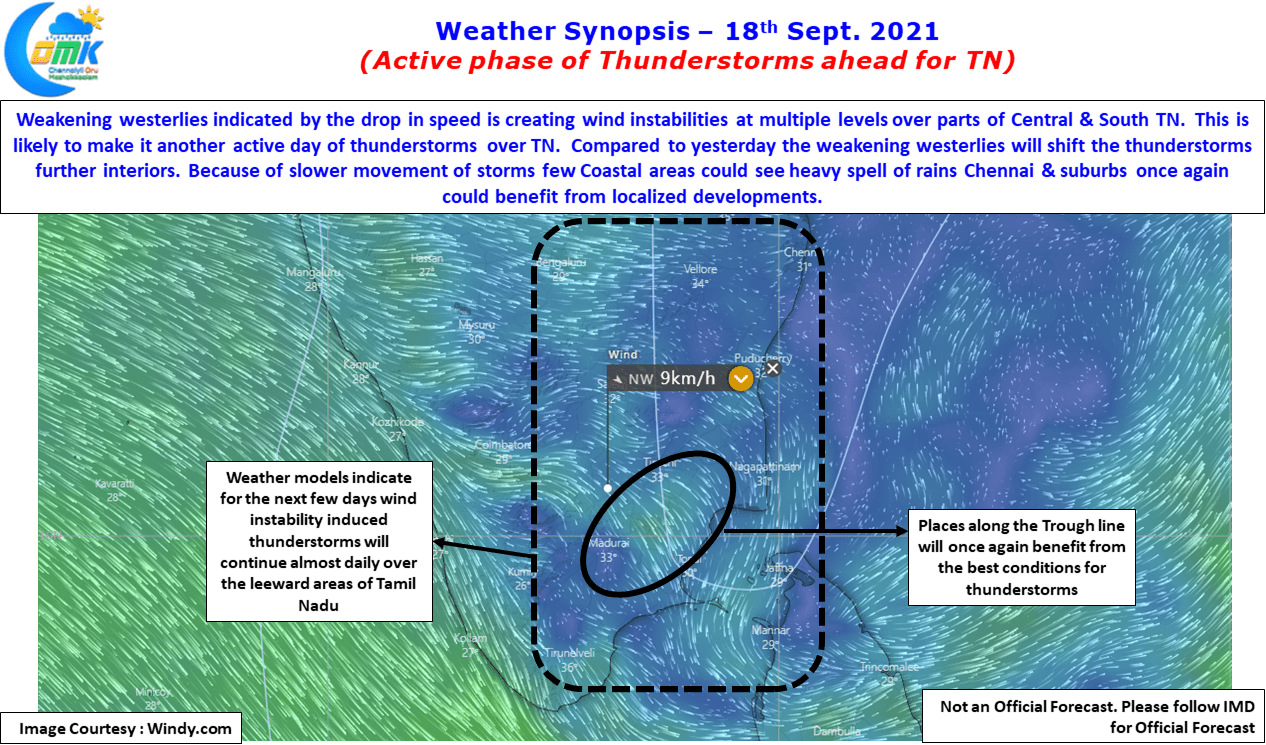
While the Low Pressure over UP & adjoining areas of MP continues to gradually weaken & move further west there is likely to to be another Low Pressure that may form in North Bay under the influence of the pulse coming in from Indo China Peninsular region. This intervening period could also mean some good news for Tamil Nadu too. Weather models indicate the next few days are likely to be good as far as thunderstorms go for the leeward areas of Tamil Nadu. Westerlies have weakened sufficiently enough to trigger wind induced instabilities at various levels of altitude while this also provides for sea breeze front to penetrate strongly along the coast providing the necessary conditions for thunderstorms to develop.
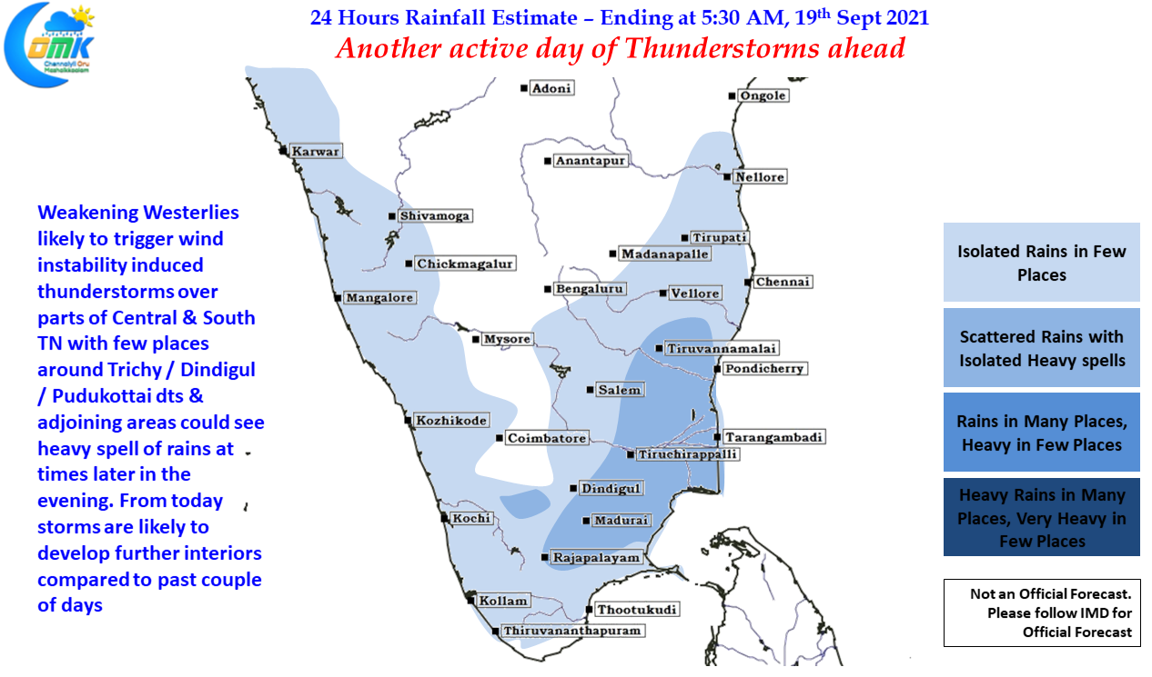
Once again today we might see another active day of thunderstorms with parts of Central TN & adjoining areas of South TN well placed to benefit from the lower level wind convergence. Places in Trichy, Pudukottai, Dindigul & Madurai dt along with adjoining areas of Thanjavur & Nagappattinam dt may see moderate rains in many places with isolated places getting heavy rains. With weakening Westerlies we will start seeing slow moving thunderstorms that is likely to dump a fair bit of rains in places it passes along. Like Yesterday Chennai & Suburbs may benefit from localized developments.


