
As we get closer to the onset of Southwest Monsoon the most active phase of thunderstorms for Tamil Nadu is upon us. The most intense thunderstorms are normally seen just before the onset of monsoon as a lot of moisture gets pumped into the atmosphere creating ideal conditions for instability driven thunderstorms to explode. Yesterday saw parts of Trichy, Madurai, Namakkal, Erode, Salem & Coimbatore districts record good rains as isolated places saw intense thunderstorms late in the evening.
We had indicated in our yesterday’s post about how the last few days of thunderstorms are underway. Models indicate possibly Tamil Nadu will three / four more days of thunderstorms before we see complete Monsoon dynamics take over at least in the Southern parts of Peninsular India. In all probability before the weekend we are likely to see onset of Monsoon over Andaman Islands while early next week Kerala & parts of Coastal Karnataka could see monsoon onset.
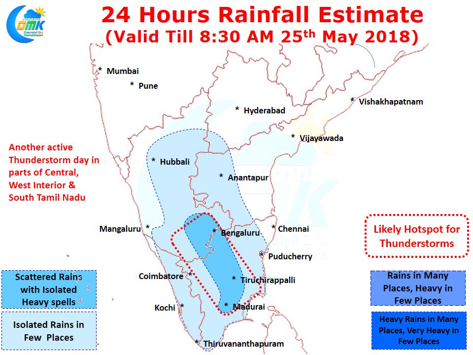
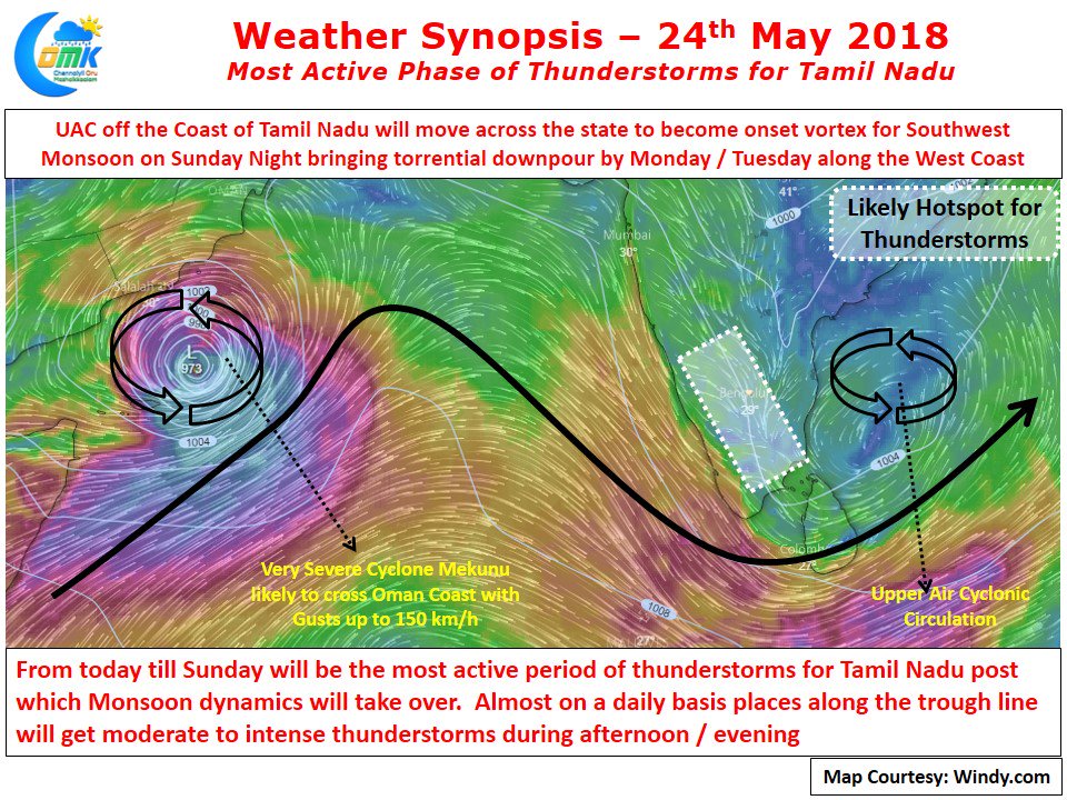
With Westerly winds streamlining slowly for the next 2 / 3 days all those places which fall along the trough line where converging winds meet will see moderate to intense thunderstorms during afternoons / evenings. Additionally the UAC currently lying off the coast of Tamil Nadu will move in a W/SW direction under the influence of mid level winds bringing rains as it traverses the interior areas of the state. Today could be another day of thunderstorms for the districts of Madurai, Dindigul, Tiruchirappalli, Karur, Namakkal, Erode, Salem, Krishnagiri & Dharmapuri along with parts of adjoining districts like Pudukottai, Sivanganga, Virudhunagar, Coimbatore, Nilgiris etc. Chennai will remain a spectator with not much luck on the wind pattern to bring rains. Temperature though will remain under control.