
Active Monsoon in West Coast triggered by the west travelling monsoon disturbance over Central India. After maintaining its depression status for more than 48 hours, currently lying as a Well Marked Low over North Chhattisgarh & East Madhya Pradesh has indeed brought back Monsoon in West Coast after a lull of nearly fortnight. As mentioned in our post yesterday morning under certain conditions both sides of Peninsular India get rains.
Despite active Monsoon in West Coast parts of Coastal Tamil Nadu recorded rains from thunderstorms yesterday evening. The storms were fast moving due to the strong Westerlies bringing sudden sharp spells of showers over parts of Chennai & Suburbs. Places around Villupuram dt, Puducherry aslo recorded moderate rains in the evening.
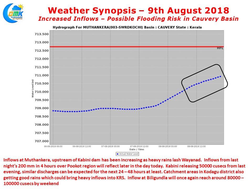
With active monsoon in West Coast we are once again staring at the prospect of increased inflows into Cauvery and possible flooding. Muthanakera the water gauge upstream of Kabini has started reflecting yesterday morning’s heavy rainfall. With Pookot receiving nearly 400 mm till today morning we can see further increases in the inflow into Kabini and possibly water level inching closer to the Highest Flown levels. 50000 cusecs is already being released from Kabini dam and we can expect similar numbers to continue for next 24 – 48 hours at least. The key point one needs to keep in mind is trapped moisture in the valleys will result in moderate to heavy rains for next 2 / 3 days even if monsoon comes to a complete standstill immediately. We are once again looking at the firm prospect of inflows into Mettur once again getting close to 1,00,000 cusecs. Similarly in Central Kerala dams like Idamalayar, Idukki are already at FRL and with moderate rains continuing in the Central High Ranges downstream flood risk persist for districts like Kottayam, Ernakulam etc.
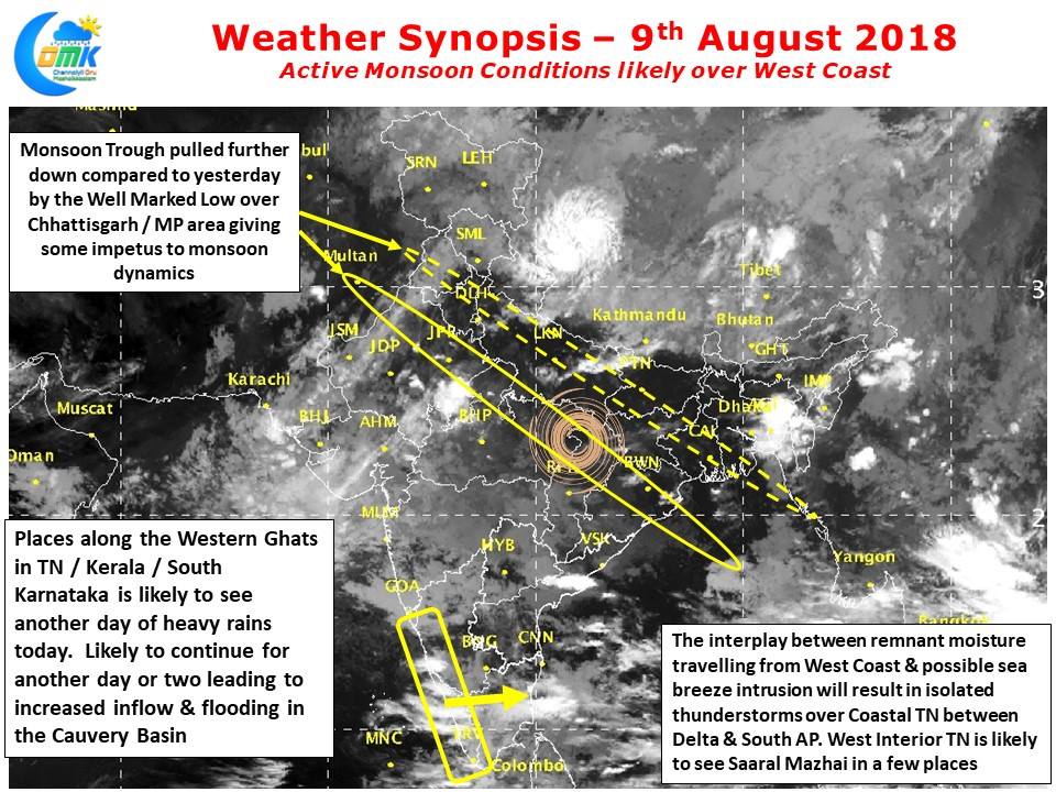
Models indicate Active Monsoon in West Coast is likely to continue for next couple of days aided by the low pressure in Central India. Kerala & South Karnataka is likely to see the best conditions while Konkan region of Karnataka & Maharashtra may see slightly subdued conditions. Some of the remnant moisture travelling across Peninsular India is likely to get converted into thunderstorms in Coastal Tamil Nadu through the interplay of Westerlies & intrusion of sea breeze front.