
Aided by the Low Pressure Area in North Bay Southwest Monsoon has moved to an active phase over the West Coast. The fast moving thunderstorms over Chennai & suburbs is a confirmation of the strengthening Westerlies.
While on Monday the Southern parts of Chennai recorded rains for little more than 15 minutes yesterday the storms moved even before one realised it’s arrival. As always they slow down once they cross the coast & reach the sea creating one of the best squall lines in recent times albeit to the East of Chennai.
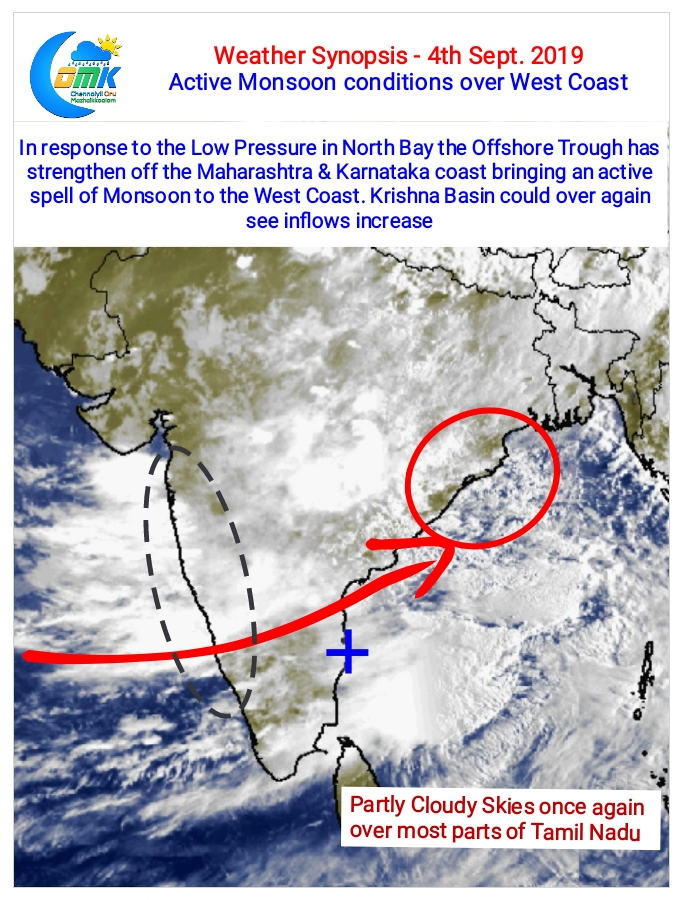
Often we mention about how Monsoon is about the interplay between Bay Of Bengal & Arabian Sea. When Bay hosts a low pressure area in the Northern parts as a balancing measure Arabian Sea creates an off Shore Trough that brings heavy rains along the coast.
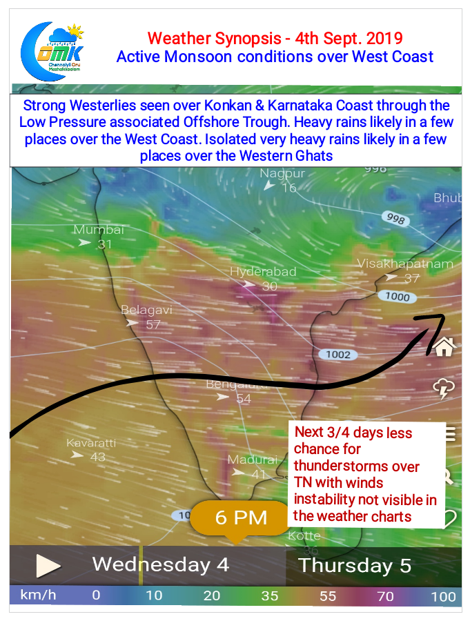
As far as Tamil Nadu goes while places in the Western Ghats may record moderate rains at many places thunderstorms are likely to be subdued for next 3 / 4 days. Wind charts indicate the Mid Level Convergence has moved to the Northern areas of Peninsular India leaving streamlined Westerlies over Tamil Nadu reducing thunderstorm prospects.