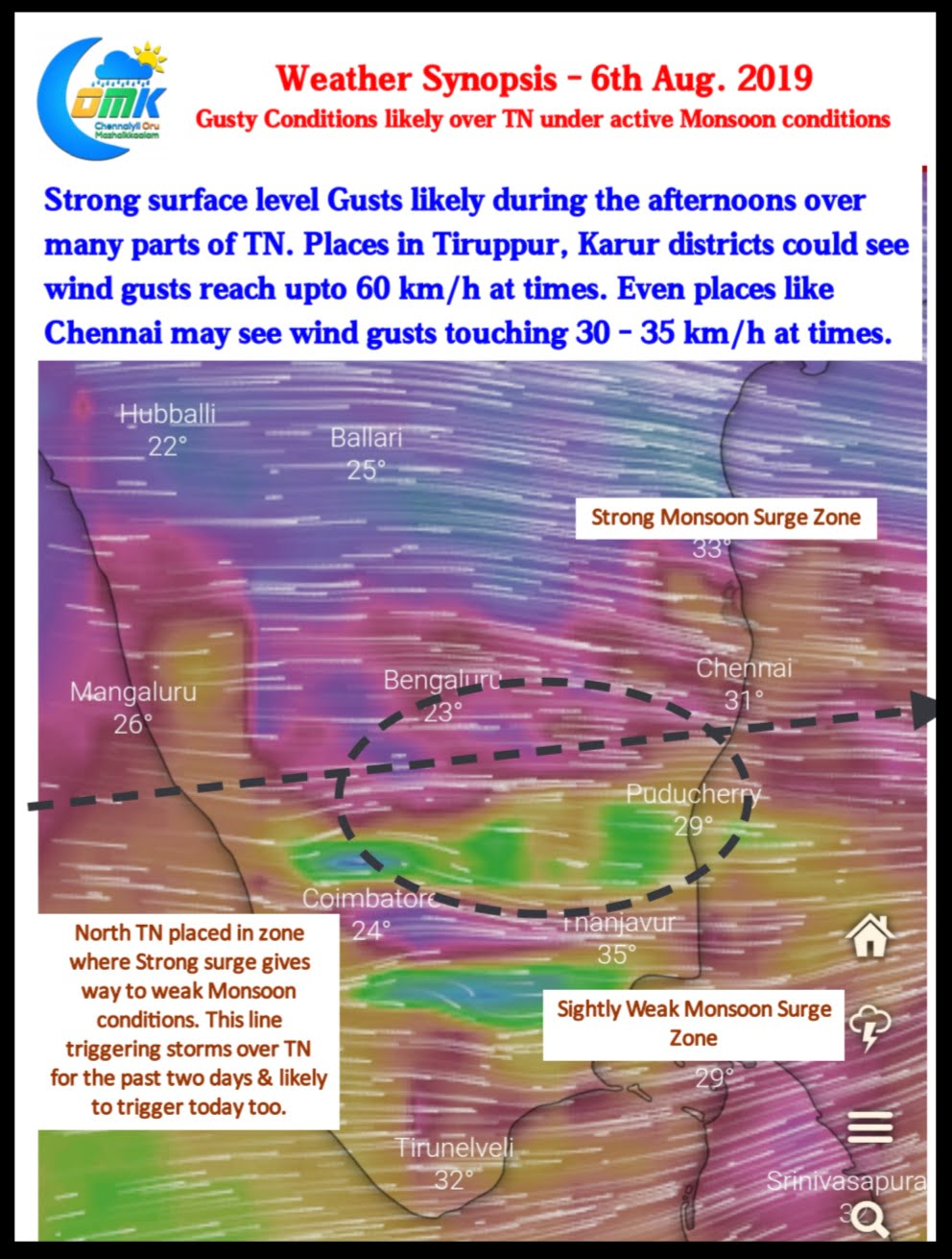
Southwest Monsoon has been vigorous over the West Coast with many places along the Ghats all the way from Maharashtra to Tamil Nadu seeing heavy rains. Mukurthi Peak recorded 31 cms for the 24 hours ending today morning.
With West coast seeing active monsoon conditions it’s likely to be a very windy day over many parts of Tamil Nadu. In particular places in Tiruppur, Coimbatore, Karur is likely to see wind gusts reach 60 km/h or more during the afternoons. Even places like Chennai along the coast is likely to see surface winds occasionally gust up to 30 km/h.

Roughly between 12.5N & 13N an invisible line differentiates the Monsoon surge and slightly weaker Monsoon conditions. This line has been triggering Thunderstorms and will trigger today too. With Westerlies remaining very strong the storms could move very fast giving sharp spell of showers. With the surge gradually shifting South compared to yesterday today more places in North TN could benefit from thunderstorms.
Maharashtra & North Karnataka has been reeling under floods already with more Rains expected for the next few days as the Low over Bay of Bengal intensifies and becomes Well Marked either today or tomorrow. Krishna & Godavari basin is likely to see further flood stress with most dams nearing Full Capacity.

While things have certainly improved in the Cauvery Basin the next 3 / 4 days promises to be very good for the catchment areas as the Offshore Trough currently running along the coast from Konkan to Kerala could strengthen under the influence of the Bay Low. This will result in an increase in rainfall quantum over South Karnataka Ghats like Kodagu etc. Wayanad has been receiving good rains for the last couple of days so Kabini is on course to possibly be the first major dam in the basin to reach FRL.


