Southwest Monsoon for the season so far ending up to 31st August has recorded 652.5 mm against a normal rainfall of 716.9 mm which is about 9% deficit overall. Except for the Southern Peninsular India which has 8% above average rainfall during this period all other homogeneous regions are in the negative. Even with Southern Peninsular India a lot of it owes to the above average rains in the leeward areas rather than core monsoon regions. In what is an unique & alarming statistic since the beginning of Southwest Monsoon season so far not even one monsoon depression has happened this year compared to a seasonal average of 6 depressions, with one month left for the Southwest Monsoon season to end it remains to be seen if we will see any monsoon depression at all.
August 2021 also has seen the lowest number of Extremely Heavy Rainfall & Very Heavy Rainfall Events across the country in the past 5 years. Pretty much summing up the poor performance of the month. If one were to look at August numbers in isolation the country as a whole ended with -24% deficit recording just 196.2 mm against the long term average of 258.2 mm. Along with July at 285.3 mm August is the second rainiest month during the Southwest Monsoon season hence always remains critical for the overall monsoon prospects.
In the meanwhile weather models indicate the possibility of another Low Pressure Area to form in Central Bay towards the weekend. As a precursor to that southern parts of Peninsular India is seeing disturbed wind pattern with instabilities seen at multiple layers creating conducive conditions for thunderstorms to develop. Yesterday many parts of South Coastal Tamil Nadu recorded light to moderate rains from thunderstorm activities between Ramanathapuram & South Delta coast. Similarly Western & Northwestern suburbs of Chennai also recorded moderate spell of rains from evening thunderstorms triggered by possible sea breeze influence. But with poor steering winds these storms including the ones that formed over Tiruvannamalai dt later in the night also eventually did not cross the coast.
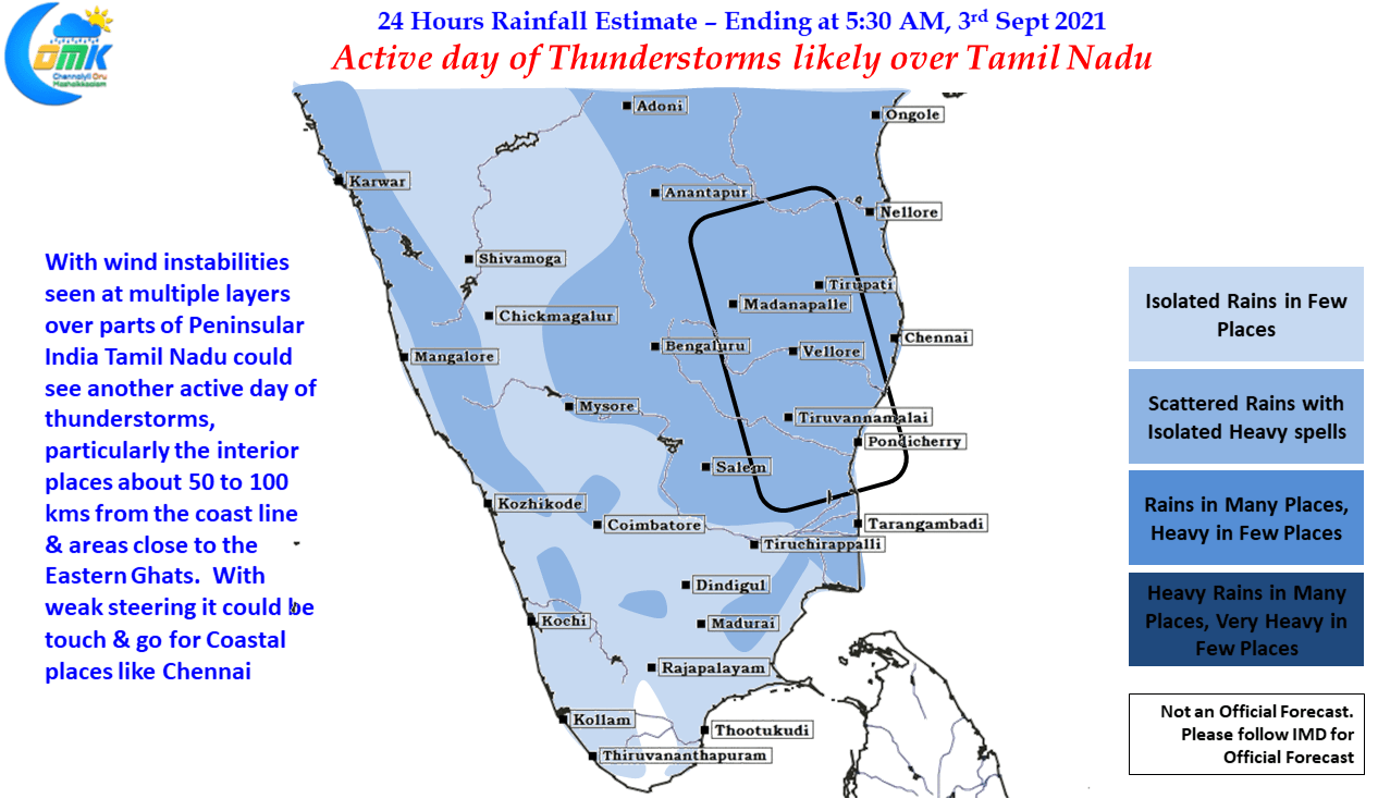
Today once again an active day of thunderstorms are expected over Tamil Nadu due to LWD like conditions over 3 Kms ASL altitude. This is likely to trigger thunderstorms over South AP & Tamil Nadu roughly around 50 to 100 kms from the coast line. With steering winds expected to remain weak today also the storms are likely to move slowly are be near stationary dumping heavy rains in the areas along the trough line. But crucially the thunderstorms are expected to be more intense than yesterday which could mean they may move towards the coast through the latent heat developed by the storms giving a touch & go possibility for coastal places like Chennai.


