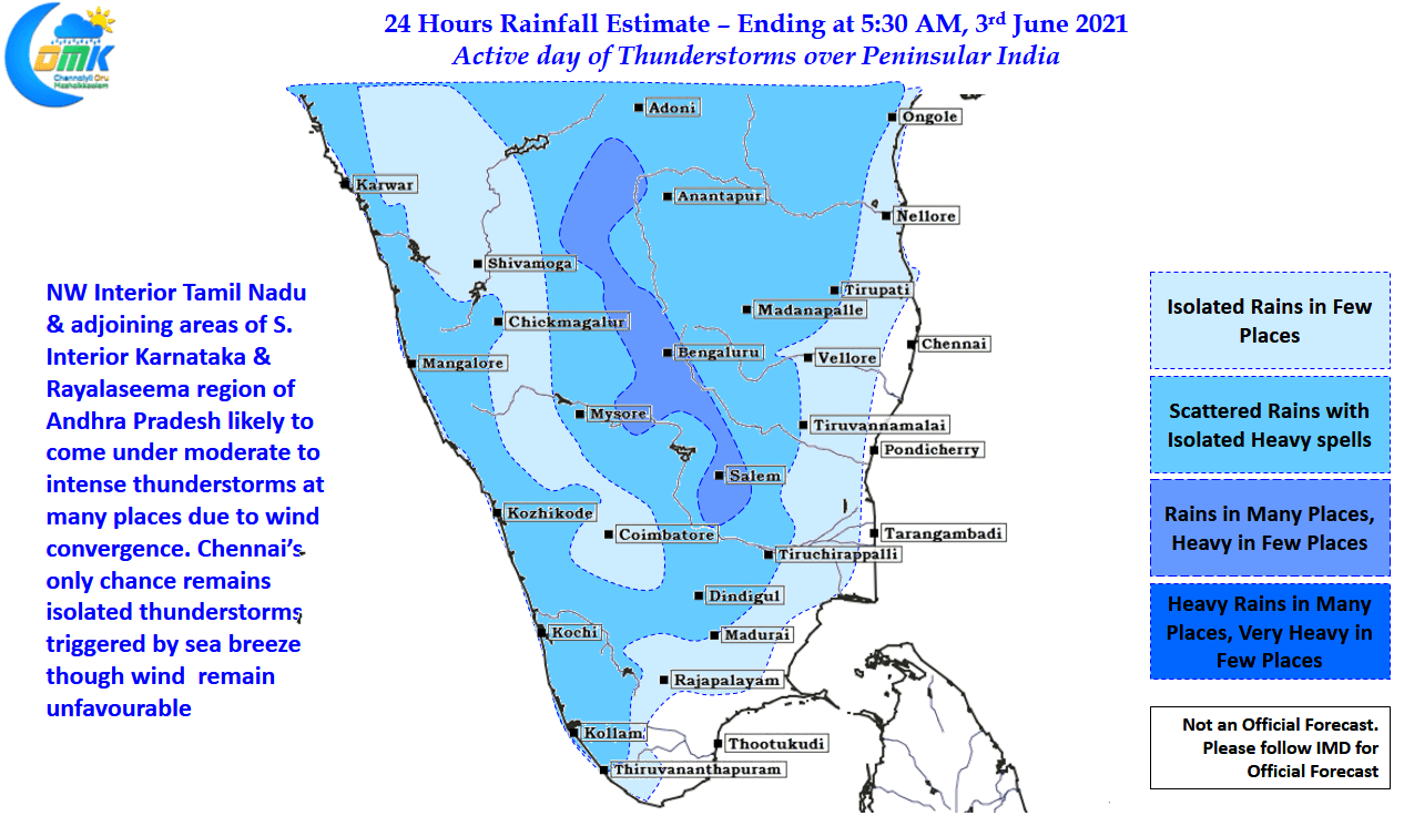
It is not often one talks about thunderstorms in the interior areas of Peninsular India like Rayalaseema, South Interior Karnataka & NW Interior Tamil Nadu, during the first week of June. It is that time of the year when weather bloggers actively look forward to tracking the first spell of heavy rains associated with the Monsoon surge coinciding with the Onset of Southwest Monsoon. Ironically during last week of May saw many parts of West Coast get pounded by heavy rains for a couple of days as Cyclone Tauk’tae moved up along the coast on its way towards Gujarat.
While one can argue whether the Monsoon Onset day is an academic exercise suited for research purpose & does not hold much of real world relevance the various announcements put out by IMD & SkyMet two premier weather agencies of the country about whether Monsoon did make an onset or not reminded one of the famous comedy by Goundamani & Senthil.
In the meanwhile looking at wind charts it is highly unlikely for the next couple of days going by weather models we are going to see the Depth of Westerlies tough 600 hPa in the Observation Zone 0 to 10N & 55 to 80E as part of the IMD Monsoon onset criteria, today & tomorrow charts indicate Easterlies in few pockets as well. It appears going by text book definition the next window for onset may be around weekend though we need to see whether “Parameters Fall in place” on expected onset dates.
While we await the onset of Monsoon may be it will be interesting to track the thunderstorms over Peninsular India for the next couple of days with interior TN also in line to get some good rains, particularly over NW Interior areas like Salem, Krishnagiri, Dharmapuri, Erode & Namakkal. Chennai continues to remain in a zone of unfavorable wind pattern though with models indicating sea breeze to strengthen we might see some close to coast overhead thunderstorm development that may not move much triggered by the arrival of sea breeze. These storms are completely a lottery & if you come under a spell of rains, thank your stars.


